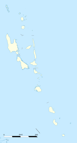
Vanuatu, officially the Republic of Vanuatu, is an island country in Melanesia, located in the South Pacific Ocean. The archipelago, which is of volcanic origin, is 1,750 km (1,090 mi) east of northern Australia, 540 km (340 mi) northeast of New Caledonia, east of New Guinea, southeast of Solomon Islands, and west of Fiji.
Malampa is one of the six provinces of Vanuatu, located in the center of the country. It consists of three main islands: Malakula, Ambrym and Paama, and takes its name from the first syllable of their names. It includes a number of other islands – the small islands of Uripiv, Norsup, Rano, Wala, Atchin and Vao off the coast of Malakula, and the volcanic island of Lopevi. Also included are the Maskelynes Islands and some more small islands along the south coast of Malakula.
Northeast Malakula, or Uripiv-Wala-Rano-Atchin, is a dialect chain spoken on the islands of Uripiv, Wala, Rano, and Atchin and on the mainland opposite to these islands. Uripiv-Wala-Rano-Atchin is spoken today by about 9,000 people. Literacy rate of its speakers in their own language is 10–30%.

Malakula Island, also spelled Malekula, is the second-largest island in the nation of Vanuatu, formerly the New Hebrides, in Melanesia, a region of the Pacific Ocean.

Erromango is the fourth largest island in the Vanuatu archipelago. With a land area of 891.9 square kilometres (344.4 sq mi), it is the largest island in Tafea Province, the southernmost of Vanuatu's six administrative regions.

Rah or Ra is a small coral islet of 0.5 km2 (0.19 sq mi), located in the Banks group of northern Vanuatu. The same name also refers to the single village which is situated within this islet.

Mataso is an island in the Shefa of Vanuatu in the Pacific Ocean. The island is a part of Shepherd Islands archipelago.
Malokilikili Island is an inhabited island in Sanma Province of Vanuatu in the Pacific Ocean. Malokilikili lies off the eastern coast of Malo Island.
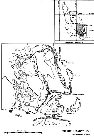
Mavea, or locally Mav̈ea, is an inhabited island in Sanma Province of Vanuatu in the Pacific Ocean. The island lies off the eastern coast of Espiritu Santo. The estimated terrain elevation above the sea level is some 63 metres.
Uripiv Island is a small inhabited island in Malampa Province of Vanuatu in the Pacific Ocean. Uripiv lies off the north coast of Malekula Island. The estimated terrain elevation above the sea level is some 8 meters.

Ifira is an offshore island of Efate, located in Shefa Province of Vanuatu in the Pacific Ocean.

Emao is a small inhabited island in Shefa Province of Vanuatu in the Pacific Ocean. It was also previously known as Montague Island.

Makura, locally known as Makira, is a small inhabited island in Shefa Province of Vanuatu in the Pacific Ocean. Makura is a part of the Shepherds Islands archipelago.
Avock Island or Avokh Island is an inhabited island in Malampa Province of Vanuatu in the Pacific Ocean. The estimated terrain elevation above the sea level is some 166 meters.
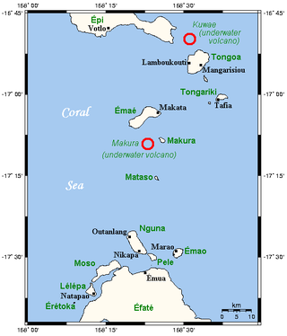
Tongoa Island is an inhabited island in Shefa Province of Vanuatu in the Pacific Ocean.
Buninga Island is an inhabited island in Shefa Province of Vanuatu in the Pacific Ocean. The island is a part of Shepherd Islands archipelago.
Tongariki Island is an inhabited island in Shefa Province of Vanuatu in the Pacific Ocean. The island is a part of Shepherd Islands archipelago.

Lamen Island is an inhabited island in Shefa Province of Vanuatu in the Pacific Ocean. The island is a part of Shepherd Islands archipelago.
Lataro is an uninhabited island in Sanma Province of Vanuatu in the Pacific Ocean.