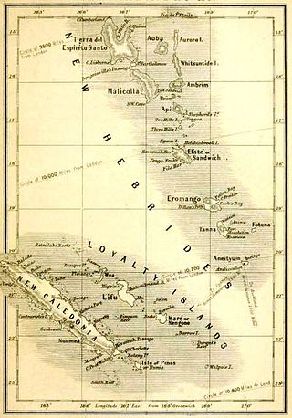
The history of Vanuatu spans over 3,200 years.

Espiritu Santo is the largest island in the nation of Vanuatu, with an area of 3,955.5 km2 (1,527.2 sq mi) and a population of around 40,000 according to the 2009 census.

Malo is an island in Vanuatu 3 km (1.9 mi) off the southern coast of Vanuatu's largest island, Espiritu Santo, in Sanma Province. It has a circumference of 55 km (34 mi) and an area of 180 km2 (69 sq mi). It is 17 kilometres or 11 miles long, and 13 kilometres or 8.1 miles across at its widest point. The highest point on the island is Mount Malo.
Bokissa is a very small island in the South Pacific island nation of Vanuatu located 10 km (6 mi) south of Espiritu Santo.
Araki is a small rocky island with an area of 2.5 km², located 3 miles off the southern shores of Espiritu Santo, which is the largest island in the nation of Vanuatu.
The North Vanuatu languages form a linkage of Southern Oceanic languages spoken in northern Vanuatu.
Tutuba is an Oceanic language spoken in Vanuatu on the southeast tip of Espiritu Santo Island and on Tutuba Island offshore.
Velit Bay Plantation is a plantation on the east coast of Espiritu Santo, Vanuatu. It lies on Velit Bay, and consists of over 1600 acres of plantation and forest. The plantation caters to tourists and contains a restaurant.

Linua is an island in the Torres Islands archipelago in Torba Province of Vanuatu in the southwestern Pacific Ocean.
Malokilikili Island is an inhabited island in Sanma Province of Vanuatu in the Pacific Ocean. Malokilikili lies off the eastern coast of Malo Island.

Mavia is an inhabited island in Sanma Province of Vanuatu in the Pacific Ocean. The island lies off the eastern coast of Espiritu Santo. The estimated terrain elevation above the sea level is some 63 metres.
Elephant Island is an uninhabited island in Sanma Province of Vanuatu in the Pacific Ocean. Another island off the coast of Antarctica in the outer reaches of the South Shetland Islands, in the Southern Ocean, shares the same name.
Lataro is an uninhabited island in Sanma Province of Vanuatu in the Pacific Ocean.
Thion is a small uninhabited island in Sanma Province of Vanuatu in the Pacific Ocean.
Malwepe is a small uninhabited island in Sanma Province of Vanuatu in the Pacific Ocean.
Malvapevu is a small uninhabited island in Sanma Province of Vanuatu in the Pacific Ocean.
Malparavu is a small uninhabited island in Sanma Province of Vanuatu in the Pacific Ocean.
Maltinerava is a small uninhabited island in Sanma Province of Vanuatu in the Pacific Ocean.
The Espiritu Santo languages are a group of North Vanuatu languages spoken on Espiritu Santo Island in northern Vanuatu. Tryon (2010) considers the Espiritu Santo languages to be a coherent group.

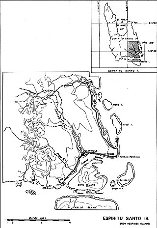
Naval Advance Base Espiritu Santo or Naval Base Espiritu Santo, most often just called Espiritu Santo, was a major advance Naval base that the U.S. Navy Seabees built during World War II to support the Allied effort in the Pacific. The base was located on the island of Espiritu Santo in the New Hebrides, now Vanuatu, in the South Pacific. The base also supported the U.S. Army and Army Air Corps, U.S. Coast Guard, and US Marine Corps. It was the first large advance base built in the Pacific. By the end of the war it had become the second-largest base in the theater. To keep ships tactically available there was a demand for bases that could repair and resupply the fleet at advance locations, rather than return them to the United States. Prior to December 7th, Pearl Harbor was the U.S. fleet's largest advance base in the Pacific. Espiritu became capable of all aspects necessary to support the Fleet's operations from fleet logistics in fuel, food, and ammunition, to transport embarkation for combat operations or returning to the continental United States. The ship repair facilities and drydocks were capable of attending to most damage and routine maintenance. Had it not existed, ships would have had to return to Pearl Harbor, Brisbane, or Sydney for major repairs and resupply. The base became a major R and R destination for the fleet.


