Inglewood-Finn Hill, Washington

Last updated
Inglewood-Finn Hill, Washington
Neighborhood
King County Washington Incorporated and Unincorporated areas Inglewood-Finn Hill Highlighted.svg
Location of Inglewood-Finn Hill, Washington
Coordinates: 47°43′21″N122°13′12″W / 47.72250°N 122.22000°W / 47.72250; -122.22000 Coordinates: 47°43′21″N122°13′12″W / 47.72250°N 122.22000°W / 47.72250; -122.22000
Country United States
State Washington
County King
Area
  Total8.0 sq mi (20.6 km2)
  Land5.8 sq mi (15.0 km2)
  Water2.2 sq mi (5.7 km2)
Population
 (2010)
  Total22,707
  Density3,922.6/sq mi (1,514.5/km2)
Time zone UTC-8 (Pacific (PST))
  Summer (DST) UTC-7 (PDT)
FIPS code 53-33380 [1]

Inglewood-Finn Hill was a census-designated place (CDP) in King County, Washington, United States. The population was 22,707 at the 2010 census. The community was largely annexed into neighboring Kirkland in 2011.

Contents

Based on per capita income, one of the more reliable measures of affluence, Inglewood-Finn Hill ranks 35th of 522 areas in the state of Washington to be ranked.

History

Inglewood was platted and named in 1888 by the settler L.A. Wold. [2] The community was largely annexed into neighboring Kirkland in 2011 and removed from the Census Bureau's list of places as part of the annual Boundary and Annexation Survey. [3]

Geography

Inglewood-Finn Hill is located at 47°43′21″N122°13′12″W / 47.72250°N 122.22000°W / 47.72250; -122.22000 (47.722620, -122.219941) [4] north of the pre-2011 Kirkland, Washington city limits and south of Kenmore. In December 2009, nearly all of the CDP was approved for annexation to Kirkland in a city council vote. [5] Norway Hill, a small neighborhood in the northeastern part of the area, is part of a potential annexation area controlled by Bothell, Washington.

According to the United States Census Bureau, the CDP had a total area of 8.0 square miles (20.6 km²), of which, 5.8 square miles (15.0 km²) of it is land and 2.2 square miles (5.6 km²) of it (27.39%) is water.

Demographics

Historical population
CensusPop.
1980 12,467
1990 29,132133.7%
2000 22,661−22.2%
2010 22,7070.2%
source: [6]

As of the census [1] of 2010, there were 22,707 people, 8,306 households, and 6,163 families residing in the CDP. The population density was 3,922.6 people per square mile (1,513.7/km²). There were 8,553 housing units at an average density of 1,480.5/sq mi (571.3/km²). The racial makeup of the CDP was 86.78% White, 1.39% African American, 0.48% Native American, 6.38% Asian, 0.19% Pacific Islander, 1.31% from other races, and 3.47% from two or more races. Hispanic or Latino of any race were 3.80% of the population.

There were 8,306 households out of which 38.6% had children under the age of 18 living with them, 61.8% were married couples living together, 8.6% had a female householder with no husband present, and 25.8% were non-families. 17.7% of all households were made up of individuals and 3.2% had someone living alone who was 65 years of age or older. The average household size was 2.71 and the average family size was 3.09.

In the CDP, the population was spread out with 26.2% under the age of 18, 7.5% from 18 to 24, 34.6% from 25 to 44, 25.8% from 45 to 64, and 6.0% who were 65 years of age or older. The median age was 36 years. For every 100 females, there were 100.9 males. For every 100 females age 18 and over, there were 98.3 males.

The median income for a household in the CDP was $72,130, and the median income for a family was $77,393 (these figures had risen to $90,301 and $101,301 respectively as of a 2007 estimate). [7] Males had a median income of $52,222 versus $35,765 for females. The per capita income for the CDP was $31,272. About 2.8% of families and 4.1% of the population were below the poverty line, including 5.1% of those under age 18 and 1.4% of those age 65 or over.

Related Research Articles

Cottage Lake, Washington Census-designated place in Washington, United States

Cottage Lake is a census-designated place (CDP) in King County, Washington, United States. The population was 22,494 at the 2010 census. The lake itself falls within the 98072 ZIP code, while the developments east of the lake fall under the 98077 ZIP code.

East Hill-Meridian, Washington Former CDP in Washington, United States

East Hill-Meridian is a former census-designated place (CDP) in King County, Washington, United States. The population was 29,878 at the 2010 census. The majority of the census area is now within the limits of Kent and Renton.

East Renton Highlands, Washington Census-designated place in Washington, United States

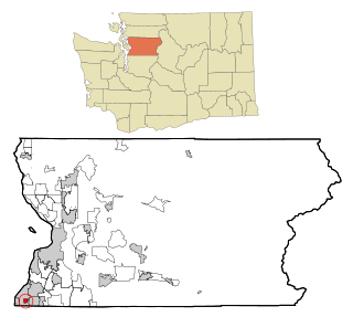
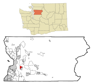
East Renton Highlands is a census-designated place (CDP) in King County, Washington, United States, located between Issaquah and Renton. The population was 11,140 at the 2010 census.

Hobart, Washington Census-designated place in Washington, United States

Hobart is an unincorporated community and census-designated place (CDP) in King County, Washington, United States. The population was 6,221 at the 2010 census.

Kingsgate, Kirkland, Washington Neighborhood in King, Washington, United States

Kingsgate is a neighborhood of Kirkland, Washington, United States. It was annexed by Kirkland on June 1, 2011. Prior to the annexation, Kingsgate was a census-designated place (CDP).

Lakeland North, Washington Census-designated place in Washington, United States

Lakeland North is a census-designated place (CDP) in King County, Washington, United States. The population was 12,942 at the 2010 census. Part of the community was annexed into neighboring Auburn in 2008.

Lea Hill, Auburn, Washington Neighborhood in King, Washington, United States

Lea Hill is a neighborhood located in the city of Auburn, Washington, United States. The community was annexed by Auburn on January 1, 2008, after Auburn and Lea Hill residents approved the annexation.

Mirrormont, Washington Census-designated place in Washington, United States

Mirrormont is a census-designated place (CDP) in King County, Washington, United States, south of Issaquah. The population was 3,659 at the 2010 census. Within the last decade, the area has seen a shift in development as larger homes have been constructed in Cedar Grove, the Highlands at Tiger Mountain and Mirrormont.

Union Hill-Novelty Hill, Washington Census-designated place in Washington, United States

Union Hill-Novelty Hill is a census-designated place (CDP) in King County, Washington, United States. The area was first recognized by the Census Bureau in the 2000 census. The population was 18,805 at the 2010 census.

White Center, Washington Census-designated place in Washington, United States

White Center is a census-designated place (CDP) in King County, Washington, United States. It lies between West Seattle and Burien. The population was 13,495 at the 2010 census.

Parkwood, Washington CDP in Washington, United States

Parkwood is a census-designated place (CDP) in Kitsap County, Washington, United States. The population was 7,126 at the 2010 census.

Suquamish, Washington Census-designated place in Washington, United States

Suquamish is a census-designated place (CDP) in Kitsap County, Washington, United States. The population was 4,140 at the 2010 census. Comprising the Port Madison Indian Reservation, it is the burial site of Chief Seattle and the site of the Suquamish tribe winter longhouse known as Old Man House.

Waller, Washington CDP in Washington, United States

Waller is a census-designated place (CDP) in Pierce County, Washington, United States. The population was 9,200 at the 2000 census.

Cathcart, Washington CDP in Washington, United States

Cathcart is a census-designated place (CDP) in Snohomish County, Washington, United States. The population was 2,458 at the 2010 census. Based on per capita income, one of the more reliable measures of affluence, Cathcart ranks 45th of 522 areas in the state of Washington to be ranked. Cathcart was named for Isaac Cathcart, a businessperson in the lumber industry.

High Bridge, Washington CDP in Washington, United States

High Bridge is a census-designated place (CDP) in Snohomish County, Washington, United States. The population was 2,994 at the 2010 census. High Bridge includes the Echo Lake community and the former Echo Lake CDP, which was superseded by the larger High Bridge CDP in 2010.

Esperance, Washington CDP in Washington, United States

Esperance is a census-designated place (CDP) in Snohomish County, Washington, United States. Esperance is an enclave of the city of Edmonds, WA. The population was 3,601 at the 2010 census.

Lake Stickney, Washington CDP in Washington, United States

Lake Stickney is a census-designated place (CDP) in Snohomish County, Washington, United States. The population was 7,777 at the 2010 census. The CDP was known as Paine Field-Lake Stickney prior to 2010. The new Lake Stickney CDP no longer contains the Paine Field airport.

Silver Firs, Washington CDP in Washington, United States

Silver Firs is a census-designated place (CDP) in Snohomish County, Washington, United States. The population was 20,891 at the 2010 census. It lies northeast of the city of Mill Creek. Silver Firs is one of two CDPs that were created out of the former Seattle Hill-Silver Firs CDP in 2010, the other being Eastmont.

Marietta-Alderwood, Washington Place in Washington, United States

Marietta-Alderwood is a census-designated place (CDP) in Whatcom County, Washington, United States. The population was 3,906 at the 2010 census. Parts of Marietta-Alderwood became part of Bellingham in 2019 through the process of annexation

Bangor Base, Washington Census-designated place in Washington, United States

Bangor Base is a census-designated place (CDP) in Kitsap County, Washington, within U.S. Naval Base Kitsap on the Kitsap Peninsula. Its population was 6,054 at the 2010 census.

References

  1. 1 2 "American FactFinder". United States Census Bureau. Archived from the original on 2020-02-12. Retrieved 2008-01-31.
  2. Meany, Edmond S. (1923). Origin of Washington geographic names. Seattle: University of Washington Press. p. 119.
  3. "Geographic Boundary Change Notes Display". United States Census Bureau. Retrieved November 26, 2012.
  4. "US Gazetteer files: 2010, 2000, and 1990". United States Census Bureau. 2011-02-12. Archived from the original on 2002-05-27. Retrieved 2011-04-23.
  5. City Council Accepts Annexation, City of Kirkland, December 16, 2009, retrieved 2010-01-01[ permanent dead link ]
  6. "CENSUS OF POPULATION AND HOUSING (1790-2000)". U.S. Census Bureau. Archived from the original on 2010-07-08. Retrieved 2010-07-31.
  7. Archived October 8, 2012, at the Wayback Machine