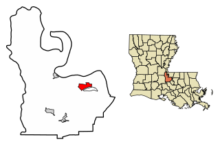
Lafayette Parish is a parish located in the U.S. state of Louisiana. According to the 2020 U.S. census, the parish had a population of 241,753, up from 221,578 at the 2010 United States census. The parish seat is the city of Lafayette. The parish was founded in 1823. Since 1996, the city and parish have operated as a consolidated government.

Loreauville is a village in Iberia Parish in the U.S. state of Louisiana. The population was 887 at the 2010 census, down from 938 at the 2000 census. It is part of the New Iberia micropolitan statistical area, and the Lafayette metropolitan statistical area.

Lake Arthur is a town in Jefferson Davis Parish, Louisiana, United States. The population was 2,738 at the 2010 census, down from 3,007 at the 2000 census. It is part of the Jennings Micropolitan Statistical Area. The current mayor is Sampson “poncho” Lejeune.

Lafayette is the most populous city in and parish seat of Lafayette Parish, Louisiana, United States, located along the Vermilion River. It is Louisiana's fourth-most populous city with a 2020 census population of 121,374; the consolidated city-parish's population was 241,753 in 2020. The Lafayette metropolitan area was Louisiana's third largest metropolitan statistical area with a population of 478,384 at the 2020 census. The Acadiana region containing Lafayette is the largest population and economic corridor between Houston, Texas and New Orleans.

Youngsville is a city in Lafayette Parish, Louisiana, United States, and is part of the Lafayette metropolitan statistical area. The population was 8,105 at the 2010 U.S. census, and 15,929 at the 2020 United States census.

New Roads is a small town in Pointe Coupee Parish, Louisiana, United States. The center of population of Louisiana was located in New Roads in 2000. The population was 4,831 at the 2010 census, down from 4,966 in 2000. In the 2020 census the population was 4,549, while at the beginning year of 2023 the census showed a population of 4,205 and expects to be under 4,000 by the years end. The city's ZIP code is 70760. It is part of the Baton Rouge Metropolitan Statistical Area.

St. Martinville is a city in and the parish seat of St. Martin Parish, Louisiana, United States. It lies on Bayou Teche, 13 miles (21 km) south of Breaux Bridge, 16 miles (26 km) southeast of Lafayette, and 9 miles (14 km) north of New Iberia. The population was 6,114 at the 2010 U.S. census, and 5,379 at the 2020 United States census. It is part of the Lafayette metropolitan statistical area.

Broussard is a city in Lafayette and St. Martin parishes in the U.S. state of Louisiana. The population was 8,197 at the 2010 U.S. census, and 13,417 at the 2020 United States census. Broussard is part of the Lafayette metropolitan statistical area.

Acadiana, also known as the Cajun Country, is the official name given to the French Louisiana region that has historically contained much of the state's Francophone population.

U.S. Route 167 is a north-south United States Highway within the U.S. states of Louisiana and Arkansas. It runs for 500 miles (800 km) from Ash Flat, Arkansas at U.S. Route 62/U.S. Route 412 to Abbeville, Louisiana at Louisiana Highway 14. It goes through the cities of Little Rock, Arkansas, Alexandria, Louisiana, and Lafayette, Louisiana.

Lafayette, Vermilionville, or the Lafayette metropolitan statistical area per the U.S. Office of Management and Budget, is the third largest metropolitan statistical area in the U.S. state of Louisiana. Located in the south central Acadiana region, it covers five parishes. At the 2020 U.S. census, 478,384 people lived in the metropolitan area, making it the 116th most populous in the United States and one of Louisiana's fastest growing metropolises; in 2010, its population was 273,738 and it outpaced the Shreveport–Bossier City metropolitan area in 2015.

U.S. Highway 90 (US 90), one of the major east–west U.S. Highways in the Southern United States, runs through southern Louisiana for 297.6 miles (478.9 km), serving Lake Charles, Lafayette, New Iberia, Morgan City, and New Orleans. Much of it west of Lafayette and east of New Orleans has been supplanted by Interstate 10 (I-10) for all but local traffic, but the section between Lafayette and New Orleans runs a good deal south of I-10.

Milton is an unincorporated community and census-designated place in Lafayette Parish, Louisiana, United States. At the 2010 U.S. census it had a population of 3,030; at the 2019 American Community Survey, it had an estimated population of 2,299. Milton is part of the Lafayette metropolitan statistical area.

Ridge is an unincorporated community in Lafayette Parish, Louisiana, United States.

Louisiana Highway 182 (LA 182) is a state highway located in central and southeastern Louisiana. It runs 173.41 miles (279.08 km) in a northwest to southeast direction from LA 29 in Whiteville to U.S. Highway 90 (US 90) north of Raceland.
Billeaud is an unincorporated community in Lafayette Parish, Louisiana, United States.
Attakapas Parish, a former parish (county) in southern Louisiana, was one of the twelve parishes in the Territory of Orleans, newly defined by the United States federal government following its Louisiana Purchase in 1803. At its core was the Poste des Attakapas trading post, which developed as the current city of St. Martinville.

Louisiana Highway 89 (LA 89) is a state highway located in southern Louisiana. It runs 12.74 miles (20.50 km) in a north–south direction from LA 14 in Delcambre to an intersection with Church Street in Youngsville.


