Kirkwood, South Africa

Last updated

Nqweba
South Africa Eastern Cape location map.svg
Red pog.svg
Nqweba
South Africa adm location map.svg
Red pog.svg
Nqweba
Coordinates: 33°24′01″S25°26′33″E / 33.40028°S 25.44250°E / -33.40028; 25.44250
Country South Africa
Province Eastern Cape
District Sarah Baartman
Municipality Sundays River Valley
Area
[1]
  Total7.18 km2 (2.77 sq mi)
Population
 (2011) [1]
  Total13,765
  Density1,900/km2 (5,000/sq mi)
Racial makeup (2011)
[1]
   Black African 67.51%
   Coloured 24.29%
   Indian/Asian 0.20%
   White 7.17%
  Other0.84%
First languages (2011)
[1]
   Afrikaans 31.78%
   IsiXhosa 59.06%
   English 1.92%
  Other7.24%
Time zone UTC+2 (SAST)
Postal code (street)
6120
PO box
6120
Area code 042

Kirkwood, officially Nqweba [2] is a town in the Eastern Cape Province of South Africa. It is situated on the banks of the Sundays River in the eponymously named Sundays River Valley, which forms part of the Sundays River Valley Municipality in the Sarah Baartman District Municipality of the Eastern Cape.

Contents

Geography and climate

Kirkwood is situated about 80 km (50 mi) from the Indian Ocean and about 100 meters (330 ft) above sea level.

The South African Weather Service recorded a temperature of 50.3 °C (122.5 °F) in Kirkwood in 1928 - the highest temperature ever recorded in South Africa. [3]

To the north of Kirkwood are the Rietberg Mountains with the Uyepoort (Uye Gateway), which provides passage to the Zuurberg Mountains and the Addo Elephant National Park.

History

The Governor of the Cape Colony, Sir John Francis Cradock, gave the first farms in the Sundays River Valley to the leaders of the successful burger commandos for their role in the victories in the border wars of 1811 and 1812.

These farms were awarded to Magistrate Cuyler (originally from the United States) of Uitenhage, who received Geelhoutboom (Yellow Tree, later Dunbrody); Commandant Ignatius Muller, who received Klaaskraal (Klaas' Corral, situated just outside what is now Kirkwood) and Field Cornet J.S. van Niekerk, who received Gouwernements Belooning (Government's Reward). It is on the latter farm that Kirkwood would be established many decades later.

In 1877 James Somers Kirkwood, an auctioneer from Port Elizabeth, arrived to auction off Gouwernements Belooning. When a flooded Sundays River prevented Kirkwood from reaching this farm he climbed a nearby hill (known today as The Lookout) instead. From there he had a view of the entire valley and had a vision of the valley - which was overgrown by bushes at the time - being transformed into irrigated fields with fruit trees. He also envisioned this farm produce being delivered via river barges to Port Elizabeth.

Shortly afterwards, James himself purchased "Goewernements Belooning" as well as some other farms in the valley. He subsequently founded the Sundays River Land and Irrigation Company as well as the village of Bayville.

Later, Kirkwood started to prepare the land for irrigation, but despite a very positive prospectus and very good publicity, nobody was interested in buying stock in his venture. One of the reasons may be that it coincided with the big diamond rush to Kimberley. In consequence, his company eventually failed and was declared bankrupt. Kirkwood died in 1889, a financially and spiritually broken man.

However, Kirkwood can be considered to have been ahead of his time as his vision became true in the next century when the Sundays River Irrigation Project and eventually the Orange River Water Project were built. His name also lives on in the town of Kirkwood that was founded in 1912 on his first farm, Gouwernements Belooning.

At the beginning of the 19th century, the Sundays River formed the eastern border of the then Cape Colony and was the area around Kirkwood consequently the scene of many armed conflicts - Khoi against Xhosa, Khoi and Xhosa together against the Boers and British together and finally the Boers against the British during the Second Anglo-Boer War.

During this war, General Jan Smuts and his Commando of 250 men passed through the valley on their epic campaign to the northwest. Indeed, the three Boers who died the furthest south during the war were killed on Cecil John Rhodes's farm Brakkefontein. Shortly after these casualties were incurred a major battle took place on the Bedrogsfontein mountain pass. [4]

Economy

Kirkwood's subtropical climate makes it ideal for the growing of citrus fruits and this has made it the citrus capital of the Eastern Cape. Indeed, Kirkwood is the center of one of the largest citrus-growing regions in South Africa with approximately 120 square kilometres (30,000 acres) of citrus orchards. Approximately 18 million cartons of oranges, lemons, grapefruit and other citrus fruit are exported from this region each year.

The Sundays River Citrus Company employs approximately 1500 people on a seasonal basis to pack the export citrus. There are packhouses in Kirkwood, Addo and Summerville.

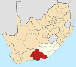
Kirkwood is also the capital town of the Sundays River Valley Municipality, which also includes places such as Paterson, Addo and Enon, and has a total population of about 70,000 people.

Roses are also grown in the area and there are several game farms situated nearby. The town also hosts an annual Wildlife Festival.

A panoramic view of Kirkwood and the surrounding citrus groves is possible from The Lookout in the Rietberg Mountains, where Kirkwood had his vision. The Lookout is also well known as a dinosaur fossil site. The first complete dinosaur fossil to be found in South Africa, nicknamed "Kirky", was discovered near here. Kirky was smaller than 2 meters. [4]

Renaming

In March 2024, the town was officially renamed Nqweba, which means 'meeting place' in isiXhosa. [2]

Notable people who lived in Kirkwood

Related Research Articles

<span class="mw-page-title-main">West Coast District Municipality</span> District municipality in Western Cape, South Africa

The West Coast District Municipality is a district municipality located in the Western Cape province of South Africa. Its municipality code is DC1. Moorreesburg is the seat of the district. As of 2011, it had a total population of 391,766.

<span class="mw-page-title-main">Gansbaai</span> Place in Western Cape, South Africa

Gansbaai is a fishing town and popular tourist destination in the Overberg District Municipality, Western Cape, South Africa. It is known for its dense population of great white sharks and as a whale-watching location.

<span class="mw-page-title-main">Worcester, South Africa</span> Town in Western Cape, South Africa

Worcester is a town in the Western Cape, South Africa. It is the third-largest city in the western cape province of South Africa. It is located 120 kilometres (75 mi) north-east of Cape Town on the N1 highway north to Johannesburg.

<span class="mw-page-title-main">Cradock, South Africa</span> Place in Eastern Cape, South Africa

Cradock is a town in the Eastern Cape Province of South Africa, in the upper valley of the Great Fish River, 250 kilometres (160 mi) by road northeast of Port Elizabeth. The town is the administrative seat of the Inxuba Yethemba Local Municipality in the Chris Hani District of the Eastern Cape.

<span class="mw-page-title-main">Sundays River</span> River in the Eastern Cape, South Africa

The !Khukaǁgamma or Sundaysriver is a river in the Eastern Cape Province of South Africa. It is said to be the fastest flowing river in the country. The Inqua Khoi people, who historically were the wealthiest group in Southern Africa, originally named this river !Khukaǁgamma because the river's banks are always green and grassy despite the arid terrain that it runs through.

<span class="mw-page-title-main">Andries Stockenström</span>

Sir Andries Stockenström, 1st Baronet, was lieutenant governor of British Kaffraria from 13 September 1836 to 9 August 1838.

<span class="mw-page-title-main">Tarkastad</span> Place in Eastern Cape, South Africa

Tarkastad is a Karoo semi-urban settlement situated on the banks of Tarka River in the Eastern Cape province of South Africa. Tarkastad is on a plain to the north of the Winterberg mountain range on the R61 between Cradock and Komani and only three hours from Gqeberha. The name Tarkastad is believed to come from the Khoi-Khoi word Traka or the Celtic word Tarka and the Afrikaans word Stad. The fact that the town is overlooked by Martha and Mary; two peaks which look like two women resting after a hard day's work, also lends to the name.

<span class="mw-page-title-main">Xhosa Wars</span> (1779-1879) Wars between the Xhosa Kingdom and the British Empire as well as Dutch settlers

The Xhosa Wars were a series of nine wars between the Xhosa Kingdom and the British Empire as well as Trekboers in what is now the Eastern Cape in South Africa. These events were the longest-running military action in the history of European colonialism in Africa.

<span class="mw-page-title-main">Butterworth, South Africa</span> Place in Eastern Cape, South Africa

Butterworth, also known as Gcuwa, is a town in the Eastern Cape Province, South Africa. Butterworth has a population of 45,900 and is situated on the N2 national highway 111 km north of East London.

<span class="mw-page-title-main">Boer commando</span> Military unit

The Boer Commandos or "Kommandos" were volunteer military units of guerilla militia organized by the Boer people of South Africa. From this came the term "commando" into the English language during the Second Boer War of 1899-1902 as per Costica Andrew.

The Sundays River Valley is a low-lying area along the Sundays River. It forms part of the Sunday's River Valley Local Municipality in Sarah Baartman District Municipality, Eastern Cape, South Africa.

<span class="mw-page-title-main">Sunday's River Valley Local Municipality</span> Local municipality in Eastern Cape, South Africa

Sundays River Valley Municipality is a local municipality within Sarah Baartman District Municipality, in the Eastern Cape province of South Africa. It has a total population of nearly 70,000 people. The municipality is one of the key production areas for citrus in South Africa. It also encompasses the Addo Elephant National Park and other significant areas of nature conservation.

<span class="mw-page-title-main">Citrusdal</span> Place in Western Cape, South Africa

Citrusdal is a town of 5,000 people in the Olifants River Valley in the Western Cape province of South Africa. It is situated at the base of the Cederberg mountains about 160 kilometres (100 mi) north of Cape Town. Agriculture in the area is dominated by citrus fruit farming, hence the town's name. Natural hot water springs occur in the area. It also has a high school named Cederberg Academy and a private school and two other primary schools and lots of creshes.

Enon is a small town in the Eastern Cape in South Africa. It is named after the biblical place mentioned in John 3:23 It lies 13 kilometres (8.1 mi) east of Kirkwood and 60 kilometres (37 mi) north-east of Uitenhage.

<span class="mw-page-title-main">Jansenville</span> Place in Eastern Cape, South Africa

Jansenville is a town in Sarah Baartman District Municipality in the Eastern Cape province of South Africa.

Field Commandant Christian Jacobus Groepe (1789–1886) was a military leader of the Khoi people of Kat River, Cape Colony, in the nineteenth century.

<span class="mw-page-title-main">Maqoma</span> Xhosa chief

Jongumsobomvu Maqoma was a Xhosa chief and a commander of the Xhosa forces during the Cape Frontier Wars. Born in the Right Hand House of the Xhosa Kingdom, he was the older brother of Chief Mgolombane Sandile and nephew to King Hintsa. In 1818, he commanded the forces of his father, Ngqika, who seemingly was trying to overthrow the government and become the king of the Xhosa nation. In 1822, he moved to the so-called neutral zone to take land but was expelled by the British troops. and Chief Maqoma his Know Usenam Ningi

<span class="mw-page-title-main">Swellendam Commando</span> Military unit

Swellendam Commando was a light infantry regiment of the South African Army. It formed part of the South African Army Infantry Formation as well as the South African Territorial Reserve.

<span class="mw-page-title-main">Eighth Xhosa War</span>

The Eighth Xhosa War was a war between the British Empire and Xhosa as well as Khoikhoi forces, between 1850 and 1853. It was the eighth of nine Xhosa Wars.

<span class="mw-page-title-main">Suurberg</span> Mountain range in southern Eastern Cape, South Africa

The Suurberg is a mountain range near the Addo Elephant National Park in the southern Sarah Baartman District Municipality of the Eastern Cape, South Africa. The range of some 70 kilometres long is situated at the eastern end of the Cape Fold Belt, and rises just north of the towns of Kirkwood and Bontrug, and Paterson further east. Its rugged terrain is intersected by many defiles and ridge lines, rising from some 200 m a.s.l. in the south to 936 m a.s.l. The southern slopes are drained by various tributaries of the Sundays River, including the Kabouga, Uie, Wit and Krom rivers. Two passes cross the mountain from south to north, namely the Suurberg Pass and Olifantskop Pass.

References

  1. 1 2 3 4 Sum of the Main Places Kirkwood and Bontrug from Census 2011.
  2. 1 2 "Kirkwood has been renamed Nqweba ' meeting place'". www.algoafm.co.za. Retrieved 28 March 2024.
  3. "Kirkwood history". Archived from the original on 12 April 2008. Retrieved 10 January 2008.
  4. 1 2 "History and Culture." Archived 9 October 2011 at the Wayback Machine Sundays River Valley Municipality website. Retrieved on 14 October 2009.