
Payyanur, is a municipal town and a taluk, a sub-district administrative unit, in the Kannur district of Kerala, India. Payyanur is the first municipality in Kerala to establish libraries in all its wards. On 10 March 2018, Kerala Chief Minister Pinarayi Vijayan inaugurated Payyanur as the fifth taluk in the district. Payyanur taluk comprises 22 villages including 16 de-linked from the Taliparamba taluk and six from the Kannur taluk. The town is situated on the banks of the Perumba River.
Pariyaram is a Grama Panchayat consisting of two villages viz. Pariyaram census town and Kuttiyeri village. Pariyaram is a suburb of Taliparamba on National Highway between Taliparamba and Payyanur in Kerala state of India. Mini villages of Thiruvattoor, Koran Peedika, Mukkunnu & Chithappile Poyil are parts of Pariyaram.
Cheruthazham is a Census Town and Grama Panchayat in Kannur district in the state of Kerala, India. It is the location of the famous Hanumarambalam, dedicated to Sri Rama and Hanuman.Cherutazham is also the birthplace of Kalamandalam Krishnan Nair who gave a new dimension to the art of Kathakali. There are many artists in Cherutazham who are experts in the traditional musical items like "panchavadyam", "taayambaka", "chenda melam" etc. The new generation of Cherutazham is also getting trained in these art forms.

Naduvil is a small town in Kannur district in the Indian State of Kerala. The town is the headquarters of Naduvil Grama panchayat.

Pulingome is a village in Kannur District of Kerala state, India.

Cherupuzha is a town in Kannur district, Kerala, India. It is the headquarters of the Cherupuzha Panchayat which is a special grade panchayat in Kerala.
Ayyankunnu is a village in Kannur district in the Indian state of Kerala.The name ayyankunnu came from the five hills "Anchu Kunnu".
Eramam is a village in Kannur district in Indian state of Kerala.

Ezhome is a census town in Kannur district in the Indian state of Kerala.

Kanichar is a village and Grama Panchayat in Kannur district in the Indian state of Kerala.

Karivellur is a census town and Gram Panchayat in Kannur district of Kerala state, India.

Manathana is a village in Peravoor Grama Panchayat of Kannur district, Kerala, India.
Panapuzha is a village in Kannur district in the Indian state of Kerala.
Pattannur is a village in Kannur district in the Indian state of Kerala. It is 4 km away from Irikkur and 7 km away from Mattanur.
Perinthatta is a village in Kannur district in the Indian state of Kerala.
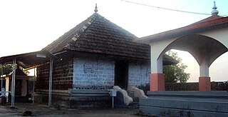
Thimiri is a village in Kannur district in the Indian state of Kerala. An ancient Shiva temple called Thimiri Sree Shiva Kshethra is situated here.

Thirumeni is a village in Kannur district in the Kerala state of India. It is known for its hill station Chathamangalam Hills. The village has several recently migrated families from various parts of the erstwhile political entity (state) of Travancore who settled here in the famed "Malabar migration period" in the nineteenth century. Most of the inhabitants of the village reside in the valley of three major hills by name Chathamangalam Theruvamala alias Alumbumala, Kottathalachimala and Thevarkunnumala. Thirumeni is a small junction with a few government institutions, religious institutions and small shops in int. and is subdivided into smaller villages like Kokkadave, Prapoyil, Chathamangalam (Kannur), Thabore, Muthuvom, Korali, Chattivayal, Thannichal, Paruthikallu etc.
Vayakkara is a village located in Payyanur Taluk of Kannur district in the Indian state of Kerala.
Vellora is a village in Kannur district in the Indian state of Kerala. It has state road connectivity, schools, hospitals, post office, and bank dating back to the 1950s.
Peralam is a village in Payyanur Taluk of Kannur district in the Indian state of Kerala.

