
Carrick-on-Shannon is the county town of County Leitrim in Ireland. It is the largest town in the county. A smaller part of the town located on the west bank of the River Shannon lies in County Roscommon and is home to the town's main train station. As of the 2022 census, the population of the town was 4,743. It is situated on a strategic crossing point of the River Shannon. The main part of the town, the County Leitrim part, is in the civil parish of Kiltoghert, which is in the barony of Leitrim, while Cortober, which is the County Roscommon side of the town, is in the civil parish of Killukin, in the barony of Boyle.
A townland is a small geographical division of land, historically and currently used in Ireland and in the Western Isles in Scotland, typically covering 100–500 acres (40–202 ha). The townland system is of Gaelic origin, antedating the Norman invasion, and most have names of Irish origin. However, some townland names and boundaries come from Norman manors, plantation divisions, or later creations of the Ordnance Survey. The total number of inhabited townlands in Ireland was 60,679 in 1911. The total number recognised by the Irish Place Names database as of 2014 was 61,098, including uninhabited townlands, mainly small islands.

Ballintoy is a small village, townland and civil parish in County Antrim, Northern Ireland. It is alongside the B15 coast road, 28 km (17 mi) north-east of Coleraine, 8 km (5.0 mi) west of Ballycastle and between it and Bushmills. It is in the historic barony of Cary. The village lies about one kilometre from Ballintoy Harbour, a small fishing harbour at the end of a very small, narrow, steep road down Knocksaughey hill which passes by the entrance to Larrybane and Carrick-a-Rede Rope Bridge. The harbour is host to a dawn service on Easter Sunday each year.
Donegore is the name of a hill, a townland, a small cluster of residences, and a civil parish in the historic barony of Antrim Upper, County Antrim, Northern Ireland. Donegore lies approximately 5 miles (8 km) east of Antrim town. 154 acres of the townland lies in the civil parish of Grange of Nilteen.
Lambeg is a small village and civil parish in County Antrim, Northern Ireland. Located between Belfast and Lisburn, it was once a small rural village, but is now within the Greater Belfast conurbation. Lambeg is also an electoral ward of Lisburn Council. In the 2001 Census it had a population of 60 people. The civil parish of Lambeg covers areas of County Down as well as County Antrim.
Barmeen is a townland in County Antrim, Northern Ireland. It is located at the foot of Glendun, one of the nine Glens of Antrim, west of Cushendun and north of Knocknacarry. It is situated in the historic barony of Cary and the civil parish of Culfeightrin and covers 59 acres.

Tullylish is a small village, townland and civil parish in County Down, Northern Ireland. It sits on the River Bann, along the main road between the towns of Banbridge and Portadown. In the 2001 census it had a population of 105 people. It lies within the civil parish of Tullylish and Banbridge District.

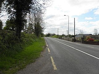
Upper Ballinderry is a small village to the east of Lower Ballinderry in County Antrim, Northern Ireland. It is within the townland of Ballyscolly and civil parish of Ballinderry, the historic barony of Massereene Upper. Upper Ballinderry is about 10 miles (15 km) north- west of Lisburn. In the 2001 Census it had a population of 192 people.

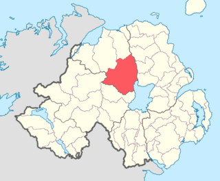
Benraw is a townland of 860 acres in County Down, Northern Ireland, two miles north of Leitrim and six miles from Castlewellan. It is situated in the civil parish of Drumgooland and the historic barony of Iveagh Upper, Lower Half. It is set in the middle of the Dromara Hills and Slieve Croob. It has an average population of 50 people. It contains two roads: the Whitehill Road and the Benraw Road. It is in the middle of the townlands Leitrim, Legananny and Derryneill. It is a very mountainous area and the two main mountains in Benraw are Benraw Mountain and The Whitehill. Benraw is also close to Legananny Dolmen.
Derryneill is a townland of 1,049 acres in County Down, Northern Ireland, near to Leitrim, County Down. It is situated in the civil parish of Drumgooland and the historic barony of Iveagh Upper, Lower Half. Derryneill is mainly made up of small rocky drumlins.
Loughinsholin is a barony in County Londonderry, Northern Ireland. Its southeast borders the northwest shore of Lough Neagh, and itself is bordered by seven other baronies: Dungannon Upper to the south; Strabane Upper to the west; Keenaght and Coleraine to the north; Kilconway, Toome Upper, and Toome Lower to the east. It was formed largely on the extent of the northern part of the medieval Irish túath of Uí Tuirtri.

Carrickfergus is a barony in County Antrim, Northern Ireland. It is bounded on the south-east by Belfast Lough, and otherwise surrounded by the barony of Belfast Lower. It is coextensive with the civil parish of Carrickfergus or St Nicholas and corresponds to the former county of the town of Carrickfergus, a county corporate encompassing Carrickfergus town.
Cavanagh is a townland in the civil parish of Tomregan, County Cavan, Ireland. It lies within the former barony of Tullyhaw.
Ballycor is a townland and civil parish in County Antrim, Northern Ireland. Both are in the historic barony of Antrim Upper.
Drummaul is a townland and civil parish in County Antrim, Northern Ireland. It is situated in the historic barony of Toome Upper and contains the town of Randalstown.
Finvoy is a hamlet and civil parish in County Antrim, Northern Ireland. It is situated in the historic barony of Kilconway. The hamlet had a population of 187 people in the 2011 Census.

Drumgooland is a civil parish in County Down, Northern Ireland. It is situated mainly in the historic barony of Iveagh Upper, Lower Half, with one townland in the barony of Iveagh Lower, Lower Half.
Clonduff is a civil parish in County Down, Northern Ireland. It is mainly in the historic barony of Iveagh Upper, Lower Half, with one townland in the barony of Iveagh Upper, Upper Half.
Coppanaghmore, an Anglicisation of the Gaelic ‘Copanach Mór’ meaning The Big Place covered with Dock-leaves, is a townland in the civil parish of Templeport, County Cavan, Ireland. It lies in the Roman Catholic parish of Glangevlin and barony of Tullyhaw.
Rockfield Lake, also known as Rockfield Lough, is a lake or lough situated between Carrigallen and Killeshandra, two small towns on the northern edge of the Midlands in Ireland. Nowadays, part of the lake is in County Leitrim, which is part of the Province of Connacht, while most of the lake is in County Cavan, which is part of the Province of Ulster. This means that the provincial boundary between Connacht and Ulster now runs through the lough. However, up until the early seventeenth century, all of the lake was considered part of County Leitrim in Connacht. The Cullies River flows through Rockfield Lake, entering the lake at its southern end and flowing out of the lake at its north-western end. This small river flows from nearby Cullies Lake, and flows on, via Drumhart Lake, through Rockfield Lake to Glasshouse Lake.


