
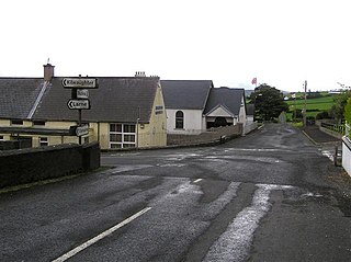
Ballintoy is a small village, townland and civil parish in County Antrim, Northern Ireland. It is alongside the B15 coast road, 28 km (17 mi) north-east of Coleraine, 8 km (5.0 mi) west of Ballycastle and between it and Bushmills. It is in the historic barony of Cary. The village lies about one kilometre from Ballintoy Harbour, a small fishing harbour at the end of a very small, narrow, steep road down Knocksaughey hill which passes by the entrance to Larrybane and Carrick-a-Rede Rope Bridge. The harbour is host to a dawn service on Easter Sunday each year.

Tobergill is a townland of 1,044 acres in County Antrim, Northern Ireland. Lying on the western aspect of Donegore hill, it is situated in the civil parish of Donegore and the historic barony of Antrim Upper.

Dunadry is a small village and townland 3 miles (5 km) from Antrim in County Antrim, Northern Ireland. It is situated in the civil parish of Grange of Nilteen and the historic barony of Antrim Upper. It is within the Borough of Antrim. It had a population of 430 people in the 2011 Census..
Dunamuggy is a townland of 172 acres in County Antrim, Northern Ireland. It is situated in the civil parish of Donegore and the historic barony of Antrim Upper.

Monkstown is a townland and electoral ward in County Antrim, Northern Ireland. It is within the urban area of Newtownabbey and the Newtownabbey Borough Council area. The townland was previously called Ballynamanagh It is also situated in the civil parish of Carnmoney and the historic barony of Belfast Lower.

Ballystrudder or Ballystruder is a small village and townland on Islandmagee in County Antrim, Northern Ireland. It is situated in the historic barony of Belfast Lower and the civil parish of Islandmagee. It is part of Mid and East Antrim Borough Council. It had a population of 992 people in the 2011 Census.
Lambeg is a small village and civil parish in County Antrim, Northern Ireland. Located between Belfast and Lisburn, it was once a small rural village, but is now within the Greater Belfast conurbation. Lambeg is also an electoral ward of Lisburn Council. In the 2001 Census it had a population of 60 people. The civil parish of Lambeg covers areas of County Down as well as County Antrim.
Ballyrashane is a small village and civil parish outside Coleraine, County Londonderry, Northern Ireland. The civil parish of Ballyrashane covers areas of County Antrim, as well as County Londonderry. It is part of Causeway Coast and Glens district.
Barmeen is a townland in County Antrim, Northern Ireland. It is located at the foot of Glendun, one of the nine Glens of Antrim, west of Cushendun and north of Knocknacarry. It is situated in the historic barony of Cary and the civil parish of Culfeightrin and covers 59 acres.
Groggan is a hamlet and townland near Randalstown in County Antrim, Northern Ireland. It is situated in the historic barony of Toome Upper and the civil parish of Drummaul and covers an area of 620 acres. It is within the Borough of Antrim. It had a population of 135 people in the 2011 Census.
Carnalbanagh is a small village and townland in County Antrim, Northern Ireland, 13 km east-north-east of Ballymena. It is situated in the civil parish of Tickmacrevan and the historic barony of Glenarm Lower, and is part of Mid and East Antrim district. It lies above Glenarm and is close to Mount Slemish.

Solar is a townland of 42 acres in County Antrim, Northern Ireland. It is situated in the civil parish of Carncastle and the historic barony of Glenarm Upper.

Antrim Lower is a barony in County Antrim, Northern Ireland. It is bordered by six other baronies: Antrim Upper to the south; Toome Upper to the south-west; Toome Lower to the west; Kilconway to the north-west; Glenarm Lower to the north-east; and Glenarm Upper to the east. The River Braid flows through this barony.
Aghalislone is a townland of 664 acres in County Antrim, Northern Ireland. It is situated in the civil parish of Derriaghy and is split between the historic Baronies of Massereene Upper and Belfast Upper.

Ballaghbeddy is a townland of 164 acres in County Antrim, Northern Ireland, near Ballymoney. It is situated in the historic barony of Kilconway and the civil parish of Finvoy, on the eastern bank of the River Bann which forms the western boundary of the parish of Finvoy.

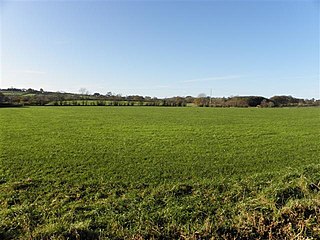
White Park, County Antrim is a townland of 170 acres in County Antrim, Northern Ireland. It is situated in the civil parish of Ballintoy and the historic barony of Cary.

Ballyclaverty is a townland of 339 acres in County Antrim, Northern Ireland. It is situated in the civil parish of Donegore and the historic barony of Antrim Upper.
Derryvullan is a civil parish and townland in County Fermanagh, Northern Ireland. The civil parish is situated in the historic baronies of Tirkennedy and Lurg. Derryvullan townland is in the portion of the parish of the same name in Tirkennedy.

Derriaghy,, , is a townland and civil parish in County Antrim, Northern Ireland, 5.5 miles (9 km) south-west of Belfast city centre. The townland is situated in the historic barony of Belfast Upper and the civil parish covers areas of both Belfast Upper and the barony of Massereene Upper.


