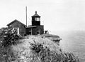
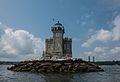
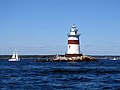
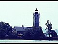
Name Image Location Coordinates Year first lit Automated Year deactivated Current Lens Focal Height Ambrose Light Lower New York Bay 40°27′00″N 73°48′00″W / 40.45000°N 73.80000°W / 40.45000; -73.80000 1967 (First) (Last) 1988 1999 (First) (Last) None 076 76 ft (23 m) Barber's Point Light Westport (Lake Champlain ) 44°09′15″N 73°24′16″W / 44.1543°N 73.4045°W / 44.1543; -73.4045 1873 Never 1935(Now a private house) None 036 36 ft (11 m) Barcelona Light Westfield 42°20′27″N 79°35′42″W / 42.34083°N 79.59500°W / 42.34083; -79.59500 1829 Never 1859 None 040 40 ft (12 m) Blackwell Island Light New York City (Roosevelt Island ) 40°46′22″N 73°56′24.6″W / 40.77278°N 73.940167°W / 40.77278; -73.940167 1872 Never 1940 None 050 50 ft (15 m) Bluff Point Light Valcour Island (Lake Champlain ) 44°37′22″N 73°25′52″W / 44.62282°N 73.43116°W / 44.62282; -73.43116 1874 1930 Active(Inactive: 1930–2004) 300mm 095 95 ft (29 m) Braddock Point Light Braddock Bay 43°20′28″N 77°45′45″W / 43.34111°N 77.76250°W / 43.34111; -77.76250 1896 Never 1954(Now a private house) None 055 55 ft (17 m) Buffalo Main Light Buffalo (Buffalo River ) 42°52′49″N 78°53′45″W / 42.88028°N 78.89583°W / 42.88028; -78.89583 1833 Never 1914 None 060 60 ft (18 m) Buffalo Harbor North Entrance Light Buffalo Unknown 1903 1935 1980 None Unknown Buffalo Harbor South Entrance Light Buffalo 42°50′0″N 78°52′3″W / 42.83333°N 78.86750°W / 42.83333; -78.86750 1903 1935 Active Unknown Unknown Buffalo North breakwater East end Light Buffalo N/A 1903 1960 1985 None 029 29 ft (8.8 m) Buffalo North Breakwater South End Light Buffalo 42°52′49″N 78°53′45″W / 42.88028°N 78.89583°W / 42.88028; -78.89583 1903 1960 1985 None Unknown Cape Vincent Breakwater Lighthouse Cape Vincent 44°7′10″N 76°19′56″W / 44.11944°N 76.33222°W / 44.11944; -76.33222 1904 Never 1951 None 025 25 ft (7.6 m) Cedar Island Light East Hampton (Cedar Point County Park ) 41°2′26.9″N 72°15′39.5″W / 41.040806°N 72.260972°W / 41.040806; -72.260972 1839 (Former) (Current) Never 1934 None 057 57 ft (17 m) Charlotte–Genesee Lighthouse Rochester 43°15′10″N 77°36′40″W / 43.25278°N 77.61111°W / 43.25278; -77.61111 1822 Never 1881(Now a museum) None Unknown Cold Spring Harbor Light Cold Spring Harbor 40°54′26.0″N 73°30′35.5″W / 40.907222°N 73.509861°W / 40.907222; -73.509861 (Preserved light) 40°54′51.0″N 73°29′35.2″W / 40.914167°N 73.493111°W / 40.914167; -73.493111 (Current structure) 1890 (Former) (Current) 1965(Current) Active(Replacement) Unknown Unknown Coney Island Light New York City (Brooklyn ) 40°34′36″N 74°00′42″W / 40.57667°N 74.01167°W / 40.57667; -74.01167 1890 (Former) (Current) 1989 Active Unknown 075 75 ft (23 m) Coxsackie Light Coxsackie, New York (Hudson River ) 42°22′47″N 73°47′41″W / 42.37972°N 73.79472°W / 42.37972; -73.79472 1830 (Former) (Current) Never 1940 None Unknown Crossover Island Light Saint Lawrence River (Border light ) 44°29′49″N 75°46′42″W / 44.49694°N 75.77833°W / 44.49694; -75.77833 1848 (Former) (Current) Never 1941 None Unknown Crown Point Light Crown Point (Lake Champlain ) 44°01′48″N 73°25′18″W / 44.0299°N 73.4216°W / 44.0299; -73.4216 1858 Never 1926 None Unknown Cumberland Head Light Cumberland Head (Lake Champlain ) 44°41′29″N 73°23′7″W / 44.69139°N 73.38528°W / 44.69139; -73.38528 1838 (Former) (Current) 2003(Relit) Active(Inactive: 1934–2003) Unknown Unknown Dunkirk Light Dunkirk 42°29′38″N 79°21′14″W / 42.49389°N 79.35389°W / 42.49389; -79.35389 1826 (Former) (Current) 1960 Active Third-order Fresnel 082 61 ft (19 m) East Charity Shoal Light Lake Ontario (Border light ) 44°2′12″N 76°28′54″W / 44.03667°N 76.48167°W / 44.03667; -76.48167 1877(Moved to NY in 1935) 1935 Active(Also a private house) Unknown 052 52 ft (16 m) Eatons Neck Light Eatons Neck 40°57′14.5″N 73°23′42.5″W / 40.954028°N 73.395139°W / 40.954028; -73.395139 1799 1969 Active Third-order Fresnel 126 126 ft (38 m) Elm Tree Beacon Light New York City (Staten Island ) 40°33′50″N 74°5′43″W / 40.56389°N 74.09528°W / 40.56389; -74.09528 1856 (Former) (Current) 1939 1964 None 062 62 ft (19 m) (Original) Esopus Meadows Light Esopus (Hudson River ) 41°52′6.2″N 73°56′29.8″W / 41.868389°N 73.941611°W / 41.868389; -73.941611 1839 (Former) (Current) 1965 Active(Inactive: 1965–2003) Unknown 052 52 ft (16 m) Execution Rocks Light Long Island Sound 40°52′41.3″N 73°44′16.3″W / 40.878139°N 73.737861°W / 40.878139; -73.737861 1850 1979 Active APRB-251 062 62 ft (19 m) Fire Island Light Fire Island (Long Island ) 40°37′56.8″N 73°13′6.9″W / 40.632444°N 73.218583°W / 40.632444; -73.218583 1826 (Former) (Current) 1938 Active(Inactive: 1974–1986) DCB-224 168 168 ft (51 m) Fort Niagara Light Porter (Fort Niagara State Park ) 43°15′42″N 79°3′48″W / 43.26167°N 79.06333°W / 43.26167; -79.06333 1782 (Former) (Current) Never 1993 None 091 91 ft (28 m) Fort Tompkins Light New York City (Staten Island ) 40°36′21″N 74°03′14″W / 40.6057°N 74.0539°W / 40.6057; -74.0539 1828(The last L.H. Never 1903(Demolished) None Unknown Fort Wadsworth Light New York City (Staten Island ) 40°36′21″N 74°3′14″W / 40.60583°N 74.05389°W / 40.60583; -74.05389 1903 2005(Relit) Active(Inactive: 1965–2005) Unknown 075 75 ft (23 m) Frenchman Island Light Oneida Lake 43°13′06″N 76°02′59″W / 43.21833°N 76.04972°W / 43.21833; -76.04972 1918 1949 Active Unknown Unknown Galloo Island Light Hounsfield (Galloo Island ) 43°53′18″N 76°26′42″W / 43.88833°N 76.44500°W / 43.88833; -76.44500 1820 (Former) (Current) 1963 Active 190mm 058 58 ft (18 m) Horse Island Light Hounsfield (Sackets Harbor ) 43°56′35″N 76°8′40″W / 43.94306°N 76.14444°W / 43.94306; -76.14444 1831 [ 1] (Former) (Current) 1925 1957(Now a private house) None Unknown Horton Point Light Southold 41°5′6.51″N 72°26′44.77″W / 41.0851417°N 72.4457694°W / 41.0851417; -72.4457694 1857 1933(Inactive: 1933–1990) Active VRB-25 103 103 ft (31 m) Hudson–Athens Lighthouse Hudson River 42°15′7″N 73°48′31″W / 42.25194°N 73.80861°W / 42.25194; -73.80861 1874 1949 Active 300mm 046 46 ft (14 m) Huntington Harbor Light Huntington 40°54′38.6″N 73°25′52.7″W / 40.910722°N 73.431306°W / 40.910722; -73.431306 1857 (Former) (Current) 1949 Active 300mm 041 41 ft (12 m) Latimer Reef Light Southold (Fishers Island ) 41°18′16.227″N 72°55′59.937″W / 41.30450750°N 72.93331583°W / 41.30450750; -72.93331583 1884 1954 Active 300mm 055 55 ft (17 m) Little Gull Island Light Long Island Sound (Little Gull Island ) 41°12′23″N 72°06′25″W / 41.20639°N 72.10694°W / 41.20639; -72.10694 1806 (Former) (Current) 1978 Active Unknown 091 91 ft (28 m) Little Red Lighthouse Jeffrey's Hook Light New York City (Manhattan ) 40°51′1″N 73°56′49″W / 40.85028°N 73.94694°W / 40.85028; -73.94694 1889 (Former) (Current) 2002(Relit) Active(Inactive: 1947–2002) 300mm Unknown Montauk Point Light Montauk 41°04′16″N 71°51′26″W / 41.07099°N 71.85709°W / 41.07099; -71.85709 1797 1987 Active VRB-25 168 168 ft (51 m) New Dorp Light New York City (Staten Island ) 40°34′51″N 74°7′12″W / 40.58083°N 74.12000°W / 40.58083; -74.12000 1856 Never 1964(Now a private house) None 190 190 ft (58 m) North Brother Island Light New York City The Bronx 40°47′57.3″N 73°53′58.5″W / 40.799250°N 73.899583°W / 40.799250; -73.899583 1869 Never 1953(Now Ruins) None 050 50 ft (15 m) North Dumpling Light Long Island Sound (Near Fishers Island ) 41°17′17″N 72°1′10″W / 41.28806°N 72.01944°W / 41.28806; -72.01944 1849 1959 Active 300mm 060 60 ft (18 m) Oak Orchard Light Oak Orchard Creek 43°22′16″N 78°11′35″W / 43.37111°N 78.19306°W / 43.37111; -78.19306 1871 Never 1914(Destroyed in 1916) None Unknown Ogdensburg Harbor Light Ogdensburg 44°41′52″N 75°30′12″W / 44.69778°N 75.50333°W / 44.69778; -75.50333 1834 (Former) (Current) 1941 Active(Inactive: 1961–2011) Unknown Unknown Olcott Light Olcott 43°20′20″N 78°42′54″W / 43.33889°N 78.71500°W / 43.33889; -78.71500 1873 Never 1930(Demolished in 1963, Unknown Unknown Old Field Point Light Old Field 40°57′45″N 73°07′49″W / 40.962370°N 73.130318°W / 40.962370; -73.130318 [ 2] 1823 (Former) (Current) 1991(Relit) Active(Inactive: 1933–1991) Unknown 074 74 ft (23 m) Old Orchard Shoal Light Lower New York Bay 40°30′44.272″N 74°5′55.369″W / 40.51229778°N 74.09871361°W / 40.51229778; -74.09871361 1893 1955 2012(Destroyed by Sandy ) None 051 51 ft (16 m) Orient Long Beach Bar Light Orient 41°6′32″N 72°18′23″W / 41.10889°N 72.30639°W / 41.10889; -72.30639 1871 Never 1945(Destroyed in 1963, Unknown 058 58 ft (18 m) Orient Point Light Orient 41°9′48.393″N 72°13′25.014″W / 41.16344250°N 72.22361500°W / 41.16344250; -72.22361500 1899 1958 Active Optic 064 64 ft (20 m) Oswego Harbor West Pierhead Light Oswego 43°28′24″N 76°31′01″W / 43.47332°N 76.51682°W / 43.47332; -76.51682 1934(Current) 1968 Active Optic 057 57 ft (17 m) Plum Island Light Southold (Plum Island ) 41°10′25.20″N 72°12′41.47″W / 41.1736667°N 72.2115194°W / 41.1736667; -72.2115194 1827 (Former) (Current) 1978 Active(metal tower) Unknown 050 50 ft (15 m) Point Aux Roches Light Champlain (Lake Champlain ) 44°47′58″N 73°21′38″W / 44.79944°N 73.36056°W / 44.79944; -73.36056 1859 1933 1989 None 059 59 ft (18 m) Prince's Bay Light New York City (Staten Island ) 40°30′27.7″N 74°12′48.3″W / 40.507694°N 74.213417°W / 40.507694; -74.213417 1828 (Former) (Current) 2006(Relit) Active(Inactive: 1922–2006) VRB-25 Unknown Race Rock Light Long Island Sound (Near Fishers Island ) 41°14′36.6″N 72°2′49.2″W / 41.243500°N 72.047000°W / 41.243500; -72.047000 1879 1978 Active Unknown 067 67 ft (20 m) Rock Island Light Saint Lawrence River 44°16′50″N 76°1′1″W / 44.28056°N 76.01694°W / 44.28056; -76.01694 1848 (Former) (Current) Never 1956 None 050 50 ft (15 m) Rondout Light Kingston 41°55′15″N 73°57′45″W / 41.92083°N 73.96250°W / 41.92083; -73.96250 1838 (Former) (Current) 1954 Active 250mm 054 54 ft (16 m) Sands Point Light North Hempstead 40°51′57.2″N 73°43′46.2″W / 40.865889°N 73.729500°W / 40.865889; -73.729500 1809 Never 1922 None 065 65 ft (20 m) Saugerties Light Saugerties 42°4′19.53″N 73°55′46.72″W / 42.0720917°N 73.9296444°W / 42.0720917; -73.9296444 1835 (Former) (Current) 1954 Active(Inactive: 1954–1990) Unknown 042 42 ft (13 m) Selkirk Light Pulaski 43°34′24″N 76°12′06″W / 43.57333°N 76.20167°W / 43.57333; -76.20167 1838 1989(Relit) Active(Inactive: 1859–1989) 190mm 050 50 ft (15 m) Shinnecock Light Southampton (Shinnecock Bay ) 40°51′2″N 72°30′15″W / 40.85056°N 72.50417°W / 40.85056; -72.50417 1858 Never 1931(Demolished in 1948) None 168 168 ft (51 m) Sodus Outer Light Sodus 43°16′38.3″N 76°58′26.4″W / 43.277306°N 76.974000°W / 43.277306; -76.974000 1858 (Former) (Current) 1980 Active Unknown 051 51 ft (16 m) Sodus Point Light Sodus (Sodus Point ) 43°16′25.7″N 76°59′10.2″W / 43.273806°N 76.986167°W / 43.273806; -76.986167 1825 (Former) (Current) Never 1901 None 070 70 ft (21 m) South Buffalo North Side Light Dunkirk 42°50′7″N 78°52′3″W / 42.83528°N 78.86750°W / 42.83528; -78.86750 1903 1960 1985 None Unknown Staten Island Light New York City (Staten Island ) 40°34′33.8″N 74°08′28.5″W / 40.576056°N 74.141250°W / 40.576056; -74.141250 [ 3] 1912 1921 Active Unknown 231 231 ft (70 m) Statue of Liberty New York City (Liberty Island ) 40°41′21″N 74°2′40″W / 40.68917°N 74.04444°W / 40.68917; -74.04444 1886 — 1902 [ 4] (As a lighthouse) — 305 305 ft (93 m) Stepping Stones Light Long Island Sound 40°49′27.6″N 73°46′29.1″W / 40.824333°N 73.774750°W / 40.824333; -73.774750 1877 1964 Active 300mm 046 46 ft (14 m) Stony Point (Henderson) Light Henderson 43°50′22″N 76°17′54″W / 43.83944°N 76.29833°W / 43.83944; -76.29833 1839 (Former) (Current) 1947 1959 None 058 58 ft (18 m) Stony Point Light Stony Point 41°14′29″N 73°58′20″W / 41.24139°N 73.97222°W / 41.24139; -73.97222 1826 1995(Relit) Active(Inactive: 1925–1995) Fourth-order Fresnel 058 58 ft (18 m) Stuyvesant Light Stuyvesant 42°24′42″N 73°46′42″W / 42.41167°N 73.77833°W / 42.41167; -73.77833 1829 (Former) (Current) Never 1933 None 042 42 ft (13 m) Sunken Rock Light Saint Lawrence River (Bush Island) 44°20′44″N 75°54′55″W / 44.34556°N 75.91528°W / 44.34556; -75.91528 1847 (Former) (Current) 1958 Active Unknown Unknown Tarrytown Light Sleepy Hollow 41°5′2.6″N 73°52′27.3″W / 41.084056°N 73.874250°W / 41.084056; -73.874250 1883 Never 1961 Fourth-order Fresnel(Replica) 056 56 ft (17 m) Thirty Mile Point Light Somerset 43°22′30″N 78°29′11″W / 43.37500°N 78.48639°W / 43.37500; -78.48639 1876 1958 Active 300mm 071 71 ft (22 m) Throgs Neck Light New York City The Bronx 40°48′16″N 73°47′26″W / 40.80444°N 73.79056°W / 40.80444; -73.79056 1826(The last L.H. Never 1934 None Unknown Tibbetts Point Light Cape Vincent 44°6′00″N 76°22′12″W / 44.10000°N 76.37000°W / 44.10000; -76.37000 1827 (Former) (Current) 1970 Active Fourth-order Fresnel 069 69 ft (21 m) West Point Light West Point 41°23′45″N 73°57′3″W / 41.39583°N 73.95083°W / 41.39583; -73.95083 1853 Never 1946 None 040 40 ft (12 m) West Bank Light Lower New York Bay 40°32′16.8″N 74°02′34.1″W / 40.538000°N 74.042806°W / 40.538000; -74.042806 1901 1980 Active 300mm 069 69 ft (21 m) Whitestone Point Light New York City Queens 40°48′06″N 73°49′10″W / 40.80167°N 73.81944°W / 40.80167; -73.81944 1889 Unknown Active Unknown 056 56 ft (17 m)