List of tourist attractions in Hamilton, Ontario

Last updated

FirstOntario Centre FirstOntario Centre.jpg
FirstOntario Centre
The Canadian Warplane Heritage Museum Canadian Warplane Heritage Museum Exterior 1.jpg
The Canadian Warplane Heritage Museum
HMCS Haida, Pier 9, Hamilton, Ontario HMCSHaidaHamiltonA.JPG
HMCS Haida, Pier 9, Hamilton, Ontario
Elephants at African Lion Safari African lion safari Elephants swim.JPG
Elephants at African Lion Safari

Hamilton, Ontario has a large variety of historical sites, cultural and educational institutions, and an aviary for exotic birds.

Contents

Historical sites and museums

Cultural institutions

Art

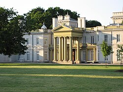
Dundurn Castle at Dundurn Park (summer) DundurnCastleSummer.JPG
Dundurn Castle at Dundurn Park (summer)
Whitehern Museum WhitehernMuseumHamilton.JPG
Whitehern Museum

Music

Theatre

Festivals

Sports

The Canadian Football Hall of Fame Statue touchdown cfhof.jpg
The Canadian Football Hall of Fame

Parks, trails and waterfront

Webster's Falls Waterdawn Webster Falls5.jpg
Webster's Falls
Pier 4 Park Pier4ParkHamilton2.JPG
Pier 4 Park
Hamilton Harbour Cruises via Hamilton Harbour Queen HamiltonHarbourQueen.JPG
Hamilton Harbour Cruises via Hamilton Harbour Queen

Related Research Articles

<span class="mw-page-title-main">Hamilton, Ontario</span> City in Ontario, Canada

Hamilton is a port city in the Canadian province of Ontario. Hamilton has a population of 569,353, and its census metropolitan area, which includes Burlington and Grimsby, has a population of 785,184. The city is approximately 45 kilometres (28 mi) southwest of Toronto in the Greater Toronto and Hamilton Area (GTHA).

<span class="mw-page-title-main">Dundas, Ontario</span> Town in Canada

Dundas is a community and town in Hamilton, Ontario, Canada. It is nicknamed the Valley Town because of its topographical location at the bottom of the Niagara Escarpment on the western edge of Lake Ontario. The population has been stable for decades at about 20,000, largely because it has not annexed rural land from the protected Dundas Valley Conservation Area.

<span class="mw-page-title-main">Flamborough, Ontario</span> Former municipality, now part of Hamilton, Ontario, Canada

Flamborough is a district and former municipality in the city of Hamilton, Ontario, Canada. For most of its existence before amalgamation with Hamilton in 2001, Flamborough comprised the former townships of East Flamborough, West Flamborough, and Beverly, as well as the village of Waterdown. The largest suburban community is the former village of Waterdown containing perhaps one third of its thirty thousand or so inhabitants. Other Flamborough communities include Carlisle, Christie's Corners, Clappison's Corners, Copetown, Freelton, Greensville, Lynden, Kirkwall, Millgrove, Mountsberg, Orkney, Peters Corners, Rockton, Troy, Sheffield, Valens, Strabane and Westover.

<span class="mw-page-title-main">Stoney Creek, Ontario</span> Dissolved city in Ontario, Canada

Stoney Creek is a community in the city of Hamilton in the Canadian province of Ontario. It was officially a city from 1984 to 2001, when it was amalgamated with the rest of the cities of the Regional Municipality of Hamilton–Wentworth.

<span class="mw-page-title-main">Waterdown, Ontario</span> Dissolved village in Ontario, Canada

Waterdown is a village in Canada which since 2001 has been a community of Hamilton, Ontario. Waterdown is approximately 60 km west of downtown Toronto.

Royal Botanical Gardens (RBG) is headquartered in Burlington owning extensive environmental protection areas, historic sites and culturally relevant gardens in Hamilton, Ontario, Canada. It is one of the major tourist attractions between Niagara Falls and Toronto, as well as a significant local and regional horticultural, education, conservation, and scientific resource. The mandate is derived by a Provincial Act of 1941 centred on human interaction with the natural world and protection of environmentally significant lands that form the western tip of Lake Ontario. Royal Botanical Gardens spans an area of about 10 km by 4 km, dominated by two coastal wetlands, and glacial-carved landscapes that extend from the lake up to the Niagara Escarpment plateau. The various gardens and natural areas are accessed through nine public entrance locations. It is one of several Prescribed Public Bodies listed under the Ontario Heritage Act.

Cootes Drive, formerly known as the Dundas Diversion, is a city street in Hamilton, Ontario. The route connects York Road and King Street in Dundas with Main Street to the southeast, and is considered one of the first divided highways in Canada. Originally constructed as the Dundas Diversion, the route served to bypass several sharp turns along the nearby Highway 8, as well as to demonstrate the new dual highway concept that would soon thereafter evolve into the 400-series highway network. Construction began in 1936, and the route opened on the weekend of September 11, 1937.

<span class="mw-page-title-main">Transportation in Hamilton, Ontario</span> Transportation infrastructure located in Hamilton, Ontario

Transport in Hamilton, Ontario consists of a variety of modes.

<span class="mw-page-title-main">Geography of Hamilton, Ontario</span>

Hamilton is located on the western end of the Niagara Peninsula and wraps around the westernmost part of the Lake Ontario. Most of the city including the downtown section lies along the south shore. Situated in the geographic centre of the Golden Horseshoe, it lies roughly midway between Toronto and Buffalo. The two major physical features are Hamilton Harbour marking the northern limit of the city and the Niagara Escarpment running through the middle of the city across its entire breadth, bisecting the city into 'upper' and 'lower' parts.

<span class="mw-page-title-main">Culture of Hamilton, Ontario</span> Overview of the culture of Hamilton, Ontario (Canada)

Hamilton, Ontario's culture has built on its historical and social background. Some attractions include a museum of aircraft, HMCS Haida National Historic Site, historic naval ship; Canada's most famous warship and the last remaining Tribal Class in the world, a stately residence of a Prime Minister of Upper Canada, a functioning nuclear reactor at McMaster University, a horticultural haven, the Canadian Football Hall of Fame, African Lion Safari and Christ the King Cathedral.

<span class="mw-page-title-main">Hughson Street</span>

Hughson Street is a Lower City collector road in Hamilton, Ontario, Canada. It starts at Charlton Avenue East at St. Joseph's hospital and runs north to Haymarket Street in the downtown where it's cut off by the Hamilton GO Transit station. Up to this point it is a two-way street. It then starts up again north of the station on Hunter Street East, where it then becomes a one-way street going north just past Barton Street East to Murray Street where it's cut off again by a parking lot for LIUNA Station. It then starts up again one block north past the CN railway tracks on Strachan Street and from this point onwards becomes a two-way street again that extends to the city's North End to the waterfront on Guise Street West, the site of the Canada Marine Discovery Centre and Pier 9.

<span class="mw-page-title-main">MacNab Street (Hamilton, Ontario)</span>

MacNab Street is a Lower City collector road in Hamilton, Ontario, Canada. It starts in the Durand neighbourhood on Markland Street, as a one-way street going north to Bold Street, where it becomes two-way for one block until Hurst Place where it's cut off by a wall for the Hunter Street railway bridge. Pedestrians may cross Hunter Street at an underpass. MacNab Street starts again north of the Railway line on Hunter Street as a two-way street but is cut off again at King Street where the Lloyd D. Jackson Square mall and Stelco Tower are situated. MacNab Street continues north of this Mall on York Boulevard, in front of the Hamilton Public Library & the entrance to the Hamilton Farmer's Market, again as a two-way street right through the city's North End to Burlington Street. It continues as a one-way street to the waterfront where it ends at Guise Street West, the site of the Royal Hamilton Yacht Club and Pier 5.

<span class="mw-page-title-main">Catharine Street (Hamilton, Ontario)</span>

Catharine Street is a Lower City collector road in Hamilton, Ontario, Canada. It starts off at Charlton Avenue East at Woolverton Park in the Corktown neighbourhood as a one-way street (southbound), tunnels underneath the Hunter Street Railway bridge and stretches up to Barton Street East where it then turns two-way and cutoff by the CN Railway lines that cut through Strachan Street Park one block north past Barton. Catharine Street then resumes again on Strachan Street East, north of the Park again as a two-way road for 3 blocks and interrupted again at Picton Street East, the site of St. Lawrence Elementary School and resumes again north of this property on Macauley Street East, again as a two-way street for another 3 blocks where it's interrupted for a third time at Brock Street, the site of Eastwood Park and Eastwood Arena. Catherine Street resumes again north of Eastwood Park on Guise Street East and ends at the city's North End waterfront, the site of a Royal Canadian Navy base and Pier 9.

<span class="mw-page-title-main">Wilson Street (Hamilton, Ontario)</span>

Wilson Street is a Lower City collector road in Hamilton, Ontario, Canada. It starts off at James Street North and works its way East and ends at Sherman Avenue North. The section between James Street and Ferguson Avenue was a one-way road, but was converted to a two-way street at 10 am on December 10, 2010.

<span class="mw-page-title-main">York Boulevard</span>

York Boulevard is a Lower City arterial road in Hamilton, Ontario, Canada. Formerly known as Highway 2 and Highway 6, it starts in Burlington, Ontario at Plains Road West as a two-way arterial road that wraps around and over Hamilton Harbour, enters the city of Hamilton in the west end at Dundurn Park, and ends at James Street North. It has a one-way section from Queen Street to Bay Street North, and continues east of James Street North as Wilson Street.)

<span class="mw-page-title-main">Burlington Heights (Ontario)</span> Promontory and peninsula between Hamilton and Burlington, Ontario, Canada

Burlington Heights refers to a promontory or area of flat land sitting elevated above the west end of Hamilton Harbour in the city of Hamilton, Ontario which continues as a peninsula to the north toward the city of Burlington, Ontario. It separates Cootes Paradise Marsh on the west from the harbor on the east. Geologically the Burlington Heights is a sand and gravel bar formed across the eastern end of the Dundas Valley by Glacial Lake Iroquois. It is the northern continuation of the longer Iroquois Bar which extends south into Hamilton.

<span class="mw-page-title-main">King Street, Dundas, Ontario</span>

King Street starts off as a collector road in the east-end of town in Dundas, Hamilton, Ontario, Canada beside Cootes Paradise and the Desjardins Canal at Olympic Drive and switches to an arterial road at York Street and cuts through the town of Dundas where it ends in the west-end by the CN railway tracks at the base of the Niagara Escarpment. It is a two-way street throughout.

References

  1. "Hamilton Children's Museum". City of Hamilton, Ontario, Canada. 18 August 2015. Retrieved 13 September 2015.
  2. "Hamilton Museum of Steam & Technology National Historic Site". City of Hamilton, Ontario, Canada. 1 September 2015. Retrieved 13 September 2015.
  3. "The Nash-Jackson House". The War of 1812 Website.{{cite web}}: Missing or empty |url= (help)
  4. "The Cotton Factory – Hamilton's largest creative arts facility, in the heart of lower Hamilton". The Cotton Factory. Retrieved 13 September 2015.
  5. "Arctic Experience McNaught Gallery" . Retrieved 13 September 2015.
  6. "McMaster Museum of Art". McMaster University. Retrieved 13 September 2015.