
The Financial District of Lower Manhattan, also known as FiDi, is a neighborhood located on the southern tip of Manhattan in New York City. It is bounded by the West Side Highway on the west, Chambers Street and City Hall Park on the north, Brooklyn Bridge on the northeast, the East River to the southeast, and South Ferry and the Battery on the south.
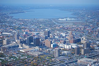
Downtown Syracuse is the economic center of Syracuse, New York, and Central New York, employing over 30,000 people, and housing over 4,300.
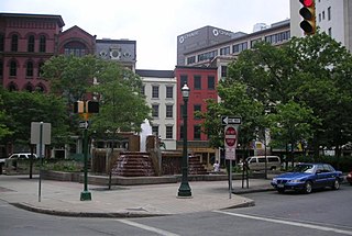
Hanover Square in downtown Syracuse is actually a triangle at the intersection of Warren, Water, and East Genesee Streets. The name may also refer to the larger Hanover Square Historic District which includes seventeen historic buildings in the area that was the first commercial district in Syracuse. In the warm weather months, entertainment is common on the plaza around the fountain. Workers in the surrounding office buildings and retail establishments often lunch there.

This is intended to be a complete list of properties and districts listed on the National Register of Historic Places in Orleans County, New York. The locations of National Register properties and districts may be seen in a map by clicking on "Map of all coordinates". Two listings, the New York State Barge Canal and the Cobblestone Historic District, are further designated a National Historic Landmark.

The Central Park West Historic District is located along Central Park West, between 61st and 97th Streets, on the Upper West Side of Manhattan in New York City, United States. The district was added to the National Register of Historic Places on November 9, 1982. The district encompasses a portion of the Upper West Side-Central Park West Historic District as designated by the New York City Landmarks Preservation Commission, and contains a number of prominent New York City designated landmarks, including the Dakota, a National Historic Landmark. The buildings date from the late 19th century to the early 1940s and exhibit a variety of architectural styles. The majority of the district's buildings are of neo-Italian Renaissance style, but Art Deco is a popular theme as well.
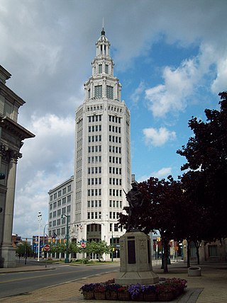
Electric Tower is a historic office building and skyscraper located at the corner of Washington and Genesee Streets in Buffalo. It is the seventh tallest building in Buffalo. It stands 294 feet (89.6 m) and 14 stories tall and is in the Beaux-Arts Classical Revival style. It was designed by James A. Johnson and built in 1912. The tower was based upon an earlier Electric Tower constructed for the 1901 Pan-American Exposition; as with most of the buildings constructed for that event, the original was only temporary and demolished shortly after the fair ended. Additions were made in 1923 and 1928. The white terra-cotta clad was originally built as the Niagara Mohawk Building and features an octagonal tower which steps back three times to terminate in a large lantern. It is also known as Iskalo Electric Tower, for the real estate development company that owns the building.

The Dwight Street Historic District is an irregularly shaped 135-acre (55 ha) historic district in New Haven, Connecticut. The district is located immediately west of the center of Downtown New Haven and is generally bounded by Elm Street on the north, Park Street on the east, North Frontage Road on the south, and Sherman Avenue on the west. It contains one of the city's highest concentrations of well-preserved 19th and early 20th-century residential architecture, much of which was developed for the working classes in the city's factories. It was listed on the National Register of Historic Places in 1983. The historic district includes most of the Dwight neighborhood and several blocks of the northeast corner of the West River neighborhood.
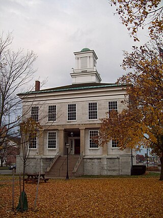
The Genesee County Courthouse is located at the intersection of Main and Ellicott streets in Batavia, New York, United States. It is a three-story Greek Revival limestone structure built in the 1840s.

The Genesee County Courthouse Historic District is located at the junction of Main, West Main and Ellicott streets in downtown Batavia, New York, United States. It is a small area with the county courthouse, a war memorial and other government buildings dating from the 1840s to the 1920s. Some were originally built for private purposes.

The former U.S. Post Office in Hornell, Steuben County, New York, United States, is located on Seneca Street. It was built in 1916 and is one of a number of post offices in New York State designed by the Office of the Supervising Architect of the Treasury Department, James A. Wetmore. It is a neo-Georgian, Colonial Revival style structure. It was vacated by the post office in 1965 and served as offices for the Hornell Board of Education and District Administration until 1989. In 1996 it was purchased by Jerome S. O'Connor, and it was listed on the National Register of Historic Places in 1997.
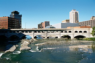
Erie Canal: Second Genesee Aqueduct, also known as the Broad Street Aqueduct or Broad Street Bridge, is a historic stone aqueduct located at Rochester in Monroe County, New York. It was constructed in 1836–1842 and originally carried the Erie Canal over the Genesee River. The overall length of the aqueduct including the wings and abutments is 800 feet (240 m). The aqueduct is 70 feet (21 m) wide and has large parapets on either side. It is one of four major aqueducts in the mid-19th century Erie Canal system. In 1927, a roadbed was added to carry automobile traffic and named Broad Street. It also carried a part of the Rochester Subway.

Lehigh Valley Railroad Station is a historic railway station located at Rochester in Monroe County, New York. The Lehigh Valley Railroad built the station in 1905 but stopped using the station for passenger service in the 1950s. Later the station was used as a bus terminal and then as a night club. In the 1980s the building was added to the National Register of Historic Places and today it houses the Dinosaur Bar-B-Que restaurant.

Brown's Race Historic District is a national historic district located at Rochester in Monroe County, New York. The district contains 15 contributing buildings, 2 contributing structures, and 14 contributing sites. All of the principal buildings are used for commercial purposes and are sited along or near the curving south rim of the Genesee River gorge at the rim of the High Falls. The district comprises a collection of 19th-century industrial buildings built of brick and stone, and ranging in size from one- to six-stories. Also in the district is the mill race and the 19th century iron Pont De Rennes bridge, which is used today as a pedestrian bridge and viewing platform of the High Falls and surrounding gorge.

The Old Post Office and Courthouse is a historic courthouse and former post office located at 157 Genesee Street in Auburn, New York. It was built in 1888–1890 and was designed by the Office of the Supervising Architect of the Treasury Department, Mifflin E. Bell, in the Richardsonian Romanesque style. The limestone-and-brick building was expanded in 1913–1914, designed by James M. Elliot, and again in 1937. It serves as a courthouse of the United States District Court for the Northern District of New York. The massive, asymmetrical, 2+1⁄2-story main block (1888) includes a 3-story tower at the southwest corner, a 2+1⁄2-story stair tower, and two massive Richardsonian Romanesque–style entrances.

The Genesee Street Hill–Limestone Plaza Historic District is a historic district in Fayetteville, New York that was listed on the National Register of Historic Places in 1982. The western border of the district is Limestone Creek. The district includes multiple Greek Revival houses, as well as Italianate and Federal architecture styles, along East Genesee Street as it rises from Limestone Plaza to Chapel Street, near the top of East Genesee Street Hill.

The Skaneateles Historic District is a 17 acres (6.9 ha) historic district in the village of Skaneateles, New York that dates back to 1796, includes one building from the 20th century, but is otherwise composed of 19th-century residences and commercial buildings. It includes 59 contributing buildings and one contributing site – Thayer Park along Skaneateles Lake, – as well as five non-contributing structures. The district runs along both sides of East Genesee Street from Jordan Street to Onondaga Street, and includes the core of Skaneateles' historic downtown area, which was rebuilt in 1836 after being almost totally destroyed by fire in 1835. Also included are properties on Jordan Street up to the intersection of Fennell Street, and the stone mill property on Fennell Street.
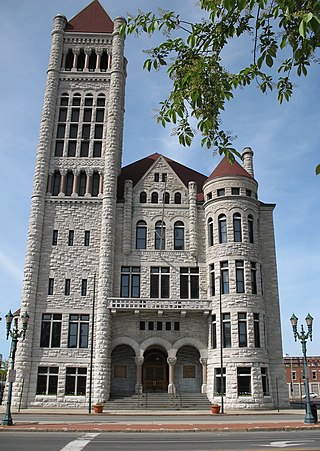
Charles Erastus Colton was an American architect who worked in Syracuse, New York.

Scottholm is an historic housing development in the Meadowbrook neighborhood of Syracuse, Onondaga County, New York. It has been registered as a National Historic District. It is bounded by Salt Springs Road on the north; Brookford Road and East Avenue on the east; Meadowbrook Drive on the south; and Scottholm Terrace on the west. Scottholm consists of single‐family homes of varying styles built in the early 20th century. When it was built, Scottholm was marketed to upper middle class and upper class residents. Today, the area attracts a diverse population of white collar, academic, and creative class professionals. Nottingham High School, in the Syracuse City School District, is nearby.

William J. Beardsley was a Poughkeepsie, New York-based architect.
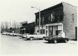
The Genesee Avenue–Walker Street Historic District is a primarily commercial- and railroad-oriented historic district, located along three blocks of Walker Street and one intersecting block of Genesee Avenue in Gaines, Michigan. It was listed on the National Register of Historic Places in 1983.


