Edremit is a municipality and district of Balıkesir Province, Turkey. Its area is 682 km2, and its population is 167,901 (2022).

Alaplı is a town in Zonguldak Province in the Black Sea region of Turkey. It is the seat of Alaplı District. Its population is 20,777 (2022). It is the westernmost town in Zonguldak Province and is located about 15 km (9.3 mi) south of Karadeniz Ereğli. The mayor is Nuri Tekin (CHP). It consists of 6 neighbourhoods: Aşağıdoğancılar, Merkez, Yeni Siteler, Karşıyaka, Tepeköy and Yenimahalle.

Keçiören is a municipality and metropolitan district of Ankara Province, Turkey. Its area is 159 km2, and its population is 939,279 (2022). It is a crowded district in the northern part of the city of Ankara. Its elevation is 950 m (3,117 ft). The Çubuk River runs through the middle of the district.
Konyaaltı is a municipality and district of Antalya Province, Turkey. Its area is 546 km2, and its population is 204,795 (2022).
Yenimahalle is a municipality and metropolitan district of Ankara Province, Turkey. Its area is 219 km2, and its population is 704,652 (2022). It is a fast-growing urban residential district of the city of Ankara, Turkey's capital. Its elevation is 861 m (2,825 ft).

Manyas is a municipality and district of Balıkesir Province, Turkey. Its area is 634 km2, and its population is 18,066 (2022). The mayor is Tancan Barçın (CHP). The important bird area Lake Kuş and the Kuşcenneti National Park cover part of the district.

Savaştepe is a municipality and district of Balıkesir Province, Turkey. Its area is 427 km2, and its population is 16,765 (2022). Its elevation is 315 m (1,033 ft). The mayor is Turhan Şimşek (AKP).
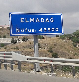
Elmadağ is a municipality and district of Ankara Province, Turkey. Its area is 647 km2, and its population is 44,379 (2022). Its average elevation is 1,135 m (3,724 ft), with the highest point being Mt. İdris at 1,995 m (6,545 ft).

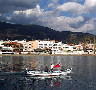
Erdek is a municipality and district of Balıkesir Province, Turkey. Its area is 307 km2, and its population is 31,902 (2022). Located on the Kapıdağ Peninsula, on the north coast of the Gulf of Erdek at the south of the Sea of Marmara, Erdek is a popular domestic holiday destination with several hotels dating back to the 1960s. The surrounding area has a rugged geology and topography with evergreen wooded areas and large olive groves. It is dominated by Mt Dindymus (782m).

Sincan is a municipality and metropolitan district of Ankara Province, Turkey. Its area is 880 km2, and its population is 572,609 (2022). It is a large town 27 km from the city of Ankara. Its elevation is 789 m (2,589 ft). Sincan has friendly relations with the municipality of Doboj Jug from Bosnia and Herzegovina.

Şereflikoçhisar, formerly known as Koçhisar, is a municipality and district of Ankara Province, Turkey. Its area is 2,155 km2, and its population is 33,140 (2022). It is 148 km south of the city of Ankara. Its average elevation ranges between 900 and 1,200 m, with the highest point being Mt. Karasenir at 1,650 m.

Pursaklar is a municipality and metropolitan district of Ankara Province, Turkey. Its area is 169 km2, and its population is 162,389 (2022). It became a town municipality within the district of Keçiören in 1986. In 2008 it became a district, and the former municipalities of Sarayköy, Sirkeli and Altınova (partly) were added to it.
Aksu is a municipality and district of Antalya Province, Turkey. Its area is 406 km2, and its population is 77,623 (2022).

Döşemealtı is a municipality and district of Antalya Province, Turkey. Its area is 687 km2, and its population is 79,495 (2022). Döşemealtı is situated 20 kilometres (12 mi) north of Antalya city center on the Turkish state highway D.650. The name of the city refers to an ancient road around the town Döşemealtı is a recent settlement. The earliest residents were from Korkuteli in 1934. Later people from Cyprus and Yörüks were also settled in Döşemealtı. It was declared as seat of township in 1972 and a district center within Greater Antalya in 1998.

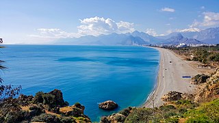
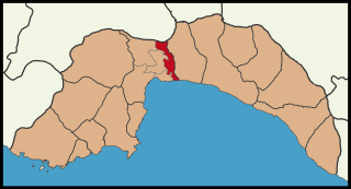
Muratpaşa is a municipality and district of Antalya Province, Turkey. Its area is 96 km2, and its population is 526,293 (2022). The district covers part of the city centre of Antalya, and has a coastline of 20 km (12 mi). The Mediterranean Sea lies to the south of the district. Ümit Uysal is the mayor of Muratpaşa.

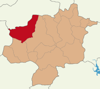
Karakoçan District is a district of Elazığ Province of Turkey. Its seat is the town Karakoçan. Its area is 1,049 km2, and its population is 28,436 (2021). The district was established in 1936.

Başmakçı District is a district of Afyonkarahisar Province of Turkey. Its seat is the town Başmakçı. Its area is 361 km2, and its population is 9,536 (2021).

Babaeski District is a district of the Kırklareli Province of Turkey. Its seat is the town of Babaeski. Its area is 670 km2, and its population is 46,357 (2022).
Yıldızeli District is a district of the Sivas Province of Turkey. Its seat is the town of Yıldızeli. Its area is 2,529 km2, and its population is 28,972 (2022).

Termal District is a district of the Yalova Province of Turkey. Its seat is the town of Termal. Its area is 67 km2, and its population is 6,977 (2022).


