McNabb, Illinois

Last updated
Village of McNabb
Putnam County Illinois Incorporated and Unincorporated areas McNabb Highlighted.svg
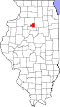
Location of McNabb in Putnam County, Illinois.
Coordinates: 41°10′35″N89°12′31″W / 41.17639°N 89.20861°W / 41.17639; -89.20861
CountryUnited States
State Illinois
County Putnam
Township Magnolia
Area
[1]
  Total0.18 sq mi (0.46 km2)
  Land0.18 sq mi (0.46 km2)
  Water0.00 sq mi (0.00 km2)  0%
Elevation
682 ft (208 m)
Population
 (2020)
  Total275
  Density1,553.67/sq mi (598.24/km2)
Time zone UTC-6 (CST)
  Summer (DST) UTC-5 (CDT)
ZIP codes
61335
FIPS code 17-45850
Website http://www.villageofmcnabb.org/

McNabb is a village in Putnam County, Illinois, United States. The population was 285 at the 2010 census, down from 310 in 2000. It is part of the Ottawa Micropolitan Statistical Area. Just outside of McNabb is the Clear Creek Meeting House, one of the few surviving western Quaker meeting houses. The Meeting House once hosted local abolitionists, such as Benjamin Lundy.

Contents

In 1900, the Indiana, Illinois, and Iowa Railroad wanted a station in Magnolia township. Hon. J. M. McNabb, at that time county judge, promoted it and the resulting station and town were named after him. Today the Toluca, Marquette & Northern Railroad also runs through the town. [2]

Geography

McNabb is located at 41°10′35″N89°12′31″W / 41.17639°N 89.20861°W / 41.17639; -89.20861 (41.176355, -89.208522). [3]

According to the 2010 census, McNabb has a total area of 0.2 square miles (0.52 km2), all land. [4]

Demographics

Historical population
CensusPop.Note
1960 176
1970 24639.8%
1980 34239.0%
1990 310−9.4%
2000 3100.0%
2010 285−8.1%
2020 275−3.5%
U.S. Decennial Census [5]

As of the census [6] of 2000, there were 310 people, 125 households, and 91 families residing in the village. The population density was 1,555.4 inhabitants per square mile (600.5/km2). There were 129 housing units at an average density of 647.2 per square mile (249.9/km2). The racial makeup of the village was 100.00% White.

There were 125 households, out of which 34.4% had children under the age of 18 living with them, 62.4% were married couples living together, 5.6% had a female householder with no husband present, and 26.4% were non-families. 24.0% of all households were made up of individuals, and 12.0% had someone living alone who was 65 years of age or older. The average household size was 2.48 and the average family size was 2.92.

In the village, the population was spread out, with 25.2% under the age of 18, 7.7% from 18 to 24, 30.3% from 25 to 44, 24.2% from 45 to 64, and 12.6% who were 65 years of age or older. The median age was 37 years. For every 100 females, there were 103.9 males. For every 100 females age 18 and over, there were 103.5 males.

The median income for a household in the village was $51,389, and the median income for a family was $55,357. Males had a median income of $32,083 versus $22,143 for females. The per capita income for the village was $20,374. About 5.7% of families and 5.6% of the population were below the poverty line, including 12.3% of those under age 18 and none of those age 65 or over.

Related Research Articles

<span class="mw-page-title-main">Malden, Illinois</span> Village in Illinois, United States

Malden is a village in Bureau County, Illinois, United States. The population was 318 at the 2010 census. It is part of the Ottawa Micropolitan Statistical Area.

<span class="mw-page-title-main">Broadview, Illinois</span> Village in Illinois, United States

Broadview is a village in Cook County, Illinois, 12 miles (19 km) west of downtown Chicago. As of the 2020 census it had a population of 7,998.

<span class="mw-page-title-main">Hooppole, Illinois</span> Village in Illinois, United States

Hooppole is a village in Henry County, Illinois, United States. The population was 204 at the 2010 census, up from 162 in 2000. As of 2018, the population has grown to an estimated 236.

<span class="mw-page-title-main">Harmon, Illinois</span> Village in Illinois, United States

Harmon is a village in Lee County, Illinois, United States. The population was 120 at the 2010 census, down from 149 in 2000.

<span class="mw-page-title-main">Nelson, Illinois</span> Village in Illinois, United States

Nelson is a village in Lee County, Illinois, United States. The population was 170 at the 2010 census, up from 163 in 2000.

<span class="mw-page-title-main">Evansville, Illinois</span> Village in Illinois, United States

Evansville is a village in Randolph County, Illinois, United States. The population was 701 at the 2010 census.

<span class="mw-page-title-main">Rockwood, Illinois</span> Village in Illinois, United States

Rockwood is a village in Randolph County, Illinois, United States. The population was 42 at the 2010 census. It is the headquarters of the Middle Mississippi River National Wildlife Refuge.

<span class="mw-page-title-main">Hillsdale, Illinois</span> Village in Illinois, United States

Hillsdale is a village in Rock Island County, Illinois, United States. The population was 523 at the 2010 census.

<span class="mw-page-title-main">Venedy, Illinois</span> Village in Illinois, United States

Venedy is a village in Washington County, Illinois, United States. The population was 138 at the 2010 census.

<span class="mw-page-title-main">Coleta, Illinois</span> Village in Illinois, United States

Coleta is a village in Whiteside County, Illinois, United States. The population was 164 at the 2010 census, up from 155 in 2000.

<span class="mw-page-title-main">Deer Grove, Illinois</span> Village in Illinois, United States

Deer Grove is a village in Whiteside County, Illinois, United States. The population was given as 45 in the 2010 census, down from 48 in 2000.

<span class="mw-page-title-main">Lyndon, Illinois</span> Village in Illinois, United States

Lyndon is a village in Whiteside County, Illinois, United States. The population was 648 at the 2010 census, up from 566 in 2000.

<span class="mw-page-title-main">Tampico, Illinois</span> Village in Illinois, United States

Tampico is a village located in Tampico Township, Whiteside County, Illinois, United States next to Rock Falls and Sterling, Illinois. As of the 2010 census the village had a total population of 790, up from 772 at the 2000 census. It is known as the birthplace of Ronald Reagan, the 40th President of the United States.

<span class="mw-page-title-main">Poplar Hills, Kentucky</span> City in Kentucky, United States

Poplar Hills is a home rule-class city in Jefferson County, Kentucky, United States. It is a part of the Louisville Metro government, but operates as a city under the Mayor to Commissioner form of government. Per the 2020 census, the population was 380, but the city administration has made several annexation ordinances that have passed and awaits updated information. The current city population is estimated to be 2380. It currently has the highest population density for any city in Kentucky.

<span class="mw-page-title-main">Pennock, Minnesota</span> City in Minnesota, United States

Pennock is a city in Kandiyohi County, Minnesota, United States. The population was 508 at the 2010 census.

<span class="mw-page-title-main">McVille, North Dakota</span> City in North Dakota, United States

McVille is a city in Nelson County, North Dakota, United States. The population was 392 at the 2020 census. McVille was founded in 1906.

<span class="mw-page-title-main">Clearview, West Virginia</span> Village in West Virginia, United States

Clearview is a village in Ohio County, West Virginia, United States. It is part of the Wheeling, West Virginia Metropolitan Statistical Area. The population was 565 at the 2010 census.

<span class="mw-page-title-main">Browntown, Wisconsin</span> Village in Wisconsin, United States

Browntown is a village in Green County, Wisconsin, United States. The population was 280 at the 2010 census.

<span class="mw-page-title-main">South Wayne, Wisconsin</span> Village in Wisconsin, United States

South Wayne is a village in Lafayette County, Wisconsin, United States. The population was 489 at the 2010 census.

<span class="mw-page-title-main">Ridgeway, Wisconsin</span> Village in Wisconsin, United States

Ridgeway is a village in Iowa County, Wisconsin, United States. The population was 624 at the 2020 census. The village is adjacent to the Town of Ridgeway. It is part of the Madison Metropolitan Statistical Area.

References

  1. "2020 U.S. Gazetteer Files". United States Census Bureau. Retrieved March 15, 2022.
  2. "McNabb". www.genealogytrails.com. Retrieved 2020-04-17.
  3. "US Gazetteer files: 2010, 2000, and 1990". United States Census Bureau. 2011-02-12. Retrieved 2011-04-23.
  4. "G001 - Geographic Identifiers - 2010 Census Summary File 1". United States Census Bureau. Archived from the original on 2020-02-13. Retrieved 2015-10-26.
  5. "Census of Population and Housing". Census.gov. Retrieved June 4, 2015.
  6. "U.S. Census website". United States Census Bureau . Retrieved 2008-01-31.