Magnolia Township, Putnam County, Illinois

Last updated

Magnolia Township
Township
Map highlighting Magnolia Township, Putnam County, Illinois.svg
Location in Putnam County
Map of Illinois highlighting Putnam County.svg
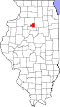
Putnam County's location in Illinois
Country United States
State Illinois
County Putnam
EstablishedNovember 8, 1855
Area
  Total
43.4 sq mi (112 km2)
  Land42.26 sq mi (109.5 km2)
  Water1.13 sq mi (2.9 km2)  2.60%
Population
 (2010)
  Estimate 
(2016) [1]
1,005
  Density25.2/sq mi (9.7/km2)
Time zone UTC-6 (CST)
  Summer (DST) UTC-5 (CDT)
FIPS code 17-155-46123

Magnolia Township is located in Putnam County, Illinois. As of the 2010 census, its population was 1,066 and it contained 532 housing units. [2]

Contents

Geography

According to the 2010 census, the township has a total area of 43.4 square miles (112 km2), of which 42.26 square miles (109.5 km2) (or 97.37%) is land and 1.13 square miles (2.9 km2) (or 2.60%) is water. [2] The village of McNabb is located in the north of the township and the village of Magnolia is located in its south.

Demographics

Historical population
CensusPop.Note
2016 (est.)1,005 [1]
U.S. Decennial Census [3]

References

  1. 1 2 "Population and Housing Unit Estimates" . Retrieved June 9, 2017.
  2. 1 2 "Population, Housing Units, Area, and Density: 2010 - County -- County Subdivision and Place -- 2010 Census Summary File 1". United States Census. Archived from the original on February 12, 2020. Retrieved May 28, 2013.
  3. "Census of Population and Housing". Census.gov. Retrieved June 4, 2016.

41°08′31″N89°13′41″W / 41.14194°N 89.22806°W / 41.14194; -89.22806