Merryvale, Queensland

Last updated

Merryvale
Queensland
Fields along Mount Walker West Road Merryvale.jpg
Fields along Mount Walker West Road, 2015
Australia Queensland location map.svg
Red pog.svg
Merryvale
Coordinates 27°47′50″S152°29′02″E / 27.7972°S 152.4838°E / -27.7972; 152.4838 (Merryvale (centre of locality))
Population22 (2016 census) [1]
 • Density2.24/km2 (5.81/sq mi)
Postcode(s) 4340
Area9.8 km2 (3.8 sq mi)
Time zone AEST (UTC+10:00)
Location
LGA(s) Scenic Rim Region
State electorate(s) Scenic Rim
Federal division(s) Wright
Suburbs around Merryvale:
Mount Mort Mount Walker West Mount Walker West
Mount Mort Merryvale Mount Walker West
Rosevale Rosevale Rosevale

Merryvale is a rural locality in the Scenic Rim Region, Queensland, Australia. [2] In the 2016 census, Merryvale had a population of 22 people. [1]

Contents

Geography

Merryvale is a predominantly agricultural area. [3]

History

Merryvale Provisional School opened on 10 September 1894. It closed in 1904 due to low enrolment, and was relocated and reopened on 5 March 1906 as Franklyn Vale Provisional School. On 1 January 1909, it became Franklyn Vale Provisional School, but again closed in 1915 due to low attendance. In 1922, it was moved back to Merryvale, reopening on 15 May 1922 as Merryvale State School. It celebrated its 50th jubilee on 7 August 1947. [4] It closed again in 1950, reopened, then finally closed in 1961. [5]

Demographics

At the 2016 census, Merryvale had a population of 22, in nine households. [1] Its male/female populations were 52.0% and 48.0%, respectively, with a median age of 34, four years below the national average. [1]

Education

There are no schools in Merryvale. The nearest government primary school is Warrill View State School in Warrill View to the east. The nearest government secondary school is Rosewood State High School in Rosewood to the north-east. [3]

Related Research Articles

<span class="mw-page-title-main">Aratula</span> Town in Queensland, Australia

Aratula is a rural town and locality in the Scenic Rim Region, Queensland, Australia. In the 2016 census, the locality of Aratula had a population of 532 people.

<span class="mw-page-title-main">Grandchester, Queensland</span> Town in Queensland, Australia

Grandchester is a rural town and locality in the City of Ipswich, Queensland, Australia. In the 2021 census, the locality of Grandchester had a population of 467 people.

<span class="mw-page-title-main">Rosevale, Queensland</span> Town in Queensland, Australia

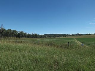
Rosevale is a rural locality in the Scenic Rim Region, Queensland, Australia. In the 2016 census, Rosevale had a population of 208 people.

<span class="mw-page-title-main">Warrill View, Queensland</span> Town in Queensland, Australia

Warrill View is a rural town and locality in the Scenic Rim Region, Queensland, Australia. In the 2021 census, the locality of Warrill View had a population of 203 people.

<span class="mw-page-title-main">Mount Walker, Queensland</span> Suburb of Scenic Rim Region, Queensland, Australia

Mount Walker is a rural locality in the Scenic Rim Region, Queensland, Australia.In the 2021 census, Mount Walker had a population of 129 people.

<span class="mw-page-title-main">Mount Forbes, Queensland</span> Suburb of City of Ipswich, Queensland, Australia

Mount Forbes is a rural locality split between the City of Ipswich and the Scenic Rim Region, Queensland, Australia. In the 2016 census, Mount Forbes had a population of 263 people.

<span class="mw-page-title-main">Munbilla, Queensland</span> Town in Queensland, Australia

Munbilla is a rural town and locality in the Scenic Rim Region, Queensland, Australia. In the 2016 census, the locality of Munbilla had a population of 100 people.

<span class="mw-page-title-main">Mutdapilly, Queensland</span> Suburb of City of Ipswich, Queensland, Australia

Mutdapilly is a rural locality in south-east Queensland, Australia. It is split between the local government areas of Scenic Rim Region and City of Ipswich. In the 2016 census, Mutdapilly had a population of 308 people.

<span class="mw-page-title-main">Coleyville, Queensland</span> Suburb of Scenic Rim Region, Queensland, Australia

Coleyville is a rural locality in the Scenic Rim Region, Queensland, Australia. In the 2021 census, Coleyville had a population of 192 people.

<span class="mw-page-title-main">Mount Walker West, Queensland</span> Suburb of Scenic Rim Region, Queensland, Australia

Mount Walker West is a locality split between the Scenic Rim Region and City of Ipswich local government areas of Queensland, Australia. In the 2021 census, Mount Walker West had a population of 31 people.

<span class="mw-page-title-main">Lower Mount Walker, Queensland</span> Suburb of City of Ipswich, Queensland, Australia

Lower Mount Walker is a locality split between the Scenic Rim Region and City of Ipswich local government areas of South East Queensland, Australia. In the 2021 census, Lower Mount Walker had a population of 192 people.

<span class="mw-page-title-main">Silverdale, Queensland</span> Suburb of Scenic Rim Region, Queensland, Australia

Silverdale is a rural locality in the Scenic Rim Region, Queensland, Australia. In the 2021 census, Silverdale had a population of 112 people.

<span class="mw-page-title-main">Frazerview, Queensland</span> Suburb of Scenic Rim Region, Queensland, Australia

Frazerview is a rural locality in the Scenic Rim Region, Queensland, Australia. In the 2016 census, Frazerview had a population of 34 people.

<span class="mw-page-title-main">Mount Mort, Queensland</span> Suburb of Ipswich, Queensland, Australia

Mount Mort is a rural locality in the City of Ipswich, Queensland, Australia. In the 2021 census, Mount Mort had a population of 78 people.

<span class="mw-page-title-main">Carneys Creek, Queensland</span> Rural locality in Queensland, Australia

Carneys Creek is a rural locality in the Scenic Rim Region, Queensland, Australia. In the 2016 census, Carneys Creek had a population of 51 people. It borders New South Wales.

<span class="mw-page-title-main">Fassifern, Queensland</span> Suburb of Scenic Rim Region, Queensland, Australia

Fassifern is a rural locality in the Scenic Rim Region, Queensland, Australia. In the 2021 census, Fassifern had a population of 18 people.

Obum Obum is a rural locality in the Scenic Rim Region, Queensland, Australia. In the 2021 census, Obum Obum had a population of 129 people.

Kulgun is a locality in the Scenic Rim Region, Queensland, Australia. In the 2016 census, Kulgun had a population of 67 people.

<span class="mw-page-title-main">Moorang, Queensland</span> Suburb of Scenic Rim Region, Queensland, Australia

Moorang is a rural locality in the Scenic Rim Region, Queensland, Australia. In the 2016 census, Moorang had a population of 46 people.

Radford is a rural locality in the Scenic Rim Region, Queensland, Australia. In the 2016 census, Radford had a population of 41 people.

References

  1. 1 2 3 4 Australian Bureau of Statistics (27 June 2017). "Merryvale (SSC)". 2016 Census QuickStats. Retrieved 20 October 2018. OOjs UI icon edit-ltr-progressive.svg
  2. "Merryvale – locality in Scenic Rim Region (entry 45214)". Queensland Place Names. Queensland Government . Retrieved 7 March 2022.
  3. 1 2 "Queensland Globe". State of Queensland . Retrieved 22 May 2022.
  4. "Merryvale State School Jubilee Celebrations". Queensland Times (Ipswich) (Qld. : 1909–1954) . Ipswich) (Qld.: National Library of Australia. 7 August 1947. p. 6 Edition: DAILY. Archived from the original on 22 May 2022. Retrieved 29 March 2015.
  5. Queensland Family History Society (2010), Queensland schools past and present (Version 1.01 ed.), Queensland Family History Society, ISBN   978-1-921171-26-0

Further reading