
George Municipality is a municipality located in the Western Cape Province of South Africa. As of 2011 the population is 193,672. Its municipality code is WC044.

Witzenberg Municipality is a local municipality located within the Cape Winelands District Municipality, in the Western Cape province of South Africa. As of 2011 it had a population of 115,946.
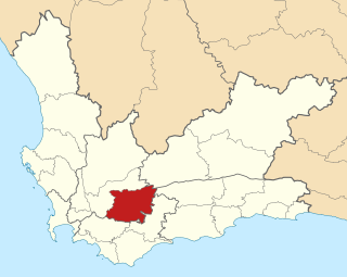
Bitou Local Municipality is a municipality part of Garden Route District Municipality located in the Western Cape Province of South Africa. Its municipality code is WC047.
Langeberg Municipality is a local municipality located within the Cape Winelands District Municipality in the Western Cape province of South Africa. As of 2011 it had a population of 97,724. Its municipality code is WC026.
Beaufort West Local Municipality is a municipality located in Western Cape Province, South Africa. As of 2011 the population is 49,586. Its municipality code is WC053.

Overstrand Municipality is a local municipality in the Western Cape province of South Africa. It is located along the Atlantic coast between Cape Town and Cape Agulhas, within the Overberg District Municipality. The principal towns in the municipality are Hermanus, Gansbaai and Kleinmond. As of 2011 it had a population of 80,432.

Breede Valley Municipality is a local municipality located within the Cape Winelands District Municipality, in the Western Cape province of South Africa. As of 2007, it had a population of 166,825. Its municipality code is WC025.

Cape Agulhas Municipality is a municipality located in the Western Cape Province of South Africa. As of 2011 it had a population of 33,038. Its municipality code is WC033. It is named after Cape Agulhas, the southernmost point of Africa. The largest town is Bredasdorp, which is the seat of the municipal headquarters. It also includes the villages of Napier, Struisbaai, Elim, Arniston and L'Agulhas, and the De Hoop Nature Reserve.

Laingsburg Municipality is a municipality located in the Western Cape Province of South Africa. As of 2011 the population is 8,289. Its municipality code is WC051.
Hessequa Local Municipality is a municipality located in the Western Cape Province of South Africa. It is flanked by the lower Breede River to the west and the Gourits River to the east. As of 2011 the population was 52,642. Its municipality code is WC042. The name Hessequa, meaning "people of the trees", refers to the tribe of indigenous Khoikhoi people.

Matzikama Local Municipality is a local municipality which governs the northernmost part of the Western Cape province of South Africa, including the towns of Vredendal, Vanrhynsdorp, Klawer and Lutzville, and the surrounding villages and rural areas. As of 2011 it had a population of 67,147. It forms part of the West Coast District Municipality, and has municipality code WC011.
Saldanha Bay Municipality is a local municipality located within the West Coast District Municipality, in the Western Cape province of South Africa. As of 2011 it had a population of 99,193. Its municipality code is WC014.

Karoo Hoogland is an administrative area in the Namakwa District of Northern Cape in South Africa.

//Khara Hais Local Municipality was a local municipality in the Northern Cape province of South Africa. It fell within the ZF Mgcawu District Municipality and governed the town of Upington and surrounding rural areas. As of 2011 the municipality had a population of approximately 93,500 people, and covered an area of 21,780 square kilometres (8,410 sq mi). The unusual spelling of the name comes from the original transcription of the Khwe language name, where the click consonant became "//".

Mamusa Local Municipality is a local municipality in Dr Ruth Segomotsi Mompati District Municipality, North West Province, South Africa. The seat of local municipality is Schweizer-Reneke.

Matjhabeng Local Municipality is a local government serving an administrative area in the Lejweleputswa District of the Free State in South Africa. The municipality services Welkom, Virginia, Odendaalsrus and Allanridge. The name is a Sesotho word meaning "where nations meet". It is derived from the migrant labour system where people from various countries like Lesotho, Mozambique, etc. meet to work in the mines of the Goldfields.

Richtersveld is an administrative area in the Namakwa District of Northern Cape in South Africa.

Inkwanca Local Municipality was a local municipality that forms part of the Chris Hani District Municipality in the Eastern Cape province of South Africa. Inkwanca is an isiXhosa name meaning cold. The municipal area is the coldest area in the country and the lowest temperatures are recorded in the area every year. After municipal elections on 3 August 2016 it was merged into the larger Enoch Mgijima Local Municipality.

Kagisano–Molopo Local Municipality is a local municipality in the Dr Ruth Segomotsi Mompati District Municipality, in the North West province of South Africa. It was created at the local government elections of 18 May 2011 by merging the Kagisano and Molopo municipalities.

Dr Beyers Naudé Local Municipality is a new local municipality that was established by merging the Camdeboo, Ikwezi and Baviaans local municipalities in the Sarah Baartman District of the Eastern Cape in South Africa. The decision to merge the municipalities was taken by the Municipal Demarcation Board in 2015 but only took effect after municipal elections on 3 August 2016. The new municipality is named after the Afrikaner cleric and anti-apartheid activist Beyers Naudé. Its seat is in Graaff-Reinet.


