Mount French, Queensland

Last updated

Mount French
Queensland
Paddocks along Frank Road at Mount French Queensland.jpg
Paddocks along Frank Road, 2016
Australia Queensland location map.svg
Red pog.svg
Mount French
Coordinates 27°59′52″S152°37′37″E / 27.9977°S 152.6269°E / -27.9977; 152.6269 (Mount French (centre of locality))
Population105 (2021 census) [1]
 • Density6.29/km2 (16.28/sq mi)
Postcode(s) 4310
Area16.7 km2 (6.4 sq mi)
Time zone AEST (UTC+10:00)
Location
LGA(s) Scenic Rim Region
State electorate(s) Scenic Rim
Federal division(s) Wright
Suburbs around Mount French:
Fassifern Valley Templin Kents Pocket
Charlwood Mount French Boonah
Burjurgen Frenches Creek Dugandan

Mount French is a rural locality in the Scenic Rim Region, Queensland, Australia. [2] In the 2021 census, Mount French had a population of 105 people. [1]

Contents

Geography

The locality of Mount French includes the mountain of the same name in the western half of the locality, part of which is within the Moogerah Peaks National Park. Elevations in the western half of the locality range from 300 metres (980 ft) above sea level to the two peaks of Mount French:

The western half of the locality is mostly undeveloped bushland. [5]

The eastern part of the Mount French is lower, ranging from 200 to 280 metres (660 to 920 ft) above sea level, and is predominantly grazing land. [5]

Mount French is a watershed with the creeks flowing west of the mountain ultimately flowing into the Bremer River, while the creeks flowing east of the mountain ultimately flow into the Logan River. [5]

Mount French Road runs from the Boonah-Rathdowney Road in Boonah and Dugandan to the east through the centre of the locality to the national park and then north to the North Peak. [5]

History

proposed site for Mt French School Proposed site for Mount French School.jpg
proposed site for Mt French School

Mount French Provisional School opened in 1900. On 1 January 1909, it became Mount French State School. It closed circa 1925. [8] The approximate location of the school was 28°00′07″S152°38′02″E / 28.002°S 152.634°E / -28.002; 152.634 (Mount French State School) . [9]

Demographics

In the 2016 census, Mount French had a population of 94 people. The locality contains 53 households, in which 50.0% of the population are males and 50.0% of the population are females with a median age of 54, 16 years above the national average. The average weekly household income is $985, $453 below the national average. [10]

In the 2021 census, Mount French had a population of 105 people. [1]

History of Mount French State School

C.L. Watson sent a letter dated 31 July 1899 on behalf of parents in the Dugandan community, to the Secretary for Public Instruction requesting the establishment of a provisional school at Mount French East. Ernest Kirchner donated and transferred 2 acres 0 roods 25 perches subdivision 1 Portion 303 Coochin for the site of the school 1 February 1900. A subsidised Provisional School was approved 17 April 1900 with a subsidy payable of £74-15-6. The following tenders had been submitted for the construction of the school building: Edward Scholz £87-12-6 and Tronc and Sons £93-10-0. The committee was authorized to accept Scholz’s tender. The building was completed 13 October 1900. The following school committee was appointed: Charles Graewe, Edward A Scholz and F William Hemmy (secretary) 20 February 1901. [11]

The first teacher was Alice Watson wife of C L Watson secretary to the building committee for the Mount French School and a local farmer. She started 19 November 1900. She had taught for ten years as the first assistant at Central Infants Brisbane and was classified Class III Division I. [11]

The school committee 9 March 1906 consisted of Albert Spletter: treasurer, Henry Falkenhagen: secretary, William Crepin: member and Mr Frank: chairman., school committee consisted of Fredrick William Krause: chairman, Henry Frank: secretary, John Carl Frank: treasurer, with Charles William Fredrick Freiberg and William Crepin being members 21 March 1923. [11]

In August 1923 children broke into the school and broke the school clock and some set squares belonging to the pupils.

Over the years the number of pupils varied. According to the annual returns from 1900 to 1925 the average attendance ranged from 9 to 25. [11]

Teacher Mike O'Connor and pupils, circa 1910 One teacher school at Mount French.jpg
Teacher Mike O'Connor and pupils, circa 1910

The teachers at the school were: [11]

The school closed at the end of 1925 with teacher Annie Mackay being reassigned to part time schools at Carlyle and Jandowae East. [12] The school building was moved and relocated to Mount Walker Lower in 1927. [13]

The school site was transferred back to Ernest Kirchner 20 March 1928 with certificate of title number 156877. [11]

Education

There are no schools in Mount French. The nearest government primary school and secondary school are Boonah State School and Boonah State High School, both in neighbouring Boonah to the east. [5]

Attractions

The Mount French area within the Moogerah Peaks National Park offers a number of walking tracks for people of varying levels of bushwalking experience. The easiest walk (suitable for wheelchairs with assistance) includes Logan's Lookout (also known as North Cliff Lookout with panoramic views over the Fassifern Valley ( 27°58′57″S152°37′20″E / 27.9824°S 152.6222°E / -27.9824; 152.6222 (Logan's Lookout (North Cliff Lookout)) ). [14] [6]

Related Research Articles

<span class="mw-page-title-main">Boonah, Queensland</span> Town in Queensland, Australia

Boonah is a rural town and locality in the Scenic Rim Region, Queensland, Australia. In the 2016 census, the locality of Boonah had a population of 2,484 people.

<span class="mw-page-title-main">Mount French (Queensland)</span> Mountain in the country of Australia

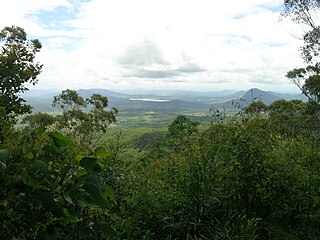
Mount French is a mountain in South East Queensland, Australia. The mountain rises 579 m above sea level and is part of the Moogerah Peaks National Park. It lies approximately 100 km west of Brisbane in the locality of Mount French west of the town of Boonah in the Scenic Rim Region. Other prominent peaks in the Scenic Rim group of mountains include Mount Edwards, Mount Moon and Mount Greville.

<span class="mw-page-title-main">Fassifern Valley</span>

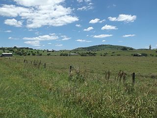
Fassifern Valley is a valley of the Scenic Rim in South East Queensland. Towns found in the valley include Harrisville, Kalbar, Roadvale, Warril View and Aratula. Fassifern Valley is known as a carrot-producing area, as well as for growing potatoes, onions, pumpkins and melons. It is one of four vegetable-producing regions in southern Queensland, the others being the Lockyer Valley, the eastern Darling Downs and the Granite Belt.

<span class="mw-page-title-main">Scenic Rim Region</span> Local government area in Queensland, Australia

The Scenic Rim Region is a local government area in West Moreton region of South East Queensland, Australia. Also, is southern part of the Brisbane. Established in 2008, it was preceded by several previous local government areas with histories extending back to the early 1900s and beyond. The main town of the region is Beaudesert.

<span class="mw-page-title-main">Mount Moon</span> Mountain in Queensland, Australia

Mount Moon is a lightly timbered, dome-shaped mountain in the Scenic Rim, Queensland, Australia. Its Indigenous name is Kibbobum. The mountain rises 784 metres (2,572 ft) above sea level and is part of the Teviot Range and is within the Moogerah Peaks National Park. It is within the locality of Croftby in the Scenic Rim Region local government area.

<span class="mw-page-title-main">Dugandan railway line</span> Railway line in Queensland, Australia

The Dugandan railway line was a branch railway in the Scenic Rim region of South East Queensland, Australia. It was also known as the Fassifern railway line. It operated from 1882 to 1964.

<span class="mw-page-title-main">Dugandan, Queensland</span> Town in Queensland, Australia

Dugandan is a rural town and locality in the Scenic Rim Region, Queensland, Australia. In the 2016 census, Dugandan had a population of 593 people.

<span class="mw-page-title-main">Maroon, Queensland</span> Suburb of Scenic Rim Region, Queensland, Australia

Maroon is a rural locality in the Scenic Rim Region, Queensland, Australia. In the 2021 census, Maroon had a population of 152 people.

<span class="mw-page-title-main">Peak Crossing, Queensland</span> Suburb of City of Ipswich, Queensland, Australia

Peak Crossing is a rural locality split between the City of Ipswich and the Scenic Rim Region of Queensland, Australia. In the 2016 census, Peak Crossing had a population of 965 people.

<span class="mw-page-title-main">Laravale, Queensland</span> Town in Queensland, Australia

Laravale is a rural locality in the Scenic Rim Region, Queensland, Australia. In the 2016 census, Laravale had a population of 189 people.

<span class="mw-page-title-main">Coulson, Queensland</span> Suburb of Scenic Rim Region, Queensland, Australia

Coulson is a rural locality in the Scenic Rim Region, Queensland, Australia. In the 2021 census, Coulson had a population of 168 people.

<span class="mw-page-title-main">Milford, Queensland</span> Suburb of Scenic Rim Region, Queensland, Australia

Milford is a rural locality in the Scenic Rim Region, Queensland, Australia. In the 2021 census, Milford had a population of 190 people.

Cannon Creek is a rural locality in the Scenic Rim Region, Queensland, Australia. In the 2021 census, Cannon Creek had a population of 75 people.

<span class="mw-page-title-main">Carneys Creek, Queensland</span> Rural locality in Queensland, Australia

Carneys Creek is a rural locality in the Scenic Rim Region, Queensland, Australia. It borders New South Wales. In the 2021 census, Carneys Creek had a population of 71 people.

<span class="mw-page-title-main">Fassifern Valley, Queensland</span> Suburb of Scenic Rim Region, Queensland, Australia

Fassifern Valley is a rural locality in the Scenic Rim Region, Queensland, Australia. In the 2021 census, Fassifern Valley had a population of 112 people.

<span class="mw-page-title-main">Moogerah, Queensland</span> Suburb of Scenic Rim Region, Queensland, Australia

Moogerah is a rural locality in the Scenic Rim Region, Queensland, Australia. In the 2021 census, Moogerah had a population of 242 people.

Croftby is a rural locality in the Scenic Rim Region, Queensland, Australia. The town of Teviot is within the locality. In the 2021 census, Croftby had a population of 129 people.

<span class="mw-page-title-main">Clumber, Queensland</span> Suburb of Scenic Rim Region, Queensland, Australia

Clumber is a rural locality in the Scenic Rim Region, Queensland, Australia. In the 2021 census, Clumber had a population of 91 people.

<span class="mw-page-title-main">Mount Edwards, Queensland</span> Suburb of Scenic Rim Region, Queensland, Australia

Mount Edwards is a rural locality in the Scenic Rim Region, Queensland, Australia. In the 2021 census, Mount Edwards had a population of 60 people.

Burnett Creek is a rural locality in the Scenic Rim Region, Queensland, Australia. It borders New South Wales to the south. In the 2021 census, Burnett Creek had a population of 16 people.

References

  1. 1 2 3 Australian Bureau of Statistics (28 June 2022). "Mount French (SAL)". 2021 Census QuickStats. Retrieved 28 February 2023. OOjs UI icon edit-ltr-progressive.svg
  2. "Mount French – locality in Scenic Rim Region (entry 45172)". Queensland Place Names. Queensland Government . Retrieved 29 December 2020.
  3. 1 2 "Mountain peaks and capes - Queensland". Queensland Open Data. Queensland Government. 12 November 2020. Archived from the original on 25 November 2020. Retrieved 25 November 2020.
  4. "Mount French (North Peak) – mountain in Scenic Rim Region (entry 13190)". Queensland Place Names. Queensland Government . Retrieved 25 November 2020.
  5. 1 2 3 4 5 6 7 "Queensland Globe". State of Queensland . Retrieved 12 March 2017.
  6. 1 2 "Things to do: Moogerah Peaks National Park". Parks and forests. Queensland Government. 19 October 2009. Archived from the original on 13 January 2022. Retrieved 13 January 2022.
  7. "Mount French (South Peak) – mountain in Scenic Rim Region (entry 13191)". Queensland Place Names. Queensland Government . Retrieved 25 November 2020.
  8. Queensland Family History Society (2010), Queensland schools past and present (Version 1.01 ed.), Queensland Family History Society, ISBN   978-1-921171-26-0
  9. Information from Dennis Frank local resident, by email, 11 Dec 2016 in possession of user lastlion0
  10. Australian Bureau of Statistics (27 June 2017). "Mount French (SSC)". 2016 Census QuickStats. Retrieved 20 October 2018. OOjs UI icon edit-ltr-progressive.svg
  11. 1 2 3 4 5 6 "Queensland State Archives Item ID15518, Administration file, Mount French School number 912". Archived from the original on 13 March 2017.
  12. "DALBY LICENSING COURT". The Dalby Herald . Queensland, Australia. 22 January 1926. p. 2. Archived from the original on 13 January 2022. Retrieved 13 March 2017 via National Library of Australia.
  13. "COUNTRY NEWS. IPSWICH". The Brisbane Courier . No. 21, 776. Queensland, Australia. 11 November 1927. p. 10. Archived from the original on 13 January 2022. Retrieved 13 March 2017 via National Library of Australia.
  14. "Tourist points - Queensland". Queensland Open Data. Queensland Government. 18 November 2020. Archived from the original on 24 November 2020. Retrieved 24 November 2020.

Commons-logo.svg Media related to Mount French, Queensland at Wikimedia Commons