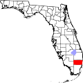
North Andrews Gardens, Florida

Last updated
North Andrews Gardens, Florida
Coordinates: 26°11′29″N80°8′40″W / 26.19139°N 80.14444°W / 26.19139; -80.14444 Coordinates: 26°11′29″N80°8′40″W / 26.19139°N 80.14444°W / 26.19139; -80.14444
Country Flag of the United States.svg  United States
State Flag of Florida.svg  Florida
County   Broward
Area
  Total1.1 sq mi (2.8 km2)
  Land1.1 sq mi (2.8 km2)
  Water0.0 sq mi (0.0 km2)
Elevation
7 ft (2 m)
Population
 (2000)
  Total9,656
  Density8,883.1/sq mi (3,429.8/km2)
Time zone UTC-5 (Eastern (EST))
  Summer (DST) UTC-4 (EDT)
FIPS code 12-49150 [1]
GNIS feature ID1867178 [2]

North Andrews Gardens was a census-designated place (CDP) in Broward County, Florida, United States. The population was 9,656 at the 2000 census. It is now annexed to Oakland Park, Florida.

Contents

Geography

North Andrews Gardens is located at 26°11′29″N80°8′40″W / 26.19139°N 80.14444°W / 26.19139; -80.14444 (26.191461, -80.144341). [3]

According to the United States Census Bureau, the CDP had a total area of 2.8 square kilometres (1.1 sq mi), all land.

Demographics

At the 2000 census, [1] of 2000, there were 9,656 people, 3,518 households and 2,409 families residing in the CDP. The population density was 3,420.4 per square kilometre (8,859/sq mi). There were 3,645 housing units at an average density of 1,291.1 per square kilometre (3,344/sq mi). The racial make-up of the CDP was 84.00% White (63.7% were Non-Hispanic White,) [4] 4.83% African American, 0.37% Native American, 1.44% Asian, 0.03% Pacific Islander, 5.58% from other races and 3.75% from two or more races. Hispanic or Latino of any race were 27.78% of the population.

There were 3,518 households, of which 36.7% had children under the age of 18 living with them, 49.1% were married couples living together, 13.6% had a female householder with no husband present, and 31.5% were non-families. 22.3% of all households were made up of individuals, and 6.7% had someone living alone who was 65 years of age or older. The average household size was 2.74 and the average family size was 3.24.

26.3% of the population were under the age of 18, 6.6% from 18 to 24, 35.6% from 25 to 44, 21.8% from 45 to 6, and 9.8% 65 years of age or older. The median age was 36 years. For every 100 females, there were 104.3 males. For every 100 females age 18 and over, there were 101.1 males.

The median household income was $41,675 and the median family income was $44,231. Males had a median income of $31,523 and females $25,469. The per capita income was $16,951. About 5.8% of families and 8.6% of the population were below the poverty line, including 11.4% of those under age 18 and 4.5% of those age 65 or over.

In 2000, the North Andrews Gardens section of Oakland Park was the sixty-third most Cuban-populated area in the US at 5.76%, and the rest of Oakland Park had the 113th highest percentage of Cubans with 2.03% of all residents. [5] The North Andrews Gardens section was also the thirty-third most Peruvian-populated area in the US, at 1.51% of the population, [6] as well as having the seventy-fourth highest percentage of Colombians in the US, at 2.03% of all residents. [7]

Related Research Articles

Chilcoot-Vinton, California census-designated place in California, United States

Chilcoot-Vinton is a census-designated place (CDP) in Plumas County, California, United States. The population was 454 at the 2010 census, up from 387 at the 2000 census.

Boulevard Gardens is a census-designated place (CDP) in Broward County, Florida, United States. The population was 1,274 at the 2010 census.

Miami Gardens was a census-designated place (CDP) in Broward County, Florida, United States. The population was 2,706 at the 2000 census.

Andrews, Levy County, Florida Census-designated place in Florida, United States

Andrews is a census-designated place (CDP) in Levy County, Florida, United States. The population was 798 at the 2010 census.

Bunche Park, Florida Neighborhood of Miami Gardens in Miami-Dade, Florida, United States

Bunche Park is a neighborhood in Miami Gardens, Florida, United States. It was formerly a census-designated place.

Coral Terrace, Florida Census-designated place & Unincorporated community in Florida, United States

Coral Terrace is a suburban unincorporated community and census-designated place in Miami-Dade County, Florida, United States. The population was 24,376 at the 2010 census.

Country Club, Florida Census-designated place & Unincorporated community in Florida, United States

Country Club is a census-designated place and a suburban unincorporated community located in northwest Miami-Dade County, Florida, United States. It is named after the Country Club of Miami, which was established in 1961 in what was then an unpopulated and undeveloped section of the county. The population was 36,310 at the 2000 census.

Lake Lucerne, Florida Neighborhood of Miami Gardens in Miami-Dade, Florida, United States

Lake Lucerne is a neighborhood in Miami Gardens, Florida. It is formerly a census-designated place. The population was 9,132 at the time of the 2000 United States census.

Cypress Gardens, Florida Census-designated place in Florida, United States

Cypress Gardens is a census-designated place (CDP) in Polk County, Florida, United States. The population was 8,844 at the 2000 census. It is part of the Lakeland–Winter Haven Metropolitan Statistical Area.

Marshfield Hills, Massachusetts Census-designated place in Massachusetts, United States

Marshfield Hills is a census-designated place (CDP) in the town of Marshfield in Plymouth County, Massachusetts, United States. The population was 2,356 at the 2010 census. The historic center of the village has been designated a historic district and listed on the National Register of Historic Places.

Clinton, Montana CDP in Montana, United States

Clinton is a census-designated place (CDP) in Missoula County, Montana, United States. It is part of the 'Missoula, Montana Metropolitan Statistical Area'. The CDP was named for General Sir Henry Clinton. The population was 1,052 at the 2010 census, an increase from its population of 549 in 2000.

Ruskin, Nebraska Village in Nebraska, United States

Ruskin is a village in Nuckolls County, Nebraska, United States. The population was 123 at the 2010 census.

Creekside, Pennsylvania Borough in Pennsylvania, United States

Creekside is a borough in Indiana County, Pennsylvania, United States. The population was 309 at the 2010 census.

Cecil-Bishop, Pennsylvania CDP in Pennsylvania, United States

Cecil-Bishop is a census-designated place (CDP) in Washington County, Pennsylvania, United States. The population was 2,476 at the 2010 census. The CDP is a merger of two unincorporated communities: larger Cecil in the east and smaller Bishop in the west.

Oakland, South Carolina CDP in South Carolina, United States

Oakland is a census-designated place (CDP) in Sumter County, South Carolina, United States. The population was 1,272 at the 2000 census. It is included in the Sumter, South Carolina Metropolitan Statistical Area. Part of the area of the census-designated place is located within the Stateburg Historic District

LaCoste, Texas City in Texas, United States

La Coste is a city in Medina County, Texas, United States. The population was 1,119 at the 2010 census. It is part of the San Antonio Metropolitan Statistical Area.

Edroy, Texas CDP in Texas, United States

Edroy is a census-designated place (CDP) in San Patricio County, Texas, United States. The population was 331 at the 2010 census.

Selma, Virginia CDP in Virginia, United States

Selma is a census-designated place (CDP) in Alleghany County, Virginia, United States. The population was 529 at the 2010 census.

Brush Prairie, Washington Census-designated place in Washington, United States

Brush Prairie is a census-designated place (CDP) in Clark County, Washington, United States. The population was 2,652 at the 2010 census, up from 2,384 at the 2000 census.

Lake Ripley, Wisconsin Census-designated place in Wisconsin, United States

Lake Ripley is a census-designated place (CDP), in the town of Oakland, Jefferson County, Wisconsin, United States. The population was 1,779 at the 2010 census.

References

  1. 1 2 "U.S. Census website". United States Census Bureau . Retrieved 31 January 2008.CS1 maint: discouraged parameter (link)
  2. "US Board on Geographic Names". United States Geological Survey. 25 October 2007. Retrieved 31 January 2008.CS1 maint: discouraged parameter (link)
  3. "US Gazetteer files: 2010, 2000, and 1990". United States Census Bureau. 12 February 2011. Retrieved 23 April 2011.CS1 maint: discouraged parameter (link)
  4. "Demographics of North Andrews Gardens, FL". MuniNet LLC. Retrieved 16 November 2007.CS1 maint: discouraged parameter (link)[ dead link ]
  5. "Ancestry Map of Cuban Communities". ePodunk Inc. Retrieved 28 October 2007.CS1 maint: discouraged parameter (link)[ dead link ]
  6. "Ancestry Map of Peruvian Communities". ePodunk Inc. Archived from the original on 11 October 2007. Retrieved 28 October 2007.CS1 maint: discouraged parameter (link)
  7. "Ancestry Map of Colombian Communities". ePodunk Inc. Retrieved 28 October 2007.CS1 maint: discouraged parameter (link)[ dead link ]