
The San Fernando Valley, known locally as the Valley, is an urbanized valley in Los Angeles County, California. Situated to the north of the Los Angeles Basin, it contains a large portion of the City of Los Angeles, as well as unincorporated areas and the incorporated cities of Burbank, Calabasas, Glendale, Hidden Hills, and San Fernando. The valley is well known for its iconic film studios such as Warner Bros. Studio and Walt Disney Studios. In addition, it is home to the Universal Studios Hollywood theme park.

The Los Angeles County Metropolitan Transportation Authority (LACMTA), branded as Metro, is the state agency that plans, operates, and coordinates funding for most of the public transportation system in Los Angeles County, California, the most populated county in the United States. The agency directly operates a large transit system that includes bus, light rail, heavy rail (subway), and bus rapid transit services; and provides funding for transit it does not operate, including Metrolink commuter rail, municipal bus operators and paratransit services. Metro also provides funding and directs planning for railroad and highway projects within Los Angeles County. In 2022, the system had a total ridership of 255,250,500 and had a ridership of 820,300 per weekday as of the fourth quarter of 2022. It is the single largest transit agency within the county as well.

The G Line is a bus rapid transit line in Los Angeles, California, operated by the Los Angeles County Metropolitan Transportation Authority (Metro). It operates between Chatsworth and North Hollywood stations in the San Fernando Valley. The 18-mile (29 km) G Line uses a dedicated, exclusive right-of-way for the entirety of its route with 17 stations located at approximately one-mile (1.6 km) intervals; fares are paid via TAP cards at vending machines on station platforms before boarding to improve performance. It is one of the two lines in the Los Angeles Metro Busway system.

Van Nuys station is a station on the G Line of the Los Angeles Metro Busway system. It is named after adjacent Van Nuys Boulevard, which travels north-south and crosses the east-west busway route and is located in the Van Nuys district of Los Angeles, in the San Fernando Valley. Adjacent to the station is the G Line's bicycle path.

Van Nuys station is an Amtrak and Metrolink train station in the Van Nuys neighborhood of Los Angeles, California. Amtrak's Pacific Surfliner from San Luis Obispo to San Diego, Amtrak's Coast Starlight from Los Angeles to Seattle, Washington, and Metrolink's Ventura County Line from Los Angeles Union Station to East Ventura stop here.

Sylmar/San Fernando station is a Metrolink rail station located in Sylmar, California, and adjacent to the city of San Fernando. It is served by Metrolink's Antelope Valley Line between Los Angeles Union Station and Lancaster.
Van Nuys Boulevard is a major north-south arterial road that runs through the central San Fernando Valley of Los Angeles County, California. The boulevard was notable for its cruising lifestyle that was prevalent in the 1960s and 1970s, which was depicted in the 1979 film Van Nuys Blvd.
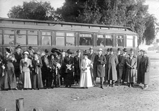
The San Fernando Line was a part of the Pacific Electric Railway system in Los Angeles County, California. It was designed to increase the reach of public transportation from the Downtown Los Angeles and Hollywood into the San Fernando Valley, to support land speculation and development expanding Los Angeles.

The Sepulveda Transit Corridor Project is a two-phased planned transit corridor project that aims to connect the Los Angeles Basin to the San Fernando Valley through Sepulveda Pass in Los Angeles, California, by supplementing the existing I-405 freeway through the pass. The corridor would partly parallel I-405, and proposed alternatives include a rapid transit HRT (subway) or a monorail line connecting the G Line in the Valley to the D Line and E Line on the Westside, and the K Line near Los Angeles International Airport.
The East San Fernando Valley Light Rail Transit Project is a transit project which proposes the construction of a light rail line on the east side of Los Angeles's San Fernando Valley, running on a north/south route along Van Nuys Boulevard and San Fernando Road. Metro selected its preferred route as light rail without tunneling, "Alternative Six". The final Environmental Impact Report is in progress and the light rail line is scheduled for construction in mid-2023, with completion in 2028.
Maclay is a planned light rail station on the Los Angeles Metro Rail system. The station is part of the East San Fernando Valley Light Rail Transit Project. It is located on North Maclay Avenue near the intersection with Truman Street in San Fernando, California. Metrolink Antelope Valley Line trains pass but will not stop here. It is planned to open as part of the second phase of the project.
Victory is a planned light rail station on the Los Angeles Metro Rail system. The station is part of the East San Fernando Valley Light Rail Transit Project and planned to open in 2028. It is located on Van Nuys Boulevard at the intersection with Victory Boulevard in the Van Nuys neighborhood of Los Angeles. The station is a split design, with the northbound platform on the north side of the intersection and the southbound platform the opposite.
Vanowen is a planned light rail station on the Los Angeles Metro Rail system. The station is part of the East San Fernando Valley Light Rail Transit Project and planned to open in 2028. It is located on Van Nuys Boulevard at the intersection with Vanowen Street in the Van Nuys neighborhood of Los Angeles. The station is a split design, with the northbound platform on the north side of the intersection and the southbound platform the opposite.
Arleta is a planned light rail station on the Los Angeles Metro Rail system. The station is part of the East San Fernando Valley Light Rail Transit Project and planned to open in 2028. It is located on Van Nuys Boulevard at the intersection with Arleta Boulevard in the Arleta neighborhood of Los Angeles. The station features a single island platform in the median strip on the southwest leg of the crossroads.
Van Nuys/San Fernando is a planned light rail station on the Los Angeles Metro Rail system. The station is part of the East San Fernando Valley Light Rail Transit Project. It is located near the corners of Van Nuys Boulevard and El Dorado Way, near San Fernando Road in Pacoima. The station is expected to open in 2028 as the interim northern terminus of the line until service is extended to Sylmar/San Fernando station.
Sherman Way is a planned light rail station in the Los Angeles Metro Rail system. The station is part of the East San Fernando Valley Light Rail Transit Project and planned to open in 2028. It is located on Van Nuys Boulevard at the intersection with Sherman Way in the Van Nuys neighborhood of Los Angeles.
Laurel Canyon is a planned light rail station in the Los Angeles Metro Rail system. The station is part of the East San Fernando Valley Light Rail Transit Project and planned to open in 2028. It is located in Arleta, California and features an island platform on the north side of on Van Nuys Boulevard at the intersection with Laurel Canyon Boulevard.
Roscoe is a planned light rail and bus rapid transit station in the Los Angeles Metro Rail system. The station is part of the East San Fernando Valley Light Rail Transit Project and is planned to open in 2028 It is located on Van Nuys Boulevard at the intersection with Roscoe Boulevard in the Panorama City neighborhood of Los Angeles.
Woodman is a planned light rail station on the Los Angeles Metro Rail system. The station is part of the East San Fernando Valley Light Rail Transit Project and planned to open in 2028. It is located on Van Nuys Boulevard at the intersection with Woodman Boulevard in the Arleta neighborhood of Los Angeles. The station features a single island platform in the median strip on the northeast leg of the crossroads.
Nordhoff is a planned light rail station on the Los Angeles Metro Rail system. The station is part of the East San Fernando Valley Light Rail Transit Project and planned to open in 2028. It is located on Van Nuys Boulevard at the intersection with Nordhoff Street in the Panorama neighborhood of Los Angeles. The station features a single island platform in the median strip on the north leg of Van Nuys.
