
Eagle Peak is a mountain in the Absaroka Range in the U.S. state of Wyoming and at 11,372 feet (3,466 m) is the highest point in Yellowstone National Park. It is located about 6 miles (9.7 km) east of the southeast arm of Yellowstone Lake.

Pilot Peak, elevation 11,699 feet (3,566 m), is a prominent mountain peak in the Absaroka Range in Park County, Wyoming. The peak is visible from US Route 212, the Beartooth Highway just east of the Northeast Entrance Station to Yellowstone National Park. Index Peak rises just north of Pilot Peak.
Schiestler Peak is an 11,624-foot-elevation (3,543-meter) mountain summit located in Sublette County of Wyoming, United States.

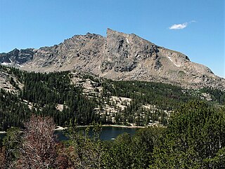
Mount Lester is a 12,342-foot-elevation (3,762-meter) mountain summit located in Sublette County, Wyoming, United States.

Ramshorn Peak is an 11,635-foot-elevation (3,546-meter) mountain summit located in Fremont County of Wyoming, United States.

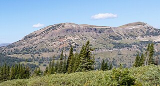
Amphitheater Mountain is a prominent 11,042-foot-elevation (3,366-meter) mountain summit located in Park County, Wyoming, United States.
Republic Mountain is a 10,162-foot-elevation (3,097-meter) mountain summit located in Park County, Wyoming, United States.
Pollux Peak is an 11,063-foot-elevation (3,372-meter) mountain summit located in Yellowstone National Park, in Park County, Wyoming, United States.

Saddle Mountain is a 10,670-foot-elevation (3,250-meter) mountain summit located in Yellowstone National Park, in Park County, Wyoming, United States.
Silvertip Peak is a 10,645-foot-elevation (3,245-meter) mountain summit located in Park County, Wyoming, United States.

Lonesome Mountain is an 11,399-foot (3,474-metre) mountain summit located in Carbon County, Montana.

Snowden Mountain is a 6,420-foot-elevation (1,960-meter) mountain summit located in the Brooks Range, in the U.S. state of Alaska.

Raymond Peak is a 10,014-foot-elevation (3,052 meter) mountain summit located in Alpine County, California, United States.

Darwin Peak is an 11,647-foot-elevation (3,550-meter) mountain summit in Teton County, Wyoming, United States.
Jim Mountain is a 10,430-foot-elevation (3,179-meter) summit in Park County, Wyoming, United States.

Indian Peak is a 10,929-foot-elevation (3,331-meter) mountain summit in Park County, Wyoming, United States.

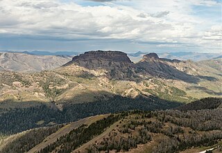
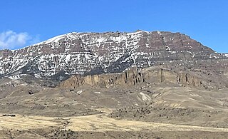
Hurricane Mesa is an 11,069-foot-elevation (3,374-meter) mountain summit in Park County, Wyoming, United States.
Mount Abundance is a 10,116-foot (3,083-metre) summit in Park County, Montana, United States.

Mount Humphreys is an 11,019-foot-elevation (3,359-meter) mountain summit in Park County, Wyoming, United States.

Table Mountain is an 11,069-foot-elevation (3,374-meter) mountain summit in Park County, Wyoming, United States.


