
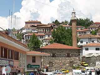
Akyurt, formerly Ravlı, is a district of Ankara Province of Turkey. According to 2010 census, population of the district is 26,006 of which 25,353 live in the urban center of Akyurt. The district covers an area of 212 km2 (82 sq mi), and the average elevation is 960 m (3,150 ft).

Alaca is one of the largest districts of Çorum Province in the Black Sea region of Turkey. It is located 52 km (32 mi) from the city of Çorum, on a road from the Black Sea coast to central Anatolia. Population is 22,092 as of 2010.

Sarıveliler is a town and district of Karaman Province in the Central Anatolia region of Turkey. According to 2000 census, population of the district is 21,308 of which 6,718 live in the town of Sarıveliler.

Çiftlik is a town and district of Niğde Province in the Central Anatolia region of Turkey, 67 km from the town of Niğde, and 65 km from Aksaray. There is a much shorter route over the mountains to Niğde but that road is often under snow and closed in winter. Population is (2010) 29,183 of which 3,304 live in the town of Çiftlik.

Elmadağ is a town and district of Ankara Province in the Central Anatolia region of Turkey. According to 2010 census, population of the district is 43,311 of which 42,099 live in the town of Elmadağ. The district covers an area of 568 km2 (219 sq mi), and the average elevation is 1,135 m (3,724 ft), with the highest point being Mt. İdris at 1,995 m (6,545 ft).

Evren, formerly Çıkınağıl, is a town and district of Ankara Province in the Central Anatolia region of Turkey, 178 km from the city of Ankara. According to 2010 census, population of the district is 3,343 of which 2,175 live in the town of Evren. The district covers an area of 218 km². Since April 2009 this municipality is governed by the MHP.

Kadınhanı is a town and district of Konya Province in the Central Anatolia region of Turkey. According to 2000 census, population of the district is 41,844 of which 14,816 live in the town of Kadınhanı.

Nallıhan is a rural town and district of Ankara Province in the Central Anatolia region of Turkey, 157 km from the city of Ankara. According to 2010 census, population of the district is 30,571 of which 12,457 live in the town of Nallıhan. The district covers an area of 1,978 km², and the average elevation is 625 m.

Sincan is a metropolitan district of Ankara Province in the Central Anatolia region of Turkey, a large town 27 km from the city of Ankara. According to 2010 census, the population of Sincan is 456,420 The district covers an area of 344 km2 (133 sq mi), and the average elevation is 855 m (2,805 ft). Sincan has friendly relations with the municipality of Doboj Jug from Bosnia and Herzegovina.

Sorgun is a town and district of Yozgat Province in the Central Anatolia region of Turkey. Sorgun is the largest and the most populated district of Yozgat. It covers an area of 1,769 km² and the population is 120,262 of which 53,884 live in the town of Sorgun.

Yalıhüyük is a town and district of Konya Province in the Central Anatolia region of Turkey. According to 2000 census, population of the district was 5,575 of whom 5,330 live in the town of Yalıhüyük.

Yerköy is a town and district of Yozgat Province in the Central Anatolia region of Turkey. According to 2000 census, population of the district is 48,889 of which 32,228 live in the town of Yerköy.The Mayor is Ferhat Yilmaz from the İyi Party (İYİ).
Bala is a town and district of Ankara Province in the Central Anatolia region of Turkey, 67 km south-east of the city of Ankara. According to 2000 census, population of the district is 19,426 of which 8,506 live in the urban center of Bala. The district covers an area of 2,563 km2 (990 sq mi), and the average elevation is 1,310 m (4,298 ft).

Arsin is a coastal town and a district of Trabzon Province in the Black Sea region of Turkey. The mayor is Erdem Şen member of ruling (AKP) party.
Ayaş is a town and district of Ankara Province in the Central Anatolia region of Turkey, 58 km from the city of Ankara which is very rich for historical monuments. According to 2000 census, population of the district is 21,239 of which 7,839 live in the urban center of Ayaş. The district covers an area of 1,112 km2 (429 sq mi), and the average elevation is 910 m (2,986 ft).

Kahramankazan is a town and district of the Ankara Province in the Central Anatolia region of Turkey, standing on the plain of Akıncı to the north west of the city of Ankara. According to 2010 census, population of the district is 39,537 of which 37,718 live in the town of Kahramankazan. The district covers an area of 408 km2 (158 sq mi), and the average elevation is 890 m (2,920 ft).

Kızılcahamam is a town and district of Ankara Province in the Central Anatolia region of Turkey, 70 km north of the city of Ankara, near the motorway to Istanbul. According to 2010 census, population of the district is 25,203 of which 16,726 live in the town of Kızılcahamam. The district covers an area of 1,712 km², and the average elevation in district center is 975 m.
Altunhisar is a town and district of Niğde Province in the Central Anatolia region of Turkey. In 2012, it had a population of 14,416 of whom 2,969 lived in the town of Altunhisar.

Gölbaşı is a town and district of the Ankara Province in the Central Anatolia region of Turkey, 20 km (12 mi) south of the city of Ankara. According to a 2010 census, the population of the district is 95,109, 93,852 of whom live in the town of Gölbaşı. The district covers an area of 738 km2 (285 sq mi), and the average elevation is 970 m (3,182 ft). The district includes the Mogan and Eymir lakes.
Toroslar is a municipality and district governorate in Greater Mersin, Turkey. Mersin is one of 30 metropolitan centers in Turkey with more than one municipality within city borders. Now in Mersin there are four second-level municipalities in addition to Greater Mersin (büyükşehir) municipality. The mayor of Toroslar is Hamit Tuna ).


