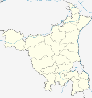
Rakhigarhi or Rakhi Garhi is a village and an archaeological site in the Hisar District of the northern Indian state of Haryana, situated about 150 km northwest of Delhi. It is located in the Ghaggar River plain, some 27 km from the seasonal Ghaggar river, and belonged to the Indus Valley civilisation, being part of the pre-Harappan, early Harappan, and the mature phase of the Indus Valley Civilisation.

Hisar also known as Hissar is the administrative headquarters of Hisar district in the state of Haryana in northwestern India. It is located 164 km (102 mi) to the west of New Delhi, India's capital, and has been identified as a counter-magnet city for the National Capital Region to develop as an alternative center of growth to Delhi.

The Chautang is a seasonal river, originating in the Sivalik Hills, in the Indian state of Haryana. The Chautang River is a tributary of the Sarsuti river which in turn is a tributary of the Ghaggar river.

Kalibangān is a town located at 29.47°N 74.13°E on the left or southern banks of the Ghaggar in Tehsil Pilibangān, between Suratgarh and Hanumangarh in Hanumangarh District, Rajasthan, India 205 km. from Bikaner. It is also identified as being established in the triangle of land at the confluence of Drishadvati and Sarasvati Rivers. The prehistoric and pre-Mauryan character of Indus Valley civilization was first identified by Luigi Tessitori at this site. Kalibangan's excavation report was published in its entirety in 2003 by the Archaeological Survey of India, 34 years after the completion of excavations. The report concluded that Kalibangan was a major provincial capital of the Indus Valley Civilization. Kalibangan is distinguished by its unique fire altars and "world's earliest attested ploughed field". It is around 2900 BC that the region of Kalibangan developed into what can be considered a planned city.

Amri is an ancient settlement in modern-day Sindh, Pakistan, that goes back to 3600 BCE. The site is located south of Mohenjo Daro on Hyderabad-Dadu Road more than 100 kilometres north of Hyderabad, Pakistan.

Pottery in the Indian subcontinent has an ancient history and is one of the most tangible and iconic elements of Indian art. Evidence of pottery has been found in the early settlements of Lahuradewa and later the Indus Valley Civilisation. Today, it is a cultural art that is still practiced extensively in the subcontinent. Until recent times all Indian pottery has been earthenware, including terracotta.
Banawali is an archaeological site belonging to the Indus Valley civilization period in Fatehabad district, Haryana, India and is located about 120 km northeast of Kalibangan and 16 km from Fatehabad. Banawali, which is earlier called Vanavali, is on the left banks of dried up Sarasvati River. Comparing to Kalibangan, which was a town established in lower middle valley of dried up Sarasvathi River, Banawali was built over upper middle valley of Sarasvati River.
Kheri Jalab is a village and an Indus Valley civilization site, located in Hisar District of the state of Haryana in India.

Siswal is a village in Hisar district, Haryana, India. It located 28 km from Hisar city. It is a site of Chalcolithic age. It is a typesite for Siswal culture, dating from around 3800 BC, also known as Sothi–Siswal culture.
Mitathal is a village and Indus Valley civilization (IVC) Archaeological sites in the Bhiwani tehsil of the Bhiwani district in the Indian state of Haryana. Part of Hisar division, it lies 12 kilometres (7.5 mi) north of the district headquarters Bhiwani and 249 kilometres (155 mi) from the state capital Chandigarh. As of the 2011 Census of India, the village had 1,448 households with a total population of 7,434 of which 4,002 were male and 3,432 female.
Lohari Ragho is a village and Indus Valley civilization archaeological site, located in Hisar district of the Haryana state in India. It has 3 separate mounds, each 1 to 1.5 km apart within the peripheral suburban zone of Rakhigarhi city cite, where artifacts belonging to Mature Harappan and Sothi-Siswal cultural period have been confirmed based on filed visits. These mounds, unprotected and under risk of encroachment and threat of obliteration, are yet to be excavated, fenced, protected or conserved.
Sisai is a village situated 9 kilometres (5.6 mi) from Hansi tehsil in Hisar district in the Indian state of Haryana. The village was established by "Shisram Kaliraman"on whose name the village is named "Sisai". It is a prominent village of Kaliraman Jats and serves as headquarters of Akhil Bharatiya Kaliraman Khap. Kaliraman and Sihag are the gotras of Jats in this village.There are two panas in this village, Sisai Kaliraman and Sisai Bola. Master Chandgi Ram Pehlwan also belonged to this village. It is the largest village not having a police station. Altius and eklvya public schools are proceeding towards making this village "wrestling Hub".

Firoz Shah palace complex (Hisar-e-Firoza) is an archaeological complex located in modern-day Hisar, in the Haryana state of India, built by Firoz Shah Tughlaq of the Delhi Sultanate in 1354 AD. It is maintained by the Archaeological Survey of India.
Kunal is a pre-Harappan Indus Valley civilisation settlement located, just 30 km from Fatehabad City in Fatehabad district of Haryana state in India. Compared to other IVC sites, such as cities like Rakhigarhi and towns like Kalibangan, Kunal site was a village. Excavation at Kunal show 3 successive phases of Pre-Harappan indigenous culture on the Saraswati river who also traded with Kalibanga and Lothal. Kunal, along with its other contemporary sites Bhirrana and Rakhigarhi on Sarasvati-Ghaggar river system, is recognised as the oldest Pre-Harappan settlement, with Kunal being an older cultural ancestor to Rehman Dheri in Pakistan< which is on the Tentative List for future World Heritage Sites.
Mirchpur is an Indus Valley civilization site and village in Narnaund, Hissar district, Haryana, India.
Masudpur is a village and Indus Valley civilization archaeological site in the Hisar district in Haryana state in India.
Tourism in Haryana relates to tourism in the state of Haryana, India. There are 22 tourism hubs created by Haryana Tourism Corporation (HTC), which are located in Ambala, Bhiwani Faridabad, Fatehabad, Gurgaon, Hisar, Jhajjar, Jind, Kaithal, Karnal, Kaimla, Kurukshetra, Panchkula, Sirsa, Sonipat, Panipat, Rewari, Rohtak, Yamunanagar, Palwal and Mahendergarh.
Sothi is an early archaeological site of the Indus Valley civilization dating to around 4600 BCE, located in the Hanumangarh District of Rajasthan, India, at a distance of about 10 km southwest of Nohar railway station.
Dhatrath is a village in Safidon, Jind district at Haryana, India. It belongs to Hisar Division. It is located 16 km from Jind and about 180 km from state capital Chandigarh. Pin code is 126110. Dhatrath is a very old village and also known as Seharda.


