Hisar district is one of the 22 districts of Haryana, India. Hisar city serves as the district headquarters. Hisar district has four sub-divisions that is, Hisar, Barwala, Hansi and Narnaud, each headed by an SDM. The district is also part of Hisar division. Hisar was founded by Firuz Shah Tughlaq.
The largest district in Haryana until its 1966 reorganisation, some parts of Hisar were transferred to the newly created Jind district. In 1974, the Tehsils of Bhiwani and Loharu were transferred to Bhiwani district. Hisar was further bifurcated when Sirsa district was formed. Fatehabad district was later created as well.[3]
Hisar is a divisional headquarters of the Hisar division and also the headquarters of Police Range. It is also a battalion headquarters of B.S.F. 3rd Bn. H.A.P. and commando force. In order to accommodate all of these departments, a five-storey District Administrative Complex was built, with the offices transferred in 1980. It adjoins the new Judiciary Complex, which is also made functional. This administrative and judiciary complex is the largest in Haryana; as a district headquarters it may be one of the largest in the country.
It is one of the five cities belonging to Indus Valley Civilisation while its name is cited in the history books in the context of Indus civilisation and in general knowledge books as the location of Banawali, one of five sheep farms. As of 2011[update] it is the second most populous of the 21 districts of Haryana, after Faridabad.[4]
Hisar is also known as the steel city because of the Jindal Stainless Steel Factories. It is also the largest producer of galvanised iron in India.[citation needed]
In any doab, khadar land (green) lies next to a river, while bangar land (olive) has greater elevation and lies further from the river
North Hisar district falls in doab between Ghagghar river flowing through fatehabad district and paleo channel of Dhrishadvati river flowing through the Narnaul tehsil. Eastern, central, and south-eastern Hisar district falls in doab between Dhrishadvati river and Yamuna river. Western Hisar district is part of bagar tract. The regions of the doabs near the rivers consist of low-lying, flood-prone, but usually very fertile khadir and the higher-lying land away from the rivers consist of bangar, less prone to flooding but also less fertile on average.[5] For the purpose of irrigation, Hisar district has been classified into 5 circles, namely barani (low rain area where rain-fed dry farming is practised which nowadays are dependent on tubewells for the irrigation),[6]bagar (dry sandy tract of land on the border of Rajasthan state adjoining the states of Haryana and Punjab)[6]nahri (canal-irrigated land), nali or naili (fertile prairie tract between the Ghaggar river and the southern limits of the Saraswati channel depression in northern Hissar district of Haryana that gets flooded during the rains),[7] and Rangoi tract (an area irrigated by the Rangoi canal made for the purpose of carrying flood waters of Ghagghar river to dry areas).[8][9]
Hisar has fertile alluvial soil interspersed with highly permeable very sandy tracts in bagar region several with water table more than 100 feet below ground containing brackish water usually unfit for human consumption, where dust storms frequent during the warm summer months from April till the end of July when monsoon arrives. Previously, Hisar was solely based on the rain and irrigation was possible only in the nali region where the season Ghaggar river flows in North Hisar. After the opening of Bhakra Nangal Dam canal system in 1963 as well as the earlier Western Yamuna Canal now irrigate most of Haryana including all of the Bagar region falling in Haryana on its western border. Opening of Indira Gandhi Canal in 1983 (specially Hansi Butana branches) brought the water of Sutlej and Beas rivers to the fields of Rajasthan including its Bagar tract stabilising the sand dunes and soil erosion by preventing the expansion of desert.[6]
Hisar district was conquered by the British in 1803.[13] On 30 December 1803, the Daulat Scindia signed the Treaty of Surji-Anjangaon with the British after the Battle of Assaye and Battle of Laswari and ceded to the British, Hisar, Panipat, Rohtak, Rewari, Gurgaon, Ganges-Jumna Doab, the Delhi-Agra region, parts of Bundelkhand, Broach, some districts of Gujarat and the fort of Ahmmadnagar.[14]:73
On 1 November 1966, when Haryana was carved out of Punjab as a separate state, Hisar was already an existing district of the newly formed state of Haryana.[15]
The 2011 census[update] the district had a population of 1,743,931,[4] roughly equal to the nation of The Gambia[17] or the US state of Nebraska.[18] This gave it a ranking of 276th in India out of a total of 640 districts.[4] The district has a population density of 438 inhabitants per square kilometre (1,130/sqmi) .[4] Its population growth rate over the decade 2001-2011 was 13.38%.[4] Hisar has a sex ratio of 871 females for every 1000 males,[4] and a literacy rate of 73.2%. Scheduled Castes make up 23.44% of the population.[4]
Castes and tribes
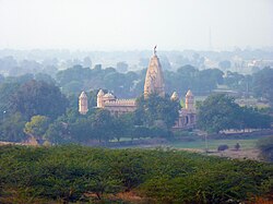
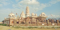
The important social groups in the district are Jats, Bishnois, Brahmins, Sainis, Banias, Gujjars, Ahirs, Rajputs, Kumhars, Aroras, Chamars and Balmikis.[8] Jat is the largest social group in the city.[8] Bishnois have migrated from Rajasthan.[8] There are three sections of Brahmins in the district, i.e., Gaur, Bias and Khandelwal. Most of the Aroras are migrant from West Punjab after the partition of the country in 1947.[8] Banias are divided into Aggarwals, Oswals and Maheshwaris. The Aggarwals are said to be the descendants of the inhabitants of Agroha.[8] They hold Agroha in great reverence. Oswals and Maheshwaris trace their origin to the Rajasthan.[8] The Gujjars of Hisar trace their origin to Rajasthan.[8] Hisar is also the origin place of Agrawal Jain Community, with Hansi being an important Jain pilgrimage town.
At the time of the 2011 Census of India, 68.76% of the population in the district spoke Haryanvi, 26.40% Hindi and 2.41% Punjabi as their first language.[19]Haryanvi is the most spoken language in the district.
Note1: British Punjab province era district borders are not an exact match in the present-day due to various bifurcations to district borders — which since created new districts — throughout the historic Punjab Province region during the post-independence era that have taken into account population increases.
Note2: 1881 census count includes Sirsa District, which was later amalgamated with Hissar District.
Religion in the Tehsils of Hisar District (1921)[29]
Note: British Punjab province era tehsil borders are not an exact match in the present-day due to various bifurcations to tehsil borders — which since created new tehsils — throughout the historic Punjab Province region during the post-independence era that have taken into account population increases.
Religion in the Tehsils of Hisar District (1941)[31]
Note1: British Punjab province era tehsil borders are not an exact match in the present-day due to various bifurcations to tehsil borders — which since created new tehsils — throughout the historic Punjab Province region during the post-independence era that have taken into account population increases.
Note2: Tehsil religious breakdown figures for Christianity only includes local Christians, labelled as "Indian Christians" on census. Does not include Anglo-Indian Christians or British Christians, who were classified under "Other" category.
Hisar continued to be the District Headquarters of the largest District in the state until its reorganisation in 1966 when parts were carved out to create the new Jind District. The Tehsil Bhiwani and Loharu estate were later transferred to Bhiwani district on its creation in 1974. It was further bifurcated when Sirsa district was created entirely out of Hisar District. Fatehabad district has now been carved out of this district.
Hisar is a divisional headquarters of the Divisional Commissioner and also the headquarters of the Police Range. It is also a battalion Headquarters of Border Security Force, 3rd battalion of Haryana Armed Police and police commando force. All these departments are now housed in a five storied District Administrative Complex completed in 1980, which adjoins the new Judiciary Complex.
The district has seven Vidhan Sabha constituencies, namely, Adampur, Uklana, Narnaund, Hansi, Barwala, Hisar and Nalwa. All of these are part of Hisar Lok Sabha constituency
Over the past three centuries Hisar had been the birthplace of individuals including Sardar Ishri Singh, Sardar Harji Ram and Rai Bahadur Sardar Nau Nihal Singh who were honorary magistrates in pre-Independence Hisar. Noteworthy individuals include the Lala Lajpat Rai (freedom fighter, elected member of Hisar municipal committee, founder of Hisar district congress (1986), Arya samaj (1986) and district bar council), Captain Abhimanyu Sindhu (entrepreneur, journalist, BJP national spokesperson and Minister in Haryana from Narnaund assembly constituency), late Dr. Gopi Chand Bhargava (First Chief Minister of joint Punjab), Om Prakash Jindal (former chairperson of Jindal Industries and Minister in Haryana government) and his wife Savitri Jindal (chairperson of Jindal Industries and Minister in Haryana government), Subhash Chandra (Chairman of Essel Group and Zee Network and BJP MP in Rajya Sabha), Amit Munjal, founder and CEO of Doctor Insta and Former CFO of Citi Holdings, Yash Tonk (Bollywood actor), Manish Joshi Bismil (theatre director), General V.K. Singh (Former Army Chief and Union Minister from BJP), General Dalbir Singh Suhag (former Army Chief) and Israr Ahmed (Islamic scholar from Pakistan, born in Hisar before independence).
↑Pakistan: Soils, Encyclopædia Britannica, 2010, ... khaddar soils. Away from the river, toward the middle of the doabs, older alluvial soils (called bangar) are widely distributed ...
↑Grove, Richard H. (2007), "The Great El Nino of 1789–93 and its Global Consequences: Reconstructing an Extreme Climate Even in World Environmental History", The Medieval History Journal, 10 (1&2): 75–98, doi:10.1177/097194580701000203, hdl:1885/51009, S2CID162783898
12Fieldhouse, David (1996), "For Richer, for Poorer?", in Marshall, P. J. (ed.), The Cambridge Illustrated History of the British Empire, Cambridge: Cambridge University Press. Pp. 400, pp.108–146, ISBN0-521-00254-0
This page is based on this Wikipedia article Text is available under the CC BY-SA 4.0 license; additional terms may apply. Images, videos and audio are available under their respective licenses.