Summit, Illinois

Last updated

Summit, Illinois
Village of Summit
Cement silo - panoramio.jpg
Cement silos in Summit
Summit Illinois Seal.png
Motto(s): 
Strength, Unity, Progress
Cook County Illinois Incorporated and Unincorporated areas Summit Highlighted.svg
Location of Summit in Cook County, Illinois.
Illinois in United States (US48).svg
Location of Illinois in the United States
Coordinates: 41°47′N87°49′W / 41.783°N 87.817°W / 41.783; -87.817
CountryUnited States
StateIllinois
County Cook
Founded1890
Government
  MayorSergio Rodriguez
Area
[1]
  Total2.26 sq mi (5.85 km2)
  Land2.12 sq mi (5.49 km2)
  Water0.14 sq mi (0.36 km2)
Population
 (2020)
  Total11,161
  Density5,267.11/sq mi (2,033.86/km2)
Time zone UTC-6 (CST)
  Summer (DST) UTC-5 (CDT)
ZIP Code(s)
60501
Area code 708
FIPS code 17-73638
Wikimedia CommonsSummit, Illinois
Website www.summit-il.org

Summit is a village in Cook County, Illinois, United States. The population was 11,161 at the 2020 census. [2] The name Summit, in use since 1836, refers to the highest point on the Chicago Portage between the northeast-flowing Chicago River and the southwest-flowing Des Plaines River located just north of the village.

Contents

Argo is a subdivision annexed by Summit in 1911 when it was new. Named for the nearby cornstarch and baking powder manufacturing plant, it developed separately from the older part of the village. The name "Argo" is still widely used but is not part of the name of the village itself.

Geography

According to the 2010 census, Summit has a total area of 2.257 square miles (5.85 km2), of which 2.12 square miles (5.49 km2) (or 93.93%) is land and 0.137 square miles (0.35 km2) (or 6.07%) is water. [3] Most of Summit is in the floodplain of the Des Plaines River. [4]

History

The area around Summit has been hunted and traveled through for 12,000 years but only continuously occupied since 900CE. When Europeans first arrived the area was inhabited or used by the Meskwaki, Illini, Miami, Sauk, and Chippewa-Ottawa-Potawatomi tribes. [5] [6]

In 1673 the Marquette-Joliet expedition arrived at the portage north of the village and went on to the location of Chicago. At that time the importance of a portage was noted. A local trading network developed from that time until the Native Americans were removed beginning in 1816. [7] [8]

Surveyed in 1821, in 1830 land was for sale by the Illinois and Michigan Canal Commission. There may have been a tavern at "Summit Ford" in 1832, by 1835 there was a sub-divided settlement with a tavern, blacksmith shop, and stagecoach stop. "Summit Corners" was where westbound Archer Ave. turned south and Lyons-Summit Rd. (now approximately Lawndale Ave.) went west. Chicago politician "Long John" Wentworth bought much of the surrounding area and used it for farming. [9] [10]

Between 1836 and 1848 the Illinois and Michigan Canal was built through the subdivision. Most of the canal workers were Irish laborers and many were able to buy property with their canal script pay. [11]

In 1850 gravel and clay pits were opened in the area for local use. After 1865 limestone quarries north of the canal provided jobs into the 1920s, when they were closed, often used as garbage dumps, then covered over. Today's Hanover Park is a filled gravel and clay pit. [12]

In 1856 the Joliet and Chicago Railroad (Chicago and Alton Railroad in 1862) built a line along the south bank of the canal. Today this is Metra's Heritage Corridor commuter line. [13] [14]

In 1890 Summit was incorporated as a village. When John Wentworth, and his political influence, died in 1888 his heirs and the settlement residents feared being annexed by Chicago. The settlement was re-platted much as it is today, with Center St. going north from Archer Ave. and Lincoln St./Lawndale Ave. going northwest from Center St. over the canal. This area was changed with the construction of Interstate 55, which effectively replaced Lawndale Ave. with the Illinois Route 171 ramp. A housing complex was at the site of the 1836 settlement. [15]

Between 1892 and 1900 the Chicago Sanitary Canal was built. It was just north of the Illinois and Michigan Canal but was much larger. In 1899 a large center-pier swing steel bridge was built for Lawndale Ave., the only crossing for miles in either direction until the 1920s. In 1900 the Chicago Sanitary Canal opened and replaced the Illinois and Michigan Canal, which was abandoned. In Summit the old canal was filled in 1974. [16] [17]

In 1901 the Chicago and Joliet Electric Railway Interurban was operating a double-track line down Archer Ave. To the east it connected with Chicago streetcars at Cicero Ave. (then the city limits), to the southwest it went past Argo and on to Joliet. A branch went north on Lawndale Ave to Ogden Ave. in Lyons. In 1933 the rail-cars were replaced with buses. [18]
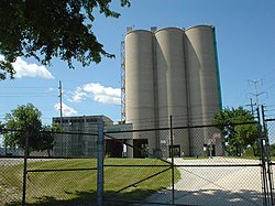
 [19]

In 1907 Corn Products Corp. (now Ingredion) began construction of the world's largest corn-processing plant south of Summit (Bedford Park today) in 1907. At the same time two properties, north and south of 63rd St., were sub-divided as a "company town" type neighborhood called "Argo" after the factory. In 1911 Summit annexed Argo but its separation by the Indiana Harbor Belt Railroad tracks at 59th St., dependence on the factory, and separate business district along 63rd St. with Chicago streetcar (later bus) service made it develop as a separate community. The name "Argo" is still in widespread use in both the public and private sectors. [20]

Between 1910 and 1920 the population of Summit more than tripled, from 949 to 4,019, and increased again to 6,548 in 1930. The nature of the village changed from rural to industrial, largely because of the Corn Products plant. Farms in the old section were sub-divided and the new Argo area was annexed into the village. In addition to Corn Products other industries went up west of Archer Rd. and the large rail yard south of the village created a large number of jobs. [21] [22]

The village was overwhelmed with the increase and public services were not able to keep up. Water supply was a major problem, and schools were severely over-crowded. Between 1910 and 1930 three elementary, one high, and two Catholic schools were opened. [23]

Demographics

Historical population
CensusPop.Note
1880 272
1900 547
1910 94973.5%
1920 4,019323.5%
1930 6,54862.9%
1940 7,0437.6%
1950 8,95727.2%
1960 10,37415.8%
1970 11,56911.5%
1980 10,110−12.6%
1990 9,971−1.4%
2000 10,6376.7%
2010 11,0543.9%
2020 11,1611.0%
U.S. Decennial Census [22]

As of the 2020 census [24] there were 11,161 people, 3,269 households, and 2,536 families residing in the village. The population density was 4,945.06 inhabitants per square mile (1,909.30/km2). There were 3,789 housing units at an average density of 1,678.78 per square mile (648.18/km2). The racial makeup of the village was 26.83% White, 7.88% African American, 2.48% Native American, 2.02% Asian, 0.03% Pacific Islander, 37.32% from other races, and 23.44% from two or more races. Hispanic or Latino of any race were 72.75% of the population.

There were 3,269 households, out of which 48.0% had children under the age of 18 living with them, 48.03% were married couples living together, 22.15% had a female householder with no husband present, and 22.42% were non-families. 20.71% of all households were made up of individuals, and 7.37% had someone living alone who was 65 years of age or older. The average household size was 3.92 and the average family size was 3.41.

The village's age distribution consisted of 30.3% under the age of 18, 9.3% from 18 to 24, 28% from 25 to 44, 20% from 45 to 64, and 12.3% who were 65 years of age or older. The median age was 32.3 years. For every 100 females, there were 98.1 males. For every 100 females age 18 and over, there were 106.2 males.

The median income for a household in the village was $46,972, and the median income for a family was $53,000. Males had a median income of $33,532 versus $26,804 for females. The per capita income for the village was $20,911. About 15.9% of families and 17.2% of the population were below the poverty line, including 26.2% of those under age 18 and 8.0% of those age 65 or over.

Summit village, Illinois – Racial and ethnic composition
Note: the US Census treats Hispanic/Latino as an ethnic category. This table excludes Latinos from the racial categories and assigns them to a separate category. Hispanics/Latinos may be of any race.
Race / Ethnicity (NH = Non-Hispanic)Pop 2010 [25] Pop 2020 [26] % 2010% 2020
White alone (NH)2,6621,79124.1%16.0%
Black or African American alone (NH)1,0118529.1%7.6%
Native American or Alaska Native alone (NH)28210.3%0.2%
Asian alone (NH)1992221.8%2.0%
Pacific Islander alone (NH)030.0%0.0%
Some Other Race alone (NH)3370.0%0.3%
Mixed Race/Multi-Racial (NH)1091151.0%1.0%
Hispanic or Latino (any race)7,0428,12063.7%72.8%
Total11,05411,161100.00%100.00%

Public education

Elementary and middle school students attend Cook County School District 104 schools, and then move on to Argo Community High School District 217.

Business and industry

Ingredion operates a corn milling and processing plant at 65th Street and Archer Avenue, in an area known as Argo. This facility is one of the largest of its kind in the world. [27]

ACH Food Companies operates a manufacturing and processing plant here for Mazola corn oil, Karo corn syrup and Argo Baking Powder and Corn Starch.

The Institute for Food Safety and Health (formerly the National Center for Food Safety and Technology) is in Bedford Park, adjacent to the Ingredion facility. It is affiliated with the Illinois Institute of Technology and the Food and Drug Administration's Center for Food Safety and Applied Nutrition. [28]

Frito-Lay has a zone office in Summit. Summit has also been the home of the Desplaines Valley News newspaper since 1913.

Transportation

Summit's multimodal transportation network encompasses the following:

Notable people

Related Research Articles

<span class="mw-page-title-main">Will County, Illinois</span> County in Illinois, United States

Will County is a county in the northeastern part of the state of Illinois. According to the 2020 census, it had a population of 696,355, an increase of 2.8% from 677,560 in 2010, making it Illinois's fourth-most populous county. The county seat is Joliet. Will County is one of the five collar counties of the Chicago–Naperville–Elgin, IL–IN–WI Metropolitan Statistical Area. The portion of Will County around Joliet uses area codes 815 and 779, while 630 and 331 are for far northern Will County and 708 is for central and eastern Will County.

<span class="mw-page-title-main">Bellwood, Illinois</span> Village in Illinois, United States

Bellwood is a village in Proviso Township, Cook County, Illinois, United States. Located 13 miles (21 km) west of Chicago's downtown Loop, the Village of Bellwood is bounded by the Eisenhower Expressway (south), the Proviso yards of the former Chicago & Northwestern, now Union Pacific Railroad (north), and the suburbs of Maywood (east) and Hillside and Berkeley (west). The population was 18,789 at the 2020 census.

<span class="mw-page-title-main">Des Plaines, Illinois</span> City in Illinois, United States

Des Plaines is a city in Cook County, Illinois, United States. Per the 2020 census, the population was 60,675. The city is a suburb of Chicago and is located just north of O'Hare International Airport. It is situated on and is named after the Des Plaines River, which runs through the city just east of its downtown area.

<span class="mw-page-title-main">East Hazel Crest, Illinois</span> Village in Illinois, United States

East Hazel Crest is a village in Cook County, Illinois, in the United States. It is a south suburb of Chicago. As of the 2020 census, the village population was 1,297.

<span class="mw-page-title-main">Frankfort, Illinois</span> Village in Illinois, United States

Frankfort is a village in Will County and Cook County in the U.S. state of Illinois. It is a southern suburb of Chicago, and is approximately 28 miles south of the city. As of the 2020 census, the population was 20,296.

<span class="mw-page-title-main">Justice, Illinois</span> Village in Illinois, United States

Justice is a village in Cook County, Illinois, United States, established in 1911. Per the 2020 census, the population was 12,600.

<span class="mw-page-title-main">Lemont, Illinois</span> Village in Illinois, United States

Lemont is a village located in Cook, DuPage, and Will counties in the U.S. state of Illinois, and is a south-west suburb of Chicago. The population was 17,629 as of the 2020 census. The village is situated on a hillside along the south banks of the Des Plaines River. It overlooks Waterfall Glen's Midwestern Bluff Savanna on the opposite side. Lemont is home to Argonne National Laboratory and other heavy industrial sites, and has a substantial European immigrant population.

<span class="mw-page-title-main">Matteson, Illinois</span> Village in Illinois, United States

Matteson is a village in Cook County, Illinois, United States. The population was 19,073 at the 2020 census. It is a suburb of Chicago.

<span class="mw-page-title-main">Midlothian, Illinois</span> Village in Illinois, United States

Midlothian is a village in Bremen Township, Cook County, Illinois, United States. It is a southwestern suburb of Chicago. As of the 2020 census the population was 14,325.

<span class="mw-page-title-main">Oak Forest, Illinois</span> City in Illinois, United States

Oak Forest is a city in Cook County, Illinois, United States. The city is out 24 miles (39 km) south-southwest of downtown Chicago in Bremen Township. Per the 2020 census, the population was 27,478.

<span class="mw-page-title-main">Palos Park, Illinois</span> Village in Illinois, United States

Palos Park is a village in southwestern Cook County, Illinois, United States. Per the 2020 census, the population was 4,899.

<span class="mw-page-title-main">River Forest, Illinois</span> Village in Illinois, United States

River Forest is a suburban village adjacent to Chicago in Cook County, Illinois, United States. Per the 2020 census, the population was 11,717. Two universities make their home in River Forest, Dominican University and Concordia University Chicago. The village is closely tied to the larger neighboring community of Oak Park. There are significant architectural designs located in River Forest such as the Winslow House by Frank Lloyd Wright. River Forest has a railroad station with service to Chicago on Metra's Union Pacific West Line.

Riverdale is a village in Cook County, Illinois, United States. The population was 10,663 at the 2020 census. The village shares its name with the bordering Riverdale neighborhood in Chicago.

<span class="mw-page-title-main">Tinley Park, Illinois</span> Village in Illinois, United States

Tinley Park is a village in Cook County, Illinois, United States, with a small portion in Will County. The village is a suburb of Chicago. Per the 2020 census, the population was 55,971. It is one of the fastest growing suburbs southwest of Chicago. In 2009 BusinessWeek named Tinley as the best place in America to raise a family.

<span class="mw-page-title-main">University Park, Illinois</span> Village in Illinois, United States

University Park is a village in Will County with a small portion in Cook County in the U.S. state of Illinois. It is a south suburb of Chicago. The village is one of the region's few planned communities; it was developed in the 1960s as Wood Hill, then Park Forest South, and finally University Park. Governors State University was established in the village in 1969. The village population was 7,145 at the 2020 census.

<span class="mw-page-title-main">Willow Springs, Illinois</span> Village in Illinois, United States

Willow Springs is a village in Cook County, Illinois, with a small portion in DuPage County. The village was founded in 1892, and was named for the springs along the Des Plaines River. In 2020, the population was 5,857.

<span class="mw-page-title-main">Joliet, Illinois</span> City in Illinois, United States

Joliet is a city in Will and Kendall counties in the U.S. state of Illinois, 35 miles (56 km) southwest of Chicago. It is the county seat of Will County. It had a population of 150,362 at the 2020 census, making it the third-most populous city in Illinois.

<span class="mw-page-title-main">Lockport, Illinois</span> City in Illinois, United States

Lockport is a city in Will County, Illinois, United States, located 30 miles southwest of Chicago. Per the 2020 census, the population was 26,094. The city was incorporated in 1853. It is situated along the Illinois and Michigan (I&M) Canal, and was the headquarters of the canal when the canal was operating. A section of the canal runs through Lockport, including the remains of the canal's Lock No. 1 from which the town received its name. The canal right-of-way is now the Illinois and Michigan National Heritage Corridor.

<span class="mw-page-title-main">New Lenox, Illinois</span> Village in Illinois, United States

New Lenox is a village in central Will County, Illinois, United States. It is a southwestern suburb of Chicago and an eastern suburb of Joliet. The village population was 27,214 as of the 2020 census. New Lenox has schools like Lincoln-Way West High School, Providence Catholic High School, and Lincoln-Way Central High School.

The Chicago and Joliet Electric Railway, or C&JE, was an electric interurban railway linking the cities of Chicago and Joliet, Illinois. It was the only interurban between those cities and provided a link between the streetcar network of Chicago and the cities along the Des Plaines River Valley in north central Illinois, which were served by the Illinois Valley Division of the Illinois Traction System.

References

  1. "2020 U.S. Gazetteer Files". United States Census Bureau. Retrieved March 15, 2022.
  2. "Census - Geography Profile: Summit village, Illinois". United States Census Bureau . Retrieved February 23, 2022.
  3. "G001 - Geographic Identifiers - 2010 Census Summary File 1". United States Census Bureau. Archived from the original on February 13, 2020. Retrieved December 25, 2015.
  4. Summit, Illinois. City-Data.com. Accessed April 15, 2012.
  5. Genzen, Jonathan (2007). The Chicago River, A History in Photographs. Westcliffe. p. 10. ISBN   978-1-56579-553-2.
  6. Kott, Robert (2009). Summit. Arcadia. pp. 8–9, 17. ISBN   978-0-7385-5248-4.
  7. Genzen (2007), pp. 12–13.
  8. Kott (2009), pp. 9, 12.
  9. Genzen (2007), pp. 24–25.
  10. Kott (2009), pp. 9, 31, 33–35, 38, 58.
  11. Kott (2009), pp. 7, 33, 36, 60.
  12. Kott (2009), pp. 17, 21–22, 33, 34, 60.
  13. Kott (2009), pp. 36, 62.
  14. "Heritage Corridor (HC) line map". Metra. 2021. Retrieved October 25, 2021.
  15. Kott (2009), pp. 35, 39, 58, 118.
  16. Genzen (2007), pp. 38–43, 59.
  17. Kott (2009), pp. 57, 59, 61.
  18. Central Electric Railfans' Association Bulletin 99. C.E.R.A. 1956. pp. 11–12, 23.
  19. Kott (2009), pp. 64, 98.
  20. Kott (2009), pp. 69–72.
  21. Kott (2009), p. 69.
  22. 1 2 "Census of Population and Housing". Census.gov. Retrieved June 4, 2015.
  23. Kott (2009), pp. 83–87.
  24. "Explore Census Data". data.census.gov. Retrieved June 28, 2022.
  25. "P2 Hispanic or Latino, and Not Hispanic or Latino by Race – 2010: DEC Redistricting Data – Summit village, Illinois". United States Census Bureau .
  26. "P2 Hispanic or Latino, and Not Hispanic or Latino by Race – 2020: DEC Redistricting Data – Summit village, Illinois". United States Census Bureau .
  27. "News Release - Investors - Ingredion Incorporated" . Retrieved November 7, 2016.
  28. "About". IIT IFSH. Illinois Institute of Technology. Archived from the original on June 28, 2013. Retrieved March 21, 2014.
  29. "John Garklavs". The New York Times. April 14, 1982.
  30. "Reds Hall of Fame and Museum" . Retrieved November 7, 2016.
  31. "How Emmett Till's Death and Open Casket Spurred Civil Rights Activism" . Retrieved November 7, 2016.