Sunday Rock

Last updated
Sunday Rock
Sunday Rock.jpg
Sunday Rock in 2014
USA New York location map.svg
Red pog.svg
Usa edcp location map.svg
Red pog.svg
Location NY 56, South Colton, New York
Coordinates 44°30′35″N74°53′39″W / 44.509722°N 74.894167°W / 44.509722; -74.894167 Coordinates: 44°30′35″N74°53′39″W / 44.509722°N 74.894167°W / 44.509722; -74.894167
Area0.34 acres (0.14 ha)
NRHP reference No. 10000990 [1]
Added to NRHPDecember 7, 2010

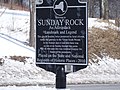
Sunday Rock is a historic natural feature located in South Colton in St. Lawrence County, New York. It is an oblong glacial erratic measuring 11 feet high and weighing 64,000 pounds. It was moved in 1925 to make way for a highway and moved again in 1965, when the highway was widened. It is located in a public roadside park, with two concrete monuments to commemorate its moves and the organizations that arranged for them. [2]

It was listed on the National Register of Historic Places in 2010. [1]

Related Research Articles

Clifton Park, New York Town in New York, United States

Clifton Park is a suburban town in Saratoga County, New York, United States. According to the United States Census Bureau, the 2010 population was 36,705. The name is derived from an early land patent. The town is in the south part of the county and is located approximately 12 miles (19 km) north of Albany, 7 miles (11 km) northeast of Schenectady, and 10 miles (16 km) south of Saratoga Springs.

Colton, New York Town in New York, United States

Colton is a town in St. Lawrence County, New York, USA. The population was 1,451 at the 2010 census. The town, originally named Matildaville, is named after early settler Jesse Colton Higley.

Going-to-the-Sun Road United States historic place

Going-to-the-Sun Road is a scenic mountain road in the Rocky Mountains of the western United States, in Glacier National Park in Montana. The Sun Road, as it is sometimes abbreviated in National Park Service documents, is the only road that traverses the park, crossing the Continental Divide through Logan Pass at an elevation of 6,646 feet (2,026 m), which is the highest point on the road. Construction began in 1921 and was completed in 1932 with formal dedication in the following summer on July 15, 1933. The road is the first to have been registered in all of the following categories: National Historic Place, National Historic Landmark and Historic Civil Engineering Landmark. The road is approximately 50 miles (80 km) long and spans the width of the park between the east and west entrance stations. The National Historic Landmark Nomination records a slightly shorter distance of 48.7 miles which is measured from the first main intersection just outside the park's west entrance to Divide Creek in St. Mary on the east side of the park.

Lime Rock Park Motorsport road racing venue located in Lakeville, CT, US

Lime Rock Park is a natural-terrain motorsport road racing venue located in Lakeville, Connecticut, United States, a hamlet in the town of Salisbury, in the state's northwest corner. Built in 1956, it is the nation's third oldest continuously operating road racing venue, behind Road America (1955) and Willow Springs International Motorsports Park (1953). The track is owned by Skip Barber, a former race car driver who started the Skip Barber Racing School in 1975. It was listed on the National Register of Historic Places in 2009.

Point Bonita Lighthouse Lighthouse at Point Bonita at the San Francisco Bay entrance, California, US

Point Bonita Lighthouse is a lighthouse located at Point Bonita at the San Francisco Bay entrance in the Marin Headlands near Sausalito, California. Point Bonita was the last manned lighthouse on the California coast. It was added to the National Register of Historic Places in 1991.

Hyde Park Firehouse United States historic place

The Hyde Park Firehouse is located along U.S. Route 9 in Hyde Park, New York. It was built in 1902 as the headquarters for the Eagle Engine and Rescue fire company, which later became part of the Hyde Park Fire Department and moved to newer quarters a block further up Route 9. Architects John O'Donnell and William J. Beardsley designed the building in a Renaissance Revival architectural style. It was added to the National Register of Historic Places in 1993.

National Register of Historic Places listings in Dakota County, Minnesota

This is a list of the National Register of Historic Places listings in Dakota County, Minnesota. It is intended to be a complete list of the properties and districts on the National Register of Historic Places in Dakota County, Minnesota, United States. Dakota County is located in the southeastern part of the U.S. state of Minnesota, bounded on the northeast side by the Upper Mississippi River and on the northwest by the Minnesota River. The locations of National Register properties and districts for which the latitude and longitude coordinates are included below, may be seen in an online map.

The National Register of Historic Places listings in Syracuse, New York are described below. There are 109 listed properties and districts in the city of Syracuse, including 19 business or public buildings, 13 historic districts, 6 churches, four school or university buildings, three parks, six apartment buildings, and 43 houses. Twenty-nine of the listed houses were designed by architect Ward Wellington Ward; 25 of these were listed as a group in 1996.

Buckley Homestead United States historic place

Buckley Homestead Living History Farm is a county park and historical museum located at Lowell, Indiana. The park is open from 7 a.m. to sunset year round. It is listed on the National Register of Historic Places. The park is operated by Lake County Parks.

Rock Island Light

Rock Island Light is a lighthouse on Rock Island in the Saint Lawrence River in Jefferson County, New York, United States. The island is owned by the New York State Office of Parks, Recreation and Historic Preservation and operated as Rock Island Lighthouse State Park.

St. Pauls Memorial Church (Staten Island) United States historic place

St. Paul's Memorial Church is an Anglo-Catholic Episcopal parish in New York City, New York located at 225 St. Paul's Avenue in the Stapleton area of Staten Island.

Syracuse station (New York Central Railroad)

New York Central Railroad Passenger Station is a former railroad station in Syracuse, New York. It was listed on the National Register of Historic Places on September 11, 2009. The former station currently is the home to Spectrum's Central New York operations.

Presbyterian Church of Atlanta United States historic place

Presbyterian Church of Atlanta is a historic Presbyterian church located at Atlanta in Steuben County, New York, United States. It was built in 1895 and is a Queen Anne style buildings constructed of red pressed brick over a limestone basement. The interior is designed on the Akron Plan. Also on the property is a former horse shed that was converted in the 1920s for use as a Sunday School and Boy Scout facility. Founded after a devastating fire destroyed most of the downtown area of the village, the church has always served a broad cross section of the community. Having nearly closed the church is now experiencing a period of renewal. Services are at 11:00 AM on Sundays.

Seaside Park (Connecticut) United States historic place

Seaside Park, located in Bridgeport, Connecticut, is a 2.5-mile (4.0 km) long crescent-shaped park bordering Bridgeport Harbor, Long Island Sound, and Black Rock Harbor. The park lies within Bridgeport's South End neighborhood.

Elmendorf Reformed Church United States historic place

The Elmendorf Reformed Church, formerly known as the Elmendorf Chapel, is a historic Reformed Church in America (RCA) church located at 171 East 121st Street between Sylvan Court and Third Avenue in the Harlem neighborhood of Manhattan, New York City. It was founded as a parish house and Sunday school for the First Collegiate Church of Harlem, which had its beginnings in 1660 as the Low Dutch Reformed Church of Harlem or Harlem Reformed Dutch Church, the first house of worship in Harlem. The Church's original burying ground for its African American congregants was discovered in 2008 at the 126th Street Depot of the MTA Regional Bus Operations when body parts were found upon digging at the location. The Metropolitan Transportation Authority agreed to move the Depot by 2015.

Dayton House (Buffalo, New York) United States historic place

The Dayton House is a historic home located at 243 Dearborn Street, in the Black Rock neighborhood of Buffalo, Erie County, New York.

Presbyterian Rest for Convalescents United States historic place

Presbyterian Rest for Convalescents, also known as the Y.W.C.A. of White Plains and Central Westchester, is a historic convalescent home located at White Plains, Westchester County, New York. It was built in 1913, and is a 3 1/2-story, "H"-shaped building in the Tudor Revival style. The two lower stories are in brick and the upper stories in half-timbering and stucco. It has a tiled gable roof with dormer windows. The section connecting the two wings includes the main entrance, which features stone facing and Tudor arches. The connected Acheson Wallace Hall was built in 1972. The building housed a convalescent home until 1967, after which it was acquired by the Y.W.C.A. and operated as a residence for women.

Sigourney Public Library United States historic place

Sigourney Public Library is located in Sigourney, Iowa, United States. After the Keokuk County Courthouse was completed in 1911 the local community formed a library committee to build a new public library. They purchased the property in 1912 and received $10,000 from the Carnegie Corporation of New York to fund the new building. The Chicago architectural firm of Patton, Holmes & Flynn designed the new library in a combination of the Bungalow and Colonial Revival styles. The single story brick structure is built on a raised foundation. It features an entrance that is slightly projected, a symmetrical facade, and it is capped with a hipped roof. It was dedicated in May 1914, and was one of 101 public libraries that were built in Iowa with assistance from the Carnegie Corporation. The building was listed on the National Register of Historic Places in 1983. The Sigourney Public Library moved to its present location in the renovated Blackie's Grocery Store building located on Iowa Highway 92 in 2005.

Rock Falls Bridge United States historic place

The Rock Falls Bridge is a historic structure located in Rock Falls, in the north-central part of the U.S. state of Iowa. The span carries Spring Street over the Shell Rock River for 142 feet (43 m). The Iowa State Highway Commission prepared the plans for this bridge in September 1928, and they were revised in February 1929. While they designed riveted steel trusses for medium-span bridges in rural areas, they used concrete open spandrel arches like this one for several urban and small town structures in the 1920s. C.A. Holvik of Mason City was awarded the contract to construct the bridge, which they completed later in 1929. It was listed on the National Register of Historic Places in 1998.

References

  1. 1 2 "National Register of Historic Places". WEEKLY LIST OF ACTIONS TAKEN ON PROPERTIES: 3/28/11 THROUGH 4/01/11. National Park Service. 2011-04-08.
  2. "Cultural Resource Information System (CRIS)" (Searchable database). New York State Office of Parks, Recreation and Historic Preservation . Retrieved 2016-05-01.Note: This includes Sally Thomas and L. Garofalini (September 2010). "National Register of Historic Places Registration Form: Sunday Rock" (PDF). Retrieved 2016-05-01. and Accompanying seven photographs