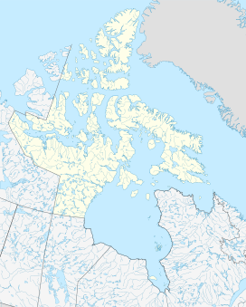
Ellesmere Island is Canada's northernmost and third largest island, and the tenth largest in the world. It comprises an area of 196,236 km2 (75,767 sq mi), slightly smaller than Great Britain, and the total length of the island is 830 km (520 mi).

Bryophytes are a group of land plants (embryophytes), sometimes treated as a taxonomic division, that contains three groups of non-vascular land plants: the liverworts, hornworts, and mosses. In the strict sense, the division Bryophyta consists of the mosses only. Bryophytes are characteristically limited in size and prefer moist habitats although some species can survive in drier environments. The bryophytes consist of about 20,000 plant species. Bryophytes produce enclosed reproductive structures, but they do not produce flowers or seeds. They reproduce sexually by spores and asexually by fragmentation or the production of gemmae.

Fram ("Forward") is a ship that was used in expeditions of the Arctic and Antarctic regions by the Norwegian explorers Fridtjof Nansen, Otto Sverdrup, Oscar Wisting, and Roald Amundsen between 1893 and 1912. It was designed and built by the Scottish-Norwegian shipwright Colin Archer for Fridtjof Nansen's 1893 Arctic expedition in which the plan was to freeze Fram into the Arctic ice sheet and float with it over the North Pole.

The Queen Elizabeth Islands are the northernmost cluster of islands in Canada's Arctic Archipelago, split between Nunavut and the Northwest Territories in Northern Canada. The Queen Elizabeth Islands contain approximately 14% of the global glacier and ice cap area. The southern islands are called the Parry Islands or Parry Archipelago.
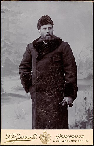
Otto Neumann Knoph Sverdrup was a Norwegian sailor and Arctic explorer.
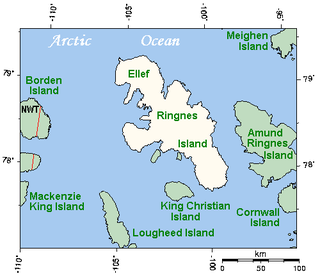
Ellef Ringnes Island is an uninhabited island and one of the Sverdrup Islands in the Qikiqtaaluk Region, Nunavut, Canada. A member of the Queen Elizabeth Islands and Arctic Archipelago, it is located in the Arctic Ocean, east of Borden Island, and west of Amund Ringnes Island. It has an area of 11,295 km2 (4,361 sq mi), making it the 69th largest island in the world and Canada's 16th largest island. Its highest mount is 260 m (850 ft).

Meighen Island is an uninhabited member of the Queen Elizabeth Islands, part of the Arctic Archipelago, in the Qikiqtaaluk Region of Nunavut, Canada.

Lincoln Sea is a body of water in the Arctic Ocean, stretching from Cape Columbia, Canada, in the west to Cape Morris Jesup, Greenland, in the east. The northern limit is defined as the great circle line between those two headlands. It is covered with sea ice throughout the year, the thickest sea ice in the Arctic Ocean, which can be up to 15 m (49 ft) thick. Water depths range from 100 m (330 ft) to 300 m (980 ft). Water and ice from Lincoln Sea empty into Robeson Channel, the northernmost part of Nares Strait, most of the time.

The Arctic Cordillera is a terrestrial ecozone in northern Canada characterized by a vast, deeply dissected chain of mountain ranges extending along the northeastern flank of the Canadian Arctic Archipelago from Ellesmere Island to the northeasternmost part of the Labrador Peninsula in northern Labrador and northern Quebec, Canada. It spans most of the eastern coast of Nunavut with high glaciated peaks rising through ice fields and some of Canada's largest ice caps, including the Penny Ice Cap on Baffin Island. It is bounded to the east by Baffin Bay, Davis Strait and the Labrador Sea while its northern portion is bounded by the Arctic Ocean.
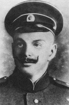
Georgy Lvovich Brusilov was a Russian naval officer of the Imperial Russian Navy and an Arctic explorer. His father, Lev Brusilov, was also a naval officer.
Hoved Island is part of the Qikiqtaaluk Region of the Canadian territory of Nunavut. The island is located between the Svendsen and Bjorne peninsulas, and within the Baumann Fiord of Ellesmere Island, considered part of the Queen Elizabeth Islands, in the Arctic Archipelago. It comprises an area of 158 km2 (61 sq mi).
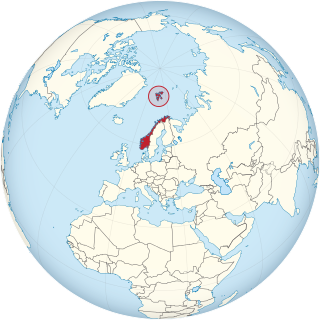
Operation Fritham was an Allied military operation during the Second World War to secure the coal mines on Spitsbergen, the main island of the Svalbard Archipelago, 650 mi (1,050 km) from the North Pole and about the same distance from Norway. The operation was intended to deny the islands to Nazi Germany.

Volcanism in Northern Canada has produced hundreds of volcanic areas and extensive lava formations across Northern Canada. The region's different volcano and lava types originate from different tectonic settings and types of volcanic eruptions, ranging from passive lava eruptions to violent explosive eruptions. Northern Canada has a record of very large volumes of magmatic rock called large igneous provinces. They are represented by deep-level plumbing systems consisting of giant dike swarms, sill provinces and layered intrusions.
Brae Bay is an Arctic waterway in the Qikiqtaaluk Region, Nunavut, Canada. It is located in Jones Sound by northern Devon Island, just north of the Devon Ice Cap and 12 km (7.5 mi) north of the Sverdrup Glacier (75°40′40″N83°16′20″W}.
Irene Bay is an Arctic waterway in the Qikiqtaaluk Region. Nunavut, Canada. It is located in Eureka Sound by western Ellesmere Island.
The Gretha Islands are an uninhabited island group located in the Qikiqtaaluk Region of Nunavut, Canada. They are situated in Eureka Sound at the confluence of Bay Fjord, north of Ellesmere Island's Raanes Peninsula, and east of Stor Island. They are members of the Sverdrup Islands group, Queen Elizabeth Islands, and the Arctic Archipelago.

Nansen's Fram expedition of 1893–1896 was an attempt by the Norwegian explorer Fridtjof Nansen to reach the geographical North Pole by harnessing the natural east–west current of the Arctic Ocean. In the face of much discouragement from other polar explorers, Nansen took his ship Fram to the New Siberian Islands in the eastern Arctic Ocean, froze her into the pack ice, and waited for the drift to carry her towards the pole. Impatient with the slow speed and erratic character of the drift, after 18 months Nansen and a chosen companion, Hjalmar Johansen, left the ship with a team of Samoyed dogs and sledges and made for the pole. They did not reach it, but they achieved a record Farthest North latitude of 86°13.6′N before a long retreat over ice and water to reach safety in Franz Josef Land. Meanwhile, Fram continued to drift westward, finally emerging in the North Atlantic Ocean.
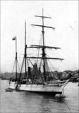
The Brusilov expedition was a Russian maritime expedition to the Arctic led by Captain Georgy Brusilov, which set out in 1912 to explore and map a route from the Atlantic Ocean to the Pacific via a northeast passage known as the Northern Sea Route. The expedition was ill-planned and ill-executed by Brusilov, and disappeared without a trace. Earlier searches were unsuccessful, and the fate of the ship and its crew is still not known.
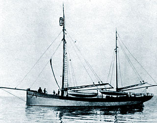
The Rusanov expedition, led by geologist Vladimir Rusanov, was a 1912 Russian expedition to the Arctic, with an initial objective of establishing mineral claims on Spitsbergen. Following completion of its official programme, Rusanov expanded the expedition's scope to include an investigation of the Northeast Passage, though it remains unclear exactly which route he proposed to take. Rusanov's ship Hercules reached Novaya Zemlya in August 1912, where he sent a message that he was continuing east; this was the last ever heard of the expedition and its 11 personnel.

Sverdrup's Fram expedition (1898–1902) took place in the Canadian Arctic Archipelago under Otto Sverdrup. The expedition ship Fram was modernized to increase cargo capacity and to accommodate a crew of 16. Originally, the expedition was planned for the northern coast of Greenland, but weather and ice conditions prevented the realization of this plan, so Sverdrup decided to explore the southern part of Ellesmere Island. The Norwegian team discovered Sverdrup islands and completed the mapping of the southern part of Ellesmere Island and the northern part of Devon Island. In total, approximately 260,000 km2 (100,000 sq mi) of islands were surveyed and mapped. Due to severe ice conditions, the fourth —unplanned— winter campaign took place in 1901–1902. Extreme weather conditions and uncertain plans led to the loss of two men in 1899.
