
Qiajivik Mountain is a mountain in Qikiqtaaluk, Nunavut, Canada. Located in northeastern Baffin Island, it is part of the Baffin Mountains. At 1,965 m (6,447 ft) Qiajivik is the highest mountain in northern Baffin Island and with a topographic prominence of 1,787 m (5,863 ft) it is one of Canada's 142 ultra-prominent peaks.

Mount Odin is a mountain in Qikiqtaaluk, Nunavut, Canada. It is located in Auyuittuq National Park along the Akshayuk Pass, 46 km (29 mi) north of Pangnirtung and south of Mount Asgard. Mount Odin is the highest mountain on Baffin Island.
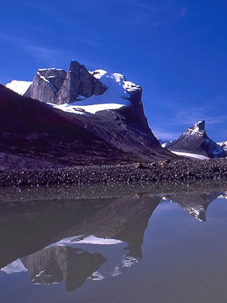
The Bruce Mountains are a small mountain range on the northeast coast of Baffin Island, Nunavut, Canada. It is a subrange of the Baffin Mountains which in turn form part of the Arctic Cordillera mountain range.
The Precipitous Mountains are a mountain range on northern Baffin Island, Nunavut, Canada. It lies in, or near, Sirmilik National Park and is a subrange of the Arctic Cordillera.

The Everett Mountains are a mountain range located at Frobisher Bay on southern Baffin Island, Nunavut, Canada. Nunavut's capital city Iqaluit is protected by the Everett Mountains. The mountain range is a subrange of the Arctic Cordillera.
The Hartz Mountains are a mountain range on Baffin Island, Nunavut, Canada. It is located in Sirmilik National Park which is Baffin Island's northernmost national park. It makes up part of the Arctic Cordillera mountain system.
The Krag Mountains are a mountain range on northern Baffin Island, Nunavut, Canada. It is part of a much larger mountain range called the Baffin Mountains which in turn form part of the Arctic Cordillera mountain system.
Angilaaq Mountain is a mountain in Qikiqtaaluk Region, Nunavut, Canada. It is located 62 km (39 mi) north of Pond Inlet. It is the highest mountain on Bylot Island and lies in the Byam Martin Mountains, which is a northern extension of the Baffin Mountains.
Breidablik Peak is a mountain on Baffin Island, located 51 km (32 mi) northeast of Pangnirtung, Nunavut, Canada. It lies in the southern Baffin Mountains which in turn form part of the Arctic Cordillera mountain system. Like Mounts Odin and Asgard and other peaks in the Arctic Cordillera, its name comes from Norse mythology. It is named after Breidablik, the home of Baldr.
Mount Baldr is a mountain on Baffin Island, located 49 km (30 mi) northeast of Pangnirtung, Nunavut, Canada. It lies in the southern Baffin Mountains, which in turn form part of the Arctic Cordillera mountain system. Like nearby Breidablik Peak and Mount Odin and other peaks in the Arctic Cordillera, its name comes from Norse mythology. It is named after Baldr, a god in Germanic paganism and is Odin's second son.

Akshayuk Pass formerly Pangnirtung Pass is a mountain pass in the Baffin Mountains of Nunavut, Canada. It is found within Auyuittuq National Park. To the southwest is Mount Thor, about 17 km (11 mi), and Pangnirtung, about 64 km (40 mi) and to the northeast is Qikiqtarjuaq, about 109 km (68 mi).

Midnight Sun Peak is a mountain in the Baffin Mountains, Baffin Island, Nunavut, Canada. It is part of the Auyuittuq National Park area with an elevation of 1,967 m (6,453 ft).
Kisimngiuqtuq Peak is a mountain in Qikiqtaaluk, Nunavut, Canada. It is associated with the Baffin Mountains on Baffin Island. It is the tenth highest peak in Nunavut and the eleventh highest peak in Nunavut by topographic prominence.
Ukpik Peak is a mountain associated with the Baffin Mountains on Baffin Island, Nunavut, Canada.
Mount Nukap is a mountain associated with the Baffin Mountains on Baffin Island, Nunavut, Canada.
Bastille Peak is a mountain located 74 km (46 mi) north of Pangnirtung, Baffin Island, Nunavut, Canada. It is associated with the Baffin Mountains which in turn form part of the Arctic Cordillera mountain system.
Mount Thule is a mountain on Bylot Island, Nunavut, Canada. It is located 38 km (24 mi) north of Pond Inlet on Baffin Island. It is associated with the Baffin Mountains which in turn form part of the Arctic Cordillera mountain system. The area around Mount Thule is permanently covered in ice and snow.

Adams Island is an uninhabited island in the Qikiqtaaluk Region of Nunavut, Canada. The island is located in Baffin Bay off the northeastern coast of Baffin Island in the Arctic Archipelago. Nearby are Dexterity Island (northeast), Dexterity Fiord and Baffin Island (east), Tromso Fiord (south), Paterson Inlet (west), Bergesen Island (northwest), and Isbjorn Strait (north).
Clyde River is a waterway on the eastern coast of Baffin Island in the Qikiqtaaluk Region of Nunavut, Canada.
