Douro Range

Last updated
Douro Range
Highest point
Coordinates 76°20′05″N92°44′02″W / 76.33472°N 92.73389°W / 76.33472; -92.73389 Coordinates: 76°20′05″N92°44′02″W / 76.33472°N 92.73389°W / 76.33472; -92.73389
Geography
Country Canada
State/Province Nunavut
Parent range Arctic Cordillera

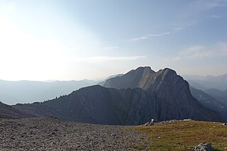
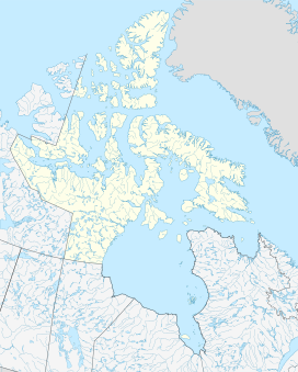
The Douro Range is a small mountain range on northwestern Devon Island, Nunavut, Canada. It is one of the northernmost mountain ranges in the world which in turn form part of the Arctic Cordillera mountain system. [1]

Mountain range A geographic area containing several geologically related mountains

A mountain range or hill range is a series of mountains or hills ranged in a line and connected by high ground. A mountain system or mountain belt is a group of mountain ranges with similarity in form, structure, and alignment that have arisen from the same cause, usually an orogeny. Mountain ranges are formed by a variety of geological processes, but most of the significant ones on Earth are the result of plate tectonics. Mountain ranges are also found on many planetary mass objects in the Solar System and are likely a feature of most terrestrial planets.

Devon Island Island in Baffin Bay, Qikiqtaaluk Region, Nunavut, Canada

Devon Island is an island in Canada and the largest uninhabited island on Earth. It is located in Baffin Bay, Qikiqtaaluk Region, Nunavut, Canada. It is one of the larger members of the Canadian Arctic Archipelago, the second-largest of the Queen Elizabeth Islands, Canada's sixth-largest island, and the 27th-largest island in the world. It comprises 55,247 km2 (21,331 sq mi) of Precambrian gneiss and Paleozoic siltstones and shales. The highest point is the Devon Ice Cap at 1,920 m (6,300 ft) which is part of the Arctic Cordillera. Devon Island contains several small mountain ranges, such as the Treuter Mountains, Haddington Range and the Cunningham Mountains. The notable similarity of its surface to that of Mars has attracted interest from scientists.

Nunavut Territory of Canada

Nunavut is the newest, largest, and most northerly territory of Canada. It was separated officially from the Northwest Territories on April 1, 1999, via the Nunavut Act and the Nunavut Land Claims Agreement Act, though the boundaries had been drawn in 1993. The creation of Nunavut resulted in the first major change to Canada's political map since the incorporation of the province of Newfoundland in 1949.

See also

Related Research Articles

Rocky Mountains mountain range in North America

The Rocky Mountains, also known as the Rockies, are a major mountain range in western North America. The Rocky Mountains stretch more than 4,800 kilometers (3,000 mi) from the northernmost part of British Columbia, in western Canada, to New Mexico in the Southwestern United States. Located within the North American Cordillera, the Rockies are somewhat distinct from the Pacific Coast Ranges, Cascade Range, and the Sierra Nevada, which all lie farther to the west.

Douro river in Spain and Portugal

The Douro is one of the major rivers of the Iberian Peninsula, flowing from its source near Duruelo de la Sierra in Soria Province across northern-central Spain and Portugal to its outlet at Porto.

Cascade Range mountain range in western North America

The Cascade Range or Cascades is a major mountain range of western North America, extending from southern British Columbia through Washington and Oregon to Northern California. It includes both non-volcanic mountains, such as the North Cascades, and the notable volcanoes known as the High Cascades. The small part of the range in British Columbia is referred to as the Canadian Cascades or, locally, as the Cascade Mountains. The latter term is also sometimes used by Washington residents to refer to the Washington section of the Cascades in addition to North Cascades, the more usual U.S. term, as in North Cascades National Park. The highest peak in the range is Mount Rainier in Washington at 14,411 feet (4,392 m).

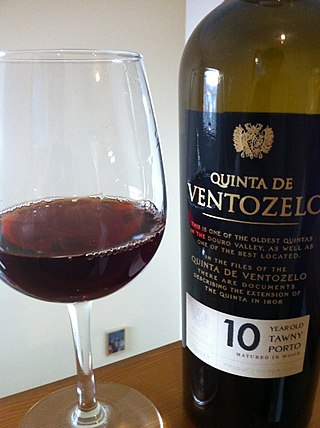
Port wine Portuguese fortified wine

Port wine is a Portuguese fortified wine produced with distilled grape spirits exclusively in the Douro Valley in the northern provinces of Portugal. It is typically a sweet, red wine, often served as a dessert wine, though it also comes in dry, semi-dry, and white varieties. Fortified wines in the style of port are also produced outside Portugal, including in Australia, France, South Africa, Canada, India, Argentina, Spain, and the United States. Under European Union Protected Designation of Origin guidelines, only the product from Portugal may be labelled as port or Porto. In the United States, wines labelled "port" may come from anywhere in the world, while the names "Oporto", "Porto", and "Vinho do Porto" have been recognized as foreign, non-generic names for port wines originating in Portugal.

Trás-os-Montes e Alto Douro Province province

Trás-os-Montes e Alto Douro is a historical province of Portugal located in the northeastern corner of the country. Vast plateaus, river valleys, mountains, and castles abound in Trás os Montes e Alto Douro.

Canadian Rockies mountain range in Canada

The Canadian Rockies or Canadian Rocky Mountains comprise the Canadian segment of the North American Rocky Mountains. They are the eastern part of the Canadian Cordillera, which is a system of multiple ranges of mountains which runs from the Canadian Prairies to the Pacific Coast. The Canadian Rockies mountain system comprises the southeastern part of this system, lying between the Interior Plains of Alberta and Northeastern British Columbia on the east to the Rocky Mountain Trench of BC on the west. The southern end borders Idaho and Montana of the United States. In geographic terms the boundary is at the Canada/US border, but in geological terms it might be considered to be at Marias Pass in northern Montana. The northern end is at the Liard River in northern British Columbia.

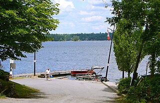
Douro-Dummer Township in Ontario, Canada

Douro-Dummer is a township in central-eastern Ontario, Canada, in Peterborough County along the Trent-Severn Waterway. It was formed on January 1, 1998, through the amalgamation of Douro and Dummer Townships.

Peterborough East was a federal electoral district represented in the House of Commons of Canada from 1867 to 1925. It was located in the province of Ontario. It was created by the British North America Act of 1867 which divided the County of Peterborough into two ridings.

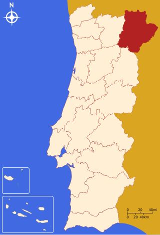
Guarda District District of Portugal

The district of Guarda is located in the Centro Region of Portugal, except Vila Nova de Foz Côa, which is in the Norte Region. The district capital and most populous city is Guarda.

Bragança District District of Portugal

Bragança District is a traditional political division of Portugal, in the northeast corner bordering on Spain, covering 7.4% of the nation's continental landmass. The capital of the district, Bragança, is 217 kilometres (135 mi) from Porto, the second largest town in Portugal, 107 kilometres (66 mi) from the Spanish town of Zamora and 169 kilometres (105 mi) from Salamanca, also in Spain. Bragança is administratively divided in twelve municipalities and 299 parishes located in the north-eastern part of Trás-os-Montes. As of the 2001 census, the total resident population was approximately 148,808. It is bordered by Spain in the north and northeast, Vila Real District in the east, Viseu District in the southwest and Guarda District in the south.

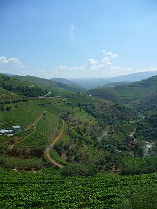
Douro DOC Portuguese wine

Douro is a Portuguese wine region centered on the Douro River in the Trás-os-Montes e Alto Douro region. It is sometimes referred to as the Alto Douro, as it is located some distance upstream from Porto, sheltered by mountain ranges from coastal influence. The region has Portugal's highest wine classification as a Denominação de Origem Controlada (DOC). While the region is associated primarily with Port wine production, the Douro produces just as much table wine as it does fortified wine. The non-fortified wines are typically referred to as "Douro wines".

The Victoria Cross Ranges are a set of mountain ranges in the Canadian Rockies, located to the northwest of Jasper. Of the 19 peaks contained within this range, five are named after Canadian recipients of the Victoria Cross. The area of the ranges is 678 square kilometers.

Balsemão River river in Portugal

The Rio Balsemão is a small stream that originates in the mountain range of Serra de Montemuro. It passes through narrow canyons before it reaches the major city Lamego.

Marco de Canaveses Municipality in Norte, Portugal

Marco de Canaveses is a city and municipality of the Porto district, in northern Portugal. The population in 2011 was 53,450, in an area of 201.89 km². The city itself had a population of 9,042 in 2001.

Palliser Range mountain in Canada

The Palliser Range is a mountain range of the Canadian Rockies that lies in the extreme southeast corner of Banff National Park.

Geography of Póvoa de Varzim

Póvoa de Varzim, with an area of 82.06 square kilometres, lies between the Cávado and Ave Rivers, or, from a wider perspective, halfway between the Minho and Douro Rivers on the northern coast of Portugal. Although in administrative reforms of 1936, the city was integrated in Douro Litoral, the case for such an administrative integration is arguable, because Póvoa de Varzim is found in a transition region. It has characteristic Minho traditions, historical and demographic bounds with several towns and villages in the region, religiously it is part of Braga archdiocese, and due to that it is perhaps preferable to recognize Póvoa as part of the old region, favouring more Entre-Douro-e-Minho, given its central geographic position in this region.

Arctic Cordillera mountain range

The Arctic Cordillera is a vast, deeply dissected chain of mountain ranges extending along the northeastern flank of the Canadian Arctic Archipelago from Ellesmere Island to the northeasternmost part of the Labrador Peninsula in northern Labrador and northern Quebec, Canada. It spans most of the eastern coast of Nunavut with high glaciated peaks rising through icefields and some of Canada's largest ice caps, including the Penny Ice Cap on Baffin Island. It is bounded to the east by Baffin Bay, Davis Strait and the Labrador Sea while its northern portion is bounded by the Arctic Ocean.

Sistema Ibérico mountain range

The Iberian System, is one of the major systems of mountain ranges in Spain. It consists of a vast and complex area of mostly relatively high and rugged mountain chains and massifs located in the central region of the Iberian Peninsula, but reaching almost the Mediterranean coast in the Valencian Country in the east.

References