Related Research Articles

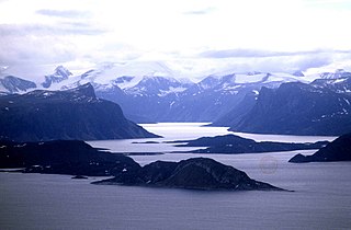
Ellesmere Island is part of the Qikiqtaaluk Region in the Canadian territory of Nunavut. Lying within the Arctic Archipelago, it is considered part of the Queen Elizabeth Islands, with Cape Columbia being the most northerly point of land in Canada. It comprises an area of 196,235 km2 (75,767 sq mi) and the total length of the island is 830 km (520 mi), making it the world's tenth largest island and Canada's third largest island. The Arctic Cordillera mountain system covers much of Ellesmere Island, making it the most mountainous in the Arctic Archipelago. The Arctic willow is the only woody species to grow on Ellesmere Island.

The Queen Elizabeth Islands are the northernmost cluster of islands in Canada's Arctic Archipelago, split between Nunavut and the Northwest Territories in Northern Canada. The Queen Elizabeth Islands contain approximately 14% of the global glacier and ice cap area..

Axel Heiberg Island is an island in the Qikiqtaaluk Region, Nunavut, Canada. Located in the Arctic Ocean, it is the 32nd largest island in the world and Canada's seventh largest island. According to Statistics Canada, it has an area of 43,178 km2 (16,671 sq mi). It is named after Axel Heiberg.

The British Empire Range is a mountain range on Ellesmere Island in Nunavut, Canada. The range is one of the most northern ranges in the world and the Arctic Cordillera, surpassed only by the Challenger Mountains which lies immediately to the northwest and the United States Range slightly further east. The highest mountain in the range is Barbeau Peak.

Kane Basin is an Arctic waterway lying between Greenland and Canada's northernmost island, Ellesmere Island. It links Smith Sound to Kennedy Channel and forms part of Nares Strait. It is approximately 180 kilometres in length and 130 km at its widest.

Lake Hazen is often called the northernmost lake of Canada, in the northern part of Ellesmere Island, Nunavut, but detailed maps show several smaller lakes up to more than 100 km (62 mi) farther north on Canada's northernmost island. Turnabout Lake is immediately northeast of the northern end of Hazen lake. Still further north are the Upper and Lower Dumbell Lakes, with Upper Dumbell Lake 5.2 km (3 mi) southwest of Alert, Canada's northernmost settlement on the coast of Lincoln Sea, Arctic Ocean.

Mount Oxford is located on Ellesmere Island, Nunavut, Canada and was named for the University of Oxford. The first known ascent was in 1935 by A. W. Moore and Nukapinguaq, a Greenland Inuit, during the Oxford University Ellesmere Land Expedition, when Moore estimated the height as 9,000 ft (2,743 m).
Gordon Noel Humphreys (1883–1966) was a British born surveyor, pilot, botanist, explorer and doctor. Originally trained as a surveyor, Humphreys worked in both Mexico and Uganda. During World War I he served as a pilot with the Royal Flying Corps, was shot down and spent his internment training himself in botany.
The Arctic Cordillera is a vast, deeply dissected chain of mountain ranges extending along the northeastern flank of the Canadian Arctic Archipelago from Ellesmere Island to the northeasternmost part of the Labrador Peninsula in northern Labrador and northern Quebec, Canada. It spans most of the eastern coast of Nunavut with high glaciated peaks rising through icefields and some of Canada's largest ice caps, including the Penny Ice Cap on Baffin Island. It is bounded to the east by Baffin Bay, Davis Strait and the Labrador Sea while its northern portion is bounded by the Arctic Ocean.
The Thorndike Peaks are a mountain range located south of the entrance to Makinson Inlet, on the east coast of Ellesmere Island, Nunavut, Canada. They are part of the Arctic Cordillera and are virtually unexplored. There are no trees or wildlife in the Thorndike Peaks because the mountains are north of the Arctic tree line and because of the harsh cold climate.
Parrish Glacier is a glacier on central Ellesmere Island, Nunavut, Canada.

Pim Island is located off the eastern coast of Ellesmere Island, part of the Qikiqtaaluk Region of the Canadian territory of Nunavut. Located within the Canadian Arctic Archipelago, it is a part of the Queen Elizabeth Islands.
Norman Lockyer Island is located off the eastern coast of Ellesmere Island, and a part of the Qikiqtaaluk Region of the Canadian territory of Nunavut. Situated in Princess Marie Bay just in front of Franklin Pierce Bay, north of Bache Peninsula, Norman Lockyer Island is within the Canadian Arctic Archipelago, a member of the Queen Elizabeth Islands.
The Cook Peninsula is located on the eastern coast of Ellesmere Island, a part of the Qikiqtaaluk Region of the Canadian territory of Nunavut. North of Princess Marie Bay, it stretches eastward into Nares Strait. The peninsula is approximately 64 square kilometres (25 sq mi) in size, and has two lowland areas frequented by muskox.
Princess Marie Bay is an Arctic waterway in Qikiqtaaluk Region, Nunavut, Canada. It is located in Nares Strait by eastern Ellesmere Island, and marks the southwestern edge of Cook Peninsula. It is also south of the Sven Hedin Glacier.
Sawyer Bay is an Arctic waterway in Qikiqtaaluk Region, Nunavut, Canada. It is located in Nares Strait by eastern Ellesmere Island. Benedict Glacier fills the head of the bay.
Rosse Bay is an Arctic waterway in Qikiqtaaluk Region, Nunavut, Canada. It is located in Nares Strait between Pim Island and Ellesmere Island's Johan Peninsula. The bay is also connected to Rice Strait.
The Glacier Strait is a natural waterway through the Canadian Arctic Archipelago within Qikiqtaaluk Region, Nunavut, Canada. It separates Ellesmere Island from Coburg Island. To the north-east it opens into Baffin Bay, and to the south-west into the Jones Sound.
David Haig-Thomas was a British ornithologist, explorer and rower who competed for Great Britain in the 1932 Summer Olympics. He was an army commando during the Second World War, and was killed in action during the Normandy Landings. Haig-Thomas Island in the Canadian Arctic is named after him.
The Oxford University Exploration Club was established in December 1927 by Edward Max Nicholson, Colin Trapnell and Charles Sutherland Elton.
References
- Nunavut Handbook, Iqaluit 2004, ISBN 0-9736754-0-3
- Noel Humphreys, Edward Shackleton and A. W. Moore: Oxford University Ellesmere Land expedition. In: Geogr. J. Vol. 37, 1936. pp. 385-441. (See p. 412.)
- Ernest Shackleton: Arctic Journeys - The Story of the Oxford University Ellesmere Land Expedition 1934–1935. Hodder and Stoughton Ltd., London 1937 and Farrar & Rinehart, New York 1938)