
Pond Inlet is a small, predominantly Inuit community in the Qikiqtaaluk Region of Nunavut, Canada, located on northern Baffin Island. To the Inuit the name of the place "is and always has been Mittimatalik." The Scottish explorer Sir John Ross had named an arm of the sea that separates Bylot Island from Baffin Island as Pond's Bay, and the hamlet now shares that name. On 29 August 1921, the Hudson's Bay Company opened its trading post near the Inuit camp and named it Pond Inlet, marking the expansion of its trading empire into the High Arctic.
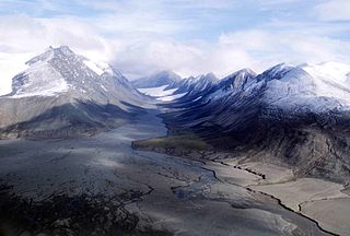
Quttinirpaaq National Park is located on the northeastern corner of Ellesmere Island in the Qikiqtaaluk Region of Nunavut, Canada. It is the second most northerly park on Earth after Northeast Greenland National Park. In Inuktitut, Quttinirpaaq means "top of the world". It was established as Ellesmere Island National Park Reserve in 1988, and the name was changed to Quttinirpaaq in 1999, when Nunavut was created, and became a national park in 2000. The reserve covers 37,775 km2 (14,585 sq mi), making it the second largest park in Canada, after Wood Buffalo National Park.
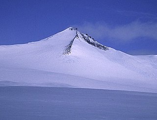
Barbeau Peak is a mountain in Qikiqtaaluk, Nunavut, Canada. Located on Ellesmere Island within Quttinirpaaq National Park, it is the highest mountain in Nunavut and the Canadian Arctic. The mountain was named in 1969 after Marius Barbeau, a Canadian anthropologist whose research into First Nations and Inuit cultures gained him international acclaim.

Eureka is a small research base on Fosheim Peninsula, Ellesmere Island, Qikiqtaaluk Region, in the Canadian territory of Nunavut. It is located on the north side of Slidre Fiord, which enters Eureka Sound farther west. It is the third-northernmost permanent research community in the world. The only two farther north are Alert, which is also on Ellesmere Island, and Nord, in Greenland. Eureka has the lowest average annual temperature and the lowest amount of precipitation of any weather station in Canada.
Bathurst Inlet, officially Kiluhiqtuq, is a deep inlet located along the northern coast of the Canadian mainland, at the east end of Coronation Gulf, into which the Burnside and Western rivers empty. The name, or its native equivalent Kingoak, is also used to identify the community of Bathurst Inlet located on the shore. Melville Sound opens into the eastern side of the inlet at Cape Croker, west of the Hurd Islands.

Canada is divided into six time zones. Most areas of the country's provinces and territories operate on standard time from the first Sunday in November to the second Sunday in March and daylight saving time the rest of the year.
Mount Oxford is located on Ellesmere Island, Nunavut, Canada and was named for the University of Oxford. The first known ascent was in 1935 by A. W. Moore and Nukapinguaq, a Greenland Inuit, during the Oxford University Ellesmere Land Expedition, when Moore estimated the height as 9,000 ft (2,743 m).
Mount Arthur is a mountain located on Ellesmere Island, Nunavut, Canada in the Quttinirpaaq National Park. First mapped by the Lady Franklin Bay Expedition, it was named for Chester A. Arthur the 21st President of the United States.
Mount Ayles is a mountain located on Ellesmere Island, Nunavut, Canada. It forms part of the border of the Quttinirpaaq National Park. Like the nearby Ayles Ice Shelf, the mountain was named by the Geological Survey of Canada in 1965 for Adam Ayles, a petty officer on-board HMS Alert, who was serving in the British Arctic Expedition under George Nares.

The Arctic Cordillera is a terrestrial ecozone in northern Canada characterized by a vast, deeply dissected chain of mountain ranges extending along the northeastern flank of the Canadian Arctic Archipelago from Ellesmere Island to the northeasternmost part of the Labrador Peninsula in northern Labrador and northern Quebec, Canada. It spans most of the eastern coast of Nunavut with high glaciated peaks rising through ice fields and some of Canada's largest ice caps, including the Penny Ice Cap on Baffin Island. It is bounded to the east by Baffin Bay, Davis Strait and the Labrador Sea while its northern portion is bounded by the Arctic Ocean.

The Baffin Mountains are a mountain range running along the northeastern coast of Baffin Island and Bylot Island, Nunavut, Canada. The ice-capped mountains are part of the Arctic Cordillera and have some of the highest peaks of eastern North America, reaching a height of 1,525–2,146 metres (5,003–7,041 ft) above sea level. While they are separated by bodies of water to make Baffin Island, they are closely related to the other mountain ranges that make the much larger Arctic Cordillera mountain range.

Mount Odin is a mountain in Qikiqtaaluk, Nunavut, Canada. It is located in Auyuittuq National Park along the Akshayuk Pass, 46 km (29 mi) north of Pangnirtung and south of Mount Asgard. Mount Odin is the highest mountain on Baffin Island.

The Challenger Mountains are a mountain range on Ellesmere Island in Nunavut, Canada. The range is the most northern range in the world and of the Arctic Cordillera. The highest mountain in the range is Commonwealth Mountain 2,225 m (7,300 ft). The United States Range is immediately to the east of the Challenger Mountains.
The Hartz Mountains are a mountain range on Baffin Island, Nunavut, Canada. It is located in Sirmilik National Park which is Baffin Island's northernmost national park. It makes up part of the Arctic Cordillera mountain system.

The following outline is provided as an overview of and topical guide to Canada:
Akshayuk Pass formerly Pangnirtung Pass is a mountain pass in the Baffin Mountains of Nunavut, Canada. It is found within Auyuittuq National Park. To the southwest is Mount Thor, about 17 km (11 mi), and Pangnirtung, about 64 km (40 mi) and to the northeast is Qikiqtarjuaq, about 109 km (68 mi).

Midnight Sun Peak is a mountain in the Baffin Mountains, Baffin Island, Nunavut, Canada. It is part of the Auyuittuq National Park area with an elevation of 1,967 m (6,453 ft).
Mount Thule is a mountain on Bylot Island, Nunavut, Canada. It is located 38 km (24 mi) north of Pond Inlet on Baffin Island. It is associated with the Baffin Mountains which in turn form part of the Arctic Cordillera mountain system. The area around Mount Thule is permanently covered in ice and snow.

Mallik Island is one of the uninhabited Canadian arctic islands of Qikiqtaaluk Region, Nunavut, Canada. It is located in Hudson Strait between Baffin Island's Foxe Peninsula and Dorset Island. Mallik Island and Dorset Island are joined by sand and boulders. Cape Dorset, an Inuit hamlet, is approximately 4.5 km (2.8 mi) away.
