Albuquerque, also known as ABQ, Burque, and the Duke City, is the most populous city in the U.S. state of New Mexico. Founded in 1706 as La Villa de Alburquerque by Santa Fe de Nuevo México governor Francisco Cuervo y Valdés, and named in honor of Francisco Fernández de la Cueva, 10th Duke of Alburquerque and Viceroy of New Spain, it served as an outpost on El Camino Real linking Mexico City to the northernmost territories of New Spain.
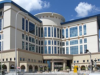
Bernalillo County is the most populous county in the U.S. state of New Mexico. As of the 2020 census, the population was 676,444. The county seat, Albuquerque, is the most populous city in New Mexico.
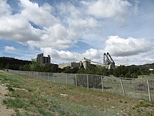
Tijeras is a village in Bernalillo County, New Mexico, United States. The population was 541 at the 2010 census. It is part of the Albuquerque metropolitan area.

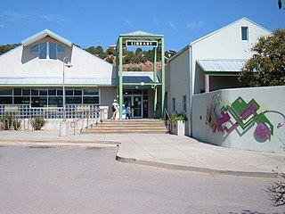
Edgewood is a town in Santa Fe County, New Mexico, United States. Through annexations, its town boundaries now extend into Bernalillo and Sandoval counties. It is part of the Albuquerque–Santa Fe–Las Vegas combined statistical area.
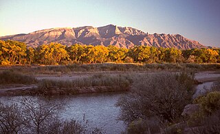
The Sandia Mountains are a mountain range located in Bernalillo and Sandoval counties, immediately to the east of the city of Albuquerque in New Mexico in the southwestern United States. The mountains are just due south of the southern terminus of the Rocky Mountains, and are part of the Sandia–Manzano Mountains. This is largely within the Cibola National Forest and protected as the Sandia Mountain Wilderness. The highest point is Sandia Crest, 10,678 feet (3,255 m).
Sandia Base was the principal nuclear weapons installation of the United States Department of Defense from 1946 to 1971. It was located on the southeastern edge of Albuquerque, New Mexico. For 25 years, the top-secret Sandia Base and its subsidiary installation, Manzano Base, carried on the atomic weapons research, development, design, testing, and training commenced by the Manhattan Project during World War II. Fabrication, assembly, and storage of nuclear weapons was also done at Sandia Base. The base played a key role in the United States nuclear deterrence capability during the Cold War. In 1971 it was merged into Kirtland Air Force Base.
New Mexico State Road 14 (NM 14) is an approximately 54-mile-long (87 km) state road located in northern New Mexico. The highway connects Albuquerque to Santa Fe and comprises most of the Turquoise Trail, a National Scenic Byway which also includes NM 536.

Sandia Pueblo is a federally recognized tribe of Native American Pueblo people inhabiting a 101-square-kilometre (40 sq mi) reservation of the same name in the eastern Rio Grande Rift of central New Mexico. It is one of 19 of New Mexico's Native American pueblos, considered one of the state's Eastern Pueblos. The population was 427 as of the 2010 census. The people are traditionally Tiwa speakers, a language of the Tanoan group, although retention of the traditional language has waned with later generations. They have a tribal government that operates Sandia Casino, Bien Mur Indian Market Center, and Sandia Lakes Recreation Area, as well as representing the will of the Pueblo in business and political matters.

TWA Flight 260 was the Trans World Airlines (TWA) designation for a flight from Albuquerque, New Mexico to Santa Fe, New Mexico. On February 19, 1955, the 40-passenger Martin 4-0-4 prop plane used by TWA for that route crashed into the Sandia Mountains. Its deviation from the normal flight path, initially believed to be the result of pilot error, was revised to "unknown" given that the contribution of other factors could not be definitively ruled out.

Sandia Crest, also known locally as Sandia Peak or simply as the Crest, is a mountain ridge that, at 10,679 feet (3,255 m), is the highpoint of the Sandia–Manzano Mountains, and is located in the Sandia Mountains of Bernalillo County, New Mexico, United States. Instead of a true summit or topographic peak, this range climbs to a long ridge line. To the east, the range slopes down from the Crest and merges into the plains below. On the west side of the Crest is a cliff; the range dramatically drops over 4,000 feet in elevation over 2 miles of horizontal distance to the Rio Grande Valley and city of Albuquerque below. It is within the Sandia Ranger District of the Cibola National Forest. The Crest features a viewing area with a shop and visitor center, telecommunications transmitters, the popular La Luz Trail, the Sandia Mountain Wilderness, and the summit of Sandia Peak Ski Area and the Sandia Peak Tramway, which is the longest aerial tramway in the Americas.

The historic U.S. Route 66 ran east–west across the central part of the state of New Mexico, along the path now taken by Interstate 40 (I-40). However, until 1937, it took a longer route via Los Lunas, Albuquerque, and Santa Fe, now roughly New Mexico State Road 6 (NM 6), I-25, and US 84. Large portions of the old road parallel to I-40 have been designated NM 117, NM 118, NM 122, NM 124, NM 333, three separate loops of I-40 Business, and state-maintained frontage roads.
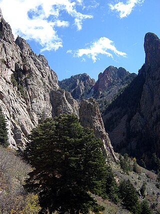
The La Luz Trail is a popular hiking trail located on the west face of the Sandia Mountains near Albuquerque, New Mexico. The trail begins at the La Luz Trailhead and proceeds approximately eight miles to either Sandia Crest or the Sandia Peak Tramway. The hike is strenuous, with 3,775 ft (1,151 m) of elevation gain and a grade of 12%. The trail allows hikers to view the flora and fauna of four climatic "life zones" and the granite cliffs and spires native to the west face of the Sandia Mountains. It also offers excellent views of Albuquerque, the cinder cones of the Albuquerque Volcanoes, and Mount Taylor. The La Luz Trail is also home to the La Luz Trail Run.

The Manzano Mountains are a small mountain range in the central part of the U.S. state of New Mexico. They are oriented north–south and are 30 miles long. The center of the range lies due east of the town of Belen. The name "Manzano" is Spanish for "apple tree"; the mountains were named for apple orchards planted at the nearby town of Manzano.

The Albuquerque–Santa Fe–Las Vegas combined statistical area is made up of eight counties in north central New Mexico. The combined statistical area consists of the Albuquerque and Santa Fe metropolitan statistical areas, and the Las Vegas, Los Alamos, and Española micropolitan statistical areas. The 2013 delineations included the Grants micropolitan statistical area, but it was removed in the 2018 revisions. As of the 2020 census, the CSA had a population of 1,162,523. Roughly 56% of New Mexico's residents live in this area. Prior to the 2013 redefinitions, the CSA consisted only of the Santa Fe metropolitan statistical area and the Española micropolitan statistical area. The total land area of the Albuquerque–Santa Fe–Las Vegas combined statistical area in the 2013 definition is 26,421 sq mi (68,430 km2).

The Albuquerque Metropolitan Statistical Area, sometimes referred to as Tiguex, is a metropolitan area in central New Mexico centered on the city of Albuquerque. The metro comprises four counties: Bernalillo, Sandoval, Torrance, and Valencia. As of the 2010 United States Census, the MSA had a population of 887,077. The population is estimated to be 923,630 as of July 1, 2020, making Greater Albuquerque the 61st-largest MSA in the nation. The Albuquerque MSA forms a part of the larger Albuquerque–Santa Fe–Las Vegas combined statistical area with a 2020 estimated population of 1,165,181, ranked 49th-largest in the country.

Interstate 40 (I-40), a major east–west route of the Interstate Highway System, runs east–west through Albuquerque in the US state of New Mexico. It is the direct replacement for the historic U.S. Highway 66 (US 66).

Interstate 25 (I-25) in the US state of New Mexico follows the north–south corridor through Albuquerque and Santa Fe. It replaced U.S. Route 85 (US 85), which is no longer signed, but still exists in route logs sharing most of the I-25 alignment. I-25 starts in New Mexico at an interchange with I-10 in Las Cruces and extends roughly 460 miles (740 km) before reaching Colorado. I-25 passes through principally rural land through central New Mexico and passes through or near the cities of Las Cruces, Truth or Consequences, Socorro, Belen, Albuquerque, Santa Fe, Las Vegas, and Raton.
Central Avenue is a major east–west street in Albuquerque, New Mexico, which historically served as the city's main thoroughfare and principal axis of development. It runs through many of Albuquerque's oldest neighborhoods, including Downtown, Old Town, Nob Hill, and the University of New Mexico area. Central Avenue was part of U.S. Route 66 from 1937 until the highway's decommissioning in 1985 and also forms one axis of Albuquerque's house numbering system. It was also signed as Business Loop 40 until the early 1990s when ownership of Central Avenue was transferred from the New Mexico State Highway Department to the City of Albuquerque.
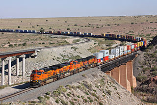
Abo Canyon, also known as Abo Pass, is a mountain pass at the southern end of the Manzano Mountains of central New Mexico in the Southwest United States.

U.S. Route 366 or US 366 was the designation of two child routes of the former U.S. Route 66 in New Mexico and Texas during the late 1920s and 1930s. Both alignments of US 366 were original U.S. Routes created in 1927. The first alignment was a route from El Paso, Texas to Amarillo, Texas crossing through New Mexico that existed until 1932. The second was a route from Albuquerque to Willard that was previously designated U.S. Route 470 before 1932. That alignment was canceled in 1939.