United States Post Office (Cooper Station)

Last updated
United States Post Office
Cooper Station
United States Post Office Cooper Station.jpg
(2023)
Location map Lower Manhattan.png
Red pog.svg
USA New York location map.svg
Red pog.svg
Usa edcp location map.svg
Red pog.svg
Location93 4th Avenue
Manhattan, New York City
Coordinates 40°43′55″N73°59′24″W / 40.73194°N 73.99000°W / 40.73194; -73.99000
Built1937 [1]
Architect William Dewey Foster
Architectural style Art Moderne [1]
MPS US Post Offices in New York State, 1858-1943, TR
NRHP reference No. 88002360
NYSRHP No.06101.001781
Significant dates
Added to NRHPMay 11, 1989 [2]
Designated NYSRHPMay 11, 1989

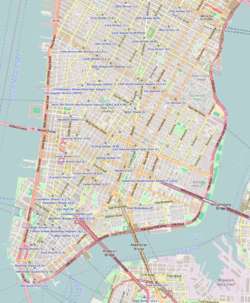
The United States Post Office Cooper Station, located at 93 Fourth Avenue, on the corner of East 11th Street in Manhattan, New York City, was built in 1937, and was designed by consulting architect William Dewey Foster in the Art Moderne style for the Office of the Supervising Architect of the United States Department of the Treasury. It serves the 10003 ZIP code, which covers the neighborhood of the East Village. Its sub-station is located on East 3rd Street near Avenue C.

Contents

Digital photo of the Cooper Station postmark on a letter sent by East-Village-based poet W. H. Auden in 1965 W. H. Auden, Cooper Station Postmark, 1965-12-07.jpg
Digital photo of the Cooper Station postmark on a letter sent by East-Village-based poet W. H. Auden in 1965

The post office is named in honor of Peter Cooper, the mid-19th century industrialist and philanthropist who founded the nearby The Cooper Union for the Advancement of Science and Art.

The building was listed on the National Register of Historic Places in 1989. [2]

The fictional character Newman from the television sitcom Seinfeld supposedly worked here. A photo of the building was frequently used as an establishing shot for scenes involving him.

Related Research Articles

<span class="mw-page-title-main">Greenwich Village</span> Neighborhood of Manhattan in New York City

Greenwich Village, or simply the Village, is a neighborhood on the west side of Lower Manhattan in New York City, bounded by 14th Street to the north, Broadway to the east, Houston Street to the south, and the Hudson River to the west. Greenwich Village also contains several subsections, including the West Village west of Seventh Avenue and the Meatpacking District in the northwest corner of Greenwich Village.

<span class="mw-page-title-main">Wappingers Falls, New York</span> Village in New York, United States

Wappingers Falls is a village in the towns of Poughkeepsie and Wappinger, in Dutchess County, New York, United States. As of the 2010 census it had a population of 5,522. The community was named for the cascade in Wappinger Creek. The Wappingers Falls post office covers areas in the towns of Wappinger, Poughkeepsie, Fishkill, East Fishkill, and LaGrange. This can result in some confusion when residents of the outlying towns, who do not live in the village, give their address as "Wappingers Falls".

<span class="mw-page-title-main">Cooperstown, New York</span> Village in New York, United States

Cooperstown is a village in and the county seat of Otsego County, New York, United States. Most of the village lies within the town of Otsego, but some of the eastern part is in the town of Middlefield. Located at the foot of Otsego Lake in the Central New York Region, Cooperstown is approximately 60 miles west of Albany, 67 mi (108 km) southeast of Syracuse and 145 mi (233 km) northwest of New York City. The population of the village was 1,794 as of the 2020 census.

<span class="mw-page-title-main">Chelsea, Manhattan</span> Neighborhood in New York City

Chelsea is a neighborhood on the West Side of the borough of Manhattan in New York City. The area's boundaries are roughly 14th Street to the south, the Hudson River and West Street to the west, and Sixth Avenue to the east, with its northern boundary variously described as near the upper 20s or 34th Street, the next major crosstown street to the north. To the northwest of Chelsea is the neighborhood of Hell's Kitchen, as well as Hudson Yards; to the northeast are the Garment District and the remainder of Midtown South; to the east are NoMad and the Flatiron District; to the southwest is the Meatpacking District; and to the south and southeast are the West Village and the remainder of Greenwich Village. Chelsea was named for an estate in the area, which in turn was named for the Royal Hospital Chelsea in London.

<span class="mw-page-title-main">Astor Place</span> Street in Manhattan, New York

Astor Place is a street in NoHo/East Village, in the lower part of the New York City borough of Manhattan. It is divided into two sections: One segment runs from Broadway in the west to Lafayette Street, and the other runs from Fourth to Third Avenues. The street encompasses two plazas at the intersection with Cooper Square, Lafayette Street, Fourth Avenue, and Eighth Street – Alamo Plaza and Astor Place Station Plaza. "Astor Place" is also sometimes used for the neighborhood around the street. It was named for John Jacob Astor, soon after his death in 1848. A $21 million reconstruction to implement a redesign of Astor Place began in 2013 and was completed in 2016.

<span class="mw-page-title-main">James A. Farley Building</span> Historic post office in Manhattan, New York

The James A. Farley Building is a mixed-use structure in Midtown Manhattan, New York City, which formerly served as the city's main United States Postal Service (USPS) branch. Designed by McKim, Mead & White in the Beaux-Arts style, the structure was built between 1911 and 1914, with an annex constructed between 1932 and 1935. The Farley Building, at 421 Eighth Avenue between 31st Street and 33rd Street in Midtown Manhattan, faces Pennsylvania Station and Madison Square Garden to the east.

<span class="mw-page-title-main">Hudson Yards, Manhattan</span> Neighborhood in New York City

Hudson Yards is a neighborhood on the West Side of Midtown Manhattan in New York City, bounded roughly by 30th Street in the south, 41st Street in the north, the West Side Highway in the west, and Eighth Avenue in the east. The area is the site of a large-scale redevelopment program that is being planned, funded, and constructed under a set of agreements among the State of New York, City of New York, and Metropolitan Transportation Authority (MTA), with the aim of expanding the Midtown Manhattan business district westward to the Hudson River. The program includes a major rezoning of the Far West Side, an extension of the New York City Subway's 7 and <7>​ trains to a new subway station at 34th Street and 11th Avenue, a renovation and expansion of the Javits Center, and a financing plan to fund the various components. The various components are being planned by New York City Department of City Planning and New York City Economic Development Corporation.

<span class="mw-page-title-main">Hudson Heights, Manhattan</span> Neighborhood in New York City

Hudson Heights is a residential neighborhood within Washington Heights in Upper Manhattan, New York City. Most residences are apartment buildings, many of which are cooperatives, and most were constructed in the 1920s through 1940s. The Art Deco style is prominent, along with Tudor Revival. Notable complexes include Hudson View Gardens and Castle Village, which were both developed by Dr. Charles V. Paterno, and were designed by George F. Pelham and his son, George F. Pelham, Jr., respectively.

<span class="mw-page-title-main">West Village</span> Neighborhood of Manhattan in New York City

The West Village is a neighborhood in the western section of the larger Greenwich Village neighborhood of Lower Manhattan, New York City. The West Village is bounded by the Hudson River to the west and 14th Street to the north. The eastern boundary is variously cited as Greenwich Avenue, Seventh Avenue, or Sixth Avenue, while the southern boundary is either Houston Street or Christopher Street.

<span class="mw-page-title-main">United States Post Office (Beacon, New York)</span> United States historic place

The U.S. Post Office in Beacon, New York, is located on Main Street. It serves the ZIP Code 12508, covering the entire city of Beacon and some of the neighboring areas of the Town of Fishkill. It is a stone structure in the Dutch Colonial Revival architectural style built in the mid-1930s. In 1988 it was listed on the National Register of Historic Places along with many other older post offices in the state.

<span class="mw-page-title-main">Old Wappingers Falls Village Hall</span> United States historic place

Formerly the Wappingers Falls Village Hall this building now houses the Police Department. It is located at the corner of South Avenue and East Main Street in the village of Wappingers Falls, Dutchess County, New York.

<span class="mw-page-title-main">Downtown Albany Historic District</span> Historic commercial core of Albany, New York

The Downtown Albany Historic District is a 19-block, 66.6-acre (27.0 ha) area of Albany, New York, United States, centered on the junction of State and North and South Pearl streets. It is the oldest settled area of the city, originally planned and settled in the 17th century, and the nucleus of its later development and expansion. In 1980 it was designated a historic district by the city and then listed on the National Register of Historic Places.

<span class="mw-page-title-main">United States Post Office (Medina, New York)</span> United States historic place

The U.S. Post Office in Medina, New York, is located at West Avenue and West Center Street. It is a brick building erected in the early 1930s, serving the ZIP Code 14103, covering the village of Medina and neighboring portions of the towns of Ridgeway and Shelby.

<span class="mw-page-title-main">United States Post Office (Nyack, New York)</span> United States historic place

The U.S. Post Office in Nyack, New York, is located on South Broadway in the center of the village. It serves the 10960 ZIP Code, which covers South Nyack and Upper Nyack in addition to the village.

<span class="mw-page-title-main">United States Post Office and Courthouse (Meridian, Mississippi)</span> United States historic place

The United States Post Office and Courthouse in Meridian, Mississippi was built in 1933. It was listed on the National Register of Historic Places in 1984. It is a three-story limestone building built in a classical Art Deco style which was home to Meridian's main post office and a federal courthouse from its construction in 1933 until 2012 when the federal courthouse was closed due to budget cuts. The building itself is still open and still houses the post office.

<span class="mw-page-title-main">Architecture of Albany, New York</span>

The architecture of Albany, New York, embraces a variety of architectural styles ranging from the early 18th century to the present. The city's roots date from the early 17th century and few buildings survive from that era or from the 18th and early 19th century. The completion of the Erie Canal in 1825 triggered a building boom, which continued until the Great Depression and the suburbanization of the area afterward. This accounts for much of the construction in the city's urban core along the Hudson River. Since then most construction has been largely residential, as the city spread out to its current boundaries, although there have been some large government building complexes in the modernist style, such as Empire State Plaza, which includes the Erastus Corning Tower, the tallest building in New York outside of New York City.

<span class="mw-page-title-main">United States Post Office (Madison Square Station)</span> Historic post office in Manhattan, New York

The United States Post Office Madison Square Station is a historic post office building located at 149 East 23rd Street between Lexington Avenue and Third Avenue on the East Side of Manhattan, New York City. In spite of the building's name, it is not located on Madison Square but about three blocks east along 23rd Street. The building runs through the block to East 24th Street, where there are loading docks and another much smaller and less formal public entrance.

<span class="mw-page-title-main">United States Post Office (Yonkers, New York)</span> United States historic place

The U.S. Post Office for Yonkers, New York, is located on Main Street downtown, opposite the city's train station. It is a two-story stone building erected in the late 1920s. It is located in the 10702 ZIP Code, but serves the entire city, which has other ZIP codes between 10701 and 10710. In 1989 it was listed on the National Register of Historic Places, along with many other historic post offices in the state.

<span class="mw-page-title-main">Pennsylvania Station (1910–1963)</span> Former train station in New York City

Pennsylvania Station was a historic railroad station in New York City that was built for, named after, and originally occupied by the Pennsylvania Railroad (PRR). The station occupied an 8-acre (3.2 ha) plot bounded by Seventh and Eighth Avenues and 31st and 33rd Streets in Midtown Manhattan. As the station shared its name with several stations in other cities, it was sometimes called New York Pennsylvania Station. Originally completed in 1910, the aboveground portions of the building were demolished between 1963 and 1966, and the underground concourses and platforms were heavily renovated to form the current Pennsylvania Station within the same footprint.

References

  1. 1 2 White, Norval; Willensky, Elliot; Leadon, Fran (2010). AIA Guide to New York City (5th ed.). New York: Oxford University Press. p. 162. ISBN   978-0-19538-386-7.
  2. 1 2 "National Register Information System". National Register of Historic Places . National Park Service. April 15, 2008.