Native name: Îlot Sowan | |
|---|---|
| Geography | |
| Location | Pacific Ocean |
| Archipelago | Vanuatu |
| Administration | |
| Province | Malampa Province |
| Demographics | |
| Population | 0 (2016) |
| Ethnic groups | None |
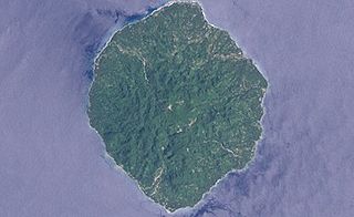
Varo is a small uninhabited island in the Malampa Province of Vanuatu. [1]
Varo is located close to Malekula. [2] The two neighboring islands are Arseo and Leumanang. [3] Although uninhabited, Varo is used by local people on a nearby island for fishing. [4]

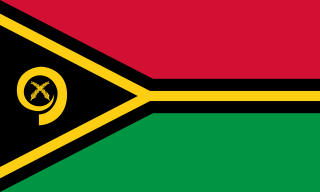
Vanuatu, officially the Republic of Vanuatu, is an island country in Melanesia, located in the South Pacific Ocean. The archipelago, which is of volcanic origin, is 1,750 km (1,090 mi) east of northern Australia, 540 km (340 mi) northeast of New Caledonia, east of New Guinea, southeast of Solomon Islands, and west of Fiji.

The history of Vanuatu spans over 3,200 years.

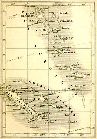
New Hebrides, officially the New Hebrides Condominium and named after the Hebrides in Scotland, was the colonial name for the island group in the South Pacific Ocean that is now Vanuatu. Native people had inhabited the islands for three thousand years before the first Europeans arrived in 1606 from a Spanish expedition led by Portuguese navigator Pedro Fernandes de Queirós. The islands were named by Captain James Cook in 1774 and subsequently colonised by both the British and the French.

Savo Island is an island in Solomon Islands in the South Pacific ocean. Administratively, Savo Island is a part of the Central Province of Solomon Islands. It is about 35 kilometres (22 mi) from the national capital of Honiara. The principal village is Alialia, in the north of the island.

Malo is an island in Vanuatu 3 km (1.9 mi) off the southern coast of Vanuatu's largest island, Espiritu Santo, in Sanma Province. It has a circumference of 55 km (34 mi) and an area of 180 km2 (69 sq mi). It is 17 kilometres or 11 miles long, and 13 kilometres or 8.1 miles across at its widest point. The highest point on the island is Mount Malo.

Honiara is the capital and largest city of Solomon Islands, situated on the northwestern coast of Guadalcanal. As of 2021, it had a population of 92,344 people. The city is served by Honiara International Airport and the seaport of Point Cruz, and lies along the Kukum Highway. In 1983, a capital territory – comprising the 22 square-kilometre metropolitan area of Honiara – was proclaimed, with a self-governing status akin to a province, although the city also retained an older role as capital of Guadalcanal Province.

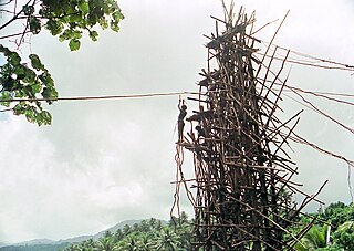
Land diving is a ritual performed by the men of the southern part of Pentecost Island, Vanuatu. Men jump off wooden towers around 20 to 30 meters high, with two tree vines wrapped around the ankles. The tradition has developed into a tourist attraction. According to the Guinness World Records, the g-force experienced by those at their lowest point in the dive is the greatest experienced in the non-industrialized world by humans.

Vot Tande is an uninhabited islet of the Banks Islands of northern Vanuatu. It is located about 50 km (31 mi) due north of the island of Mota Lava. The islet of Vot Tande has never been inhabited. It is host to thousands of sea birds—especially frigatebirds, which have given their name to the islet. It consists of two islands. The highest point of either of the islands is 64 meters above sea level.

A flèche faîtière is a carved rooftop spear, spire or finial that adorns Kanak houses, particularly the Great Houses of the Kanak Chiefs, in New Caledonia. The ceremonial carving is the home of ancestral spirits and is characterized by three major components. The ancestor is symbolized by a flat, crowned face in the centre of the spear. The ancestor's voice is symbolized by a long, rounded pole that is run through by conch shells. The symbolic connection of the clan, through the chief, is a base, which is planted into the case's central pole. Sharply pointed wood pieces fan out from either end of the central area, symbolically preventing bad spirits from being able to reach the ancestor. It evokes, beyond a particular ancestor, the community of ancestors. The flèche faîtière was depicted on a 2007 New Caledonian stamp.

The Maskelyne Islands, often abbreviated as the Maskelynes, are a small chain of low islands that forms part of Vanuatu in the Pacific Ocean. Among the islands are Awei, Avock, Leumanang, Uluveo, and Vulai. Uluveo is the main island in the group and has three villages.

Mount Wonvara or Wonvagre is the highest point of Hiw, the northernmost island of Vanuatu. It has an elevation of 366 metres (1,201 ft).
Yeyenwu is a cave in Hiw, the northernmost island of Vanuatu. It has some notable stalactite formations.

Pélé, sometimes spelled Pele in English, is a volcanic island located 11,2 miles north of the island of Éfaté in the Shefa Province of the Republic of Vanuatu. It has a total area of 1.7 square miles, Pélé is inhabited by about 200-220 Ni-Vanuatu villagers residing in the four villages: Worsiviu, Worearu, Piliura, and Launamoa.

Tutuba is an island in Vanuatu, located off the coast of Vanuatu's largest island Espiritu Santo in Sanma Province.

Linua is an island in the Torres Islands archipelago in Torba Province of Vanuatu in the southwestern Pacific Ocean.
Urelapa Island is a private uninhabited island in Sanma Province of Vanuatu in the Pacific Ocean.
Arseo Island is a small, uninhabited island in the Malampa Province of Vanuatu in the Pacific Ocean. The estimated terrain elevation above sea level is some 172 metres (564 ft). There are two small neighboring islands: Leumanang and Varo.
Sowan is a small, uninhabited island in the Malampa Province of Vanuatu.
Leumanang is a small uninhabited island in the Malampa Province of Vanuatu. Leumanang is a part of the Maskelyne group off south Malekula.
Malu'u is a village on the north coast of Malaita island in the Solomon Islands. The seat of the sub provincial area, it lies on Suafa Bay, within Malaita Province, along the road between Auki and Lau Lagoon.