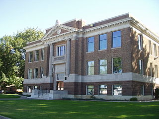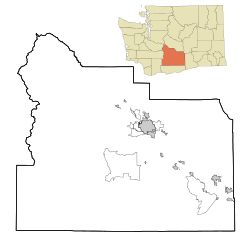
Prosser is a city in and the county seat of Benton County, Washington, United States. Situated along the Yakima River, it had a population of 6,062 at the 2020 census.

Cle Elum is a city in Kittitas County, Washington, United States. The population was 2,157 at the 2020 census. About 84 miles (135 km) by car from Seattle, Cle Elum is a popular area for camping and outdoor activities. It is also unofficially considered the starting point of Eastern Washington when driving east on I-90 from Seattle, although this is somewhat arbitrary since many consider either the town of Easton, anywhere east of Keechelus Lake, or the wildlife crossing bridge over I-90 to be the starting point.

Thorp is an unincorporated community and census-designated place (CDP) in Kittitas County, Washington, United States. In 2020, the population was 232.

The interurban is a type of electric railway, with tram-like electric self-propelled railcars which run within and between cities or towns. The term "interurban" is usually used in North America, with other terms used outside it. They were very prevalent in many parts of the world before the Second World War and were used primarily for passenger travel between cities and their surrounding suburban and rural communities. Interurban as a term encompassed the companies, their infrastructure, their cars that ran on the rails, and their service. In the United States, the early 1900s interurban was a valuable economic institution, when most roads between towns, many town streets were unpaved, and transportation and haulage was by horse-drawn carriages and carts.

Titusville is an unincorporated community and census-designated place (CDP) in Hopewell Township, Mercer County, New Jersey, in the United States. As of the 2020 census, the population was 633. The area includes a post office with its own ZIP Code (08560), several restaurants, gas stations, a firehouse, and a small cluster of homes. Washington Crossing State Park, dedicated to George Washington's crossing of the Delaware River in 1776, is adjacent to the community.

The Illinois Terminal Railroad Company, known as the Illinois Traction System until 1937, was a heavy duty interurban electric railroad with extensive passenger and freight business in central and southern Illinois from 1896 to 1956. When Depression era Illinois Traction was in financial distress and had to reorganize, the Illinois Terminal name was adopted to reflect the line's primary money making role as a freight interchange link to major steam railroads at its terminal ends, Peoria, Danville, and St. Louis. Interurban passenger service slowly was reduced, ending in 1956. Freight operation continued but was hobbled by tight street running in some towns requiring very sharp radius turns. In 1956, ITC was absorbed by a consortium of connecting railroads.

The Yakima Valley Transportation Company was an interurban electric railroad headquartered in Yakima, Washington. It was operator of the city's streetcar system from 1907–1947, and it also provided the local bus service from the 1920s until 1957.

The Glendale and Montrose Railway Company (G&M) was an interurban electrified railway in Southern California, in the United States. It was unique among the Los Angeles local railways, as it was among the area's only interurban line never absorbed into the expansive Pacific Electric system.
Parker is a census-designated place and unincorporated community in central Yakima County, Washington, United States. It is located on U.S. Route 97 between the cities of Union Gap and Wapato on the Yakama Indian Reservation. The town had a population of 154 at the 2010 census.

State Route 823 (SR 823) is a state highway in Yakima County, Washington, United States. It runs for 5.6 miles (9.0 km) from an interchange with U.S. Route 12 (US 12) and through the city of Selah to a junction with SR 821. A portion of the highway runs in the median of Interstate 82 (I-82), its parent route, as it crosses the Naches River.

State Route 223 (SR 223) is a 3.81-mile (6.13 km) long state highway located entirely in Yakima County, Washington, United States. It has served the role of connecting the city of Granger to the county seat, Yakima via Interstate 82 and to SR 22 since its establishment in 1967, serving between 4,000 and 8,500 cars per day on average in 2009.

Tunnel City is an unincorporated census-designated place in the town of Greenfield, Monroe County, Wisconsin, United States, named after the train tunnel through a hill just to the west of town.

Cazadero is an unincorporated historic locale in Clackamas County, Oregon, United States. Cazadero was a station on the Estacada interurban railway line of the Portland Railway, Light and Power Company (PRL&P) and later Portland Electric Power Company (PEPCO), near where the power plant of the PEPCO-owned Cazadero Dam was located on the Clackamas River.

Whitstran is a small, unincorporated community in Benton County, Washington, located approximately four miles Northeast of Prosser and approximately ten miles west of Benton City. The focal point of the community is at the intersection of North Rothrock Road and Foisy Road, where there is a small grocery store, and nearby Whitstran Elementary School.
Donald is a census-designated place and unincorporated community in Yakima County, Washington, United States. The population was 91 at the 2010 census.
Gromore is an unincorporated community in Yakima County, Washington, United States, located approximately one mile west of Yakima. Gromore was an agricultural area located at the terminus of a Yakima Valley Transportation Company interurban line.
Tampico is a census-designated place and unincorporated community in Yakima County, Washington, United States, located approximately eighteen miles west of Yakima on Ahtanum Creek. The population was 312 at the 2010 United States Census.
Fruitvale is an unincorporated community in Yakima County, Washington, United States, located within the north city limits of Yakima.

Situated in the heart of downtown Yakima, the Old North Yakima Historic District has been the center of transportation, government, and commerce in the Yakima Valley. In 1885, the Northern Pacific Railroad selected the site for its first depot in the region. Creating North Yakima, the district buildings, the depot, brewery, opera house, hotels and taverns, and retail stores became the nucleus for the present city of Yakima. The district includes a good collection of late Victorian and early 20th century commercial buildings. Modern construction and demolition leave these buildings as a remaining element of the original fabric of Yakima.


