Williamstown, Vermont

Last updated

Williamstown, Vermont
Williamstown VT church hs.jpg
Historical society and church in Williamstown
Williamstown vt highlight.png
Williamstown, Vermont
Usa edcp location map.svg
Red pog.svg
Williamstown, Vermont
Location in the United States
Coordinates: 44°6′58″N72°32′27″W / 44.11611°N 72.54083°W / 44.11611; -72.54083
Country United States
State Vermont
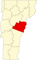
County Orange
Area
  Total40.3 sq mi (104.5 km2)
  Land40.2 sq mi (104.1 km2)
  Water0.2 sq mi (0.4 km2)
Elevation
896 ft (273 m)
Population
 (2020)
  Total3,515
  Density88/sq mi (33.8/km2)
Time zone UTC-5 (Eastern (EST))
  Summer (DST) UTC-4 (EDT)
ZIP code
05679
Area code 802
FIPS code 50-84175 [1]
GNIS feature ID1462262 [2]

Williamstown is a town in Orange County, Vermont, United States. The population was 3,515 at the 2020 census, [3] making it the second largest municipality in the county.

Contents

Geography

According to the United States Census Bureau, the town has a total area of 40.3 square miles (104.5 km2), of which 40.2 square miles (104.1 km2) is land and 0.2 square mile (0.4 km2) (0.40%) is water. The village of Williamstown is in the central part of the town.

The Ainsworth State Park is a 905-acre (3.7 km2) park located in Williamstown which provides camping, hiking, and hunting.

Demographics

Historical population
CensusPop.Note
1790 146
1800 839474.7%
1810 1,35361.3%
1820 1,4819.5%
1830 1,4870.4%
1840 1,6208.9%
1850 1,452−10.4%
1860 1,377−5.2%
1870 1,236−10.2%
1880 1,038−16.0%
1890 1,18814.5%
1900 1,61035.5%
1910 1,7267.2%
1920 1,526−11.6%
1930 1,6085.4%
1940 1,477−8.1%
1950 1,6008.3%
1960 1,553−2.9%
1970 1,82217.3%
1980 2,28425.4%
1990 2,83924.3%
2000 3,22513.6%
2010 3,3895.1%
2020 3,5153.7%
U.S. Decennial Census [4]

As of the census [1] of 2000, there were 3,225 people, 1,248 households, and 889 families residing in the town. The population density was 80.3 people per square mile (31.0/km2). There were 1,318 housing units at an average density of 32.8 per square mile (12.7/km2). The racial makeup of the town was 98.33% White, 0.06% African American, 0.28% Native American, 0.12% Asian, 0.25% from other races, and 0.96% from two or more races. Hispanic or Latino of any race were 0.78% of the population.

There were 1,248 households, out of which 34.1% had children under the age of 18 living with them, 58.7% were married couples living together, 8.4% had a female householder with no husband present, and 28.7% were non-families. 21.3% of all households were made up of individuals, and 7.8% had someone living alone who was 65 years of age or older. The average household size was 2.58 and the average family size was 3.01.

In the town, the population was spread out, with 26.2% under the age of 18, 7.0% from 18 to 24, 32.5% from 25 to 44, 24.5% from 45 to 64, and 9.8% who were 65 years of age or older. The median age was 36 years. For every 100 females, there were 105.0 males. For every 100 females age 18 and over, there were 98.4 males.

The median income for a household in the town was $38,929, and the median income for a family was $45,859. Males had a median income of $29,635 versus $22,378 for females. The per capita income for the town was $17,720. About 5.9% of families and 8.0% of the population were below the poverty line, including 10.9% of those under age 18 and 2.9% of those age 65 or over.

Notable people

Related Research Articles

<span class="mw-page-title-main">Orange County, Vermont</span> County in Vermont, United States

Orange County is a county located in the U.S. state of Vermont. As of the 2020 census, the population was 29,277. Its shire town is the town of Chelsea. Orange County was organized on February 2, 1781, as an original county within the state.

<span class="mw-page-title-main">Bennington County, Vermont</span> County in Vermont, United States

Bennington County is a county in the U.S. state of Vermont. As of the 2020 census, the population was 37,347. The shire towns are jointly Bennington and Manchester, and the largest municipality is Bennington. The county was created in 1778.

<span class="mw-page-title-main">Ainsworth, Iowa</span> City in Iowa, United States

Ainsworth is a city in Washington County, Iowa, United States. It is a part of the Iowa City, Iowa Metropolitan Statistical Area. The population was 511 at the 2020 census. It is part of the Highland Community School District.

<span class="mw-page-title-main">Gasport, New York</span> CDP & hamlet in New York, United States

Gasport is a hamlet located in the Town of Royalton in Niagara County, New York, United States. The population was 1,248 at the 2010 census. The name is derived from observed natural gas and the historic Erie Canal port at that location. It is part of the Buffalo–Niagara Falls Metropolitan Statistical Area.

<span class="mw-page-title-main">Williamstown, Pennsylvania</span> Borough in Pennsylvania, United States

Williamstown is a borough in Dauphin County, Pennsylvania, United States. The borough is 38 miles (61 km) northeast of Harrisburg. Formerly, anthracite coal mines and hosiery mills were located in the borough. The population was 1,303 at the 2020 census.

<span class="mw-page-title-main">Sandy Lake Township, Pennsylvania</span> Township in Pennsylvania, United States

Sandy Lake Township is a township that is located in Mercer County, Pennsylvania, United States. The population was 1,197 at the time of the 2020 census, a decline from the figure of 1,226 that was documented in 2010.

<span class="mw-page-title-main">Lemington, Vermont</span> Town in Vermont, United States

Lemington is a town in Essex County, Vermont, United States. The population was 87 as of the 2020 census. It is part of the Berlin, NH–VT Micropolitan Statistical Area.

<span class="mw-page-title-main">Fairfield, Vermont</span> Town in Vermont, United States

Fairfield is a town in Franklin County, Vermont, United States, chartered in 1763. The population was 2,044 at the 2020 census. President Chester A. Arthur was born in Fairfield in 1829, and lived there for the first three years of his life. A replica of his home, the Chester Alan Arthur State Historic Site, is open seasonally.

<span class="mw-page-title-main">Sudbury, Vermont</span> Town in Vermont, United States

Sudbury is a town in Rutland County, Vermont, United States. The population was 545 at the 2020 census.

<span class="mw-page-title-main">Woodbury, Vermont</span> Town in Vermont, United States

Woodbury is a town in Washington County, Vermont, United States. The population was 928 at the 2020 census.

<span class="mw-page-title-main">Whitingham, Vermont</span> Town in Vermont, United States

Whitingham is a town in Windham County, Vermont, United States. The town was named for Nathan Whiting, a landholder. The population was 1,344 at the 2020 census. Whitingham is the birthplace of Brigham Young, the second president of the Church of Jesus Christ of Latter-day Saints and founder of Salt Lake City, Utah. Its village center, census-designated place, is also listed on the National Register of Historic Places as the Whitingham Village Historic District.

<span class="mw-page-title-main">Bridgewater, Vermont</span> Town in Vermont, United States

Bridgewater is a town in Windsor County, Vermont, United States. The population was 903 at the 2020 census. Bridgewater contains the hamlets of Bridgewater Village, Bridgewater Corners, West Bridgewater, and Bridgewater Center.

<span class="mw-page-title-main">Sharon, Vermont</span> Town in Vermont, United States

Sharon is a town in Windsor County, Vermont, United States. It had a population of 1,560 at the 2020 census.

<span class="mw-page-title-main">West Windsor, Vermont</span> Town in Vermont, United States

West Windsor is a town in Windsor County, Vermont, United States. The population was 1,344 at the 2020 census. It was known for its Ascutney Mountain Resort, which closed in 2010 and was bought by its citizens in 2015.

<span class="mw-page-title-main">Vermont, Wisconsin</span> Town in Wisconsin, United States

Vermont is a town located in Dane County, Wisconsin, United States. The population was 871 at the 2020 Census. The unincorporated communities of Elvers and Vermont are located in the town.

<span class="mw-page-title-main">Ainsworth, Wisconsin</span> Town in Wisconsin, United States

Ainsworth is a town in Langlade County, Wisconsin in United States. The town was founded in 1904, and was named for Thomas Ainsworth, a civil engineer who supervised the construction of the Wolf River Dam in 1869 for the Keshena Improvement Company. The population was 469 at the 2010 census, down from 571 at the 2000 census. The unincorporated community of Pearson is located within the town. The township is served by the Pickerel Volunteer Fire Department, and the Pickerel Rescue Squad for ambulance services.

<span class="mw-page-title-main">Williamstown (CDP), Massachusetts</span> Census-designated place in Massachusetts, United States

Williamstown is a census-designated place (CDP) in the town of Williamstown in Berkshire County, Massachusetts, United States. The population of the CDP was 4,325 at the 2010 census, out of 7,754 in the entire town.

<span class="mw-page-title-main">Williamstown, Massachusetts</span> Town in Massachusetts, United States

Williamstown is a town in Berkshire County, Massachusetts, United States. It shares a border with Vermont to the north and New York to the west. Located in Berkshire County, the town is part of the Pittsfield, Massachusetts metropolitan statistical area. The population was 7,513 at the 2020 census. A college town, it is home to Williams College, the Clark Art Institute and the Tony-awarded Williamstown Theatre Festival.

<span class="mw-page-title-main">Wallingford, Vermont</span> Town in Vermont, United States

Wallingford is a town in Rutland County, Vermont, United States. The population was 2,129 at the 2020 census. Wallingford also contains the villages of East Wallingford and South Wallingford.

<span class="mw-page-title-main">Northfield, Vermont</span> Town in Vermont, United States

Northfield is a town in Washington County, Vermont, United States. The town lies in a valley within the Green Mountains and has been home to Norwich University since 1866. It contains the village of Northfield, where over half of the population lives. The town's total population was 5,918 at the 2020 census.

References

  1. 1 2 "U.S. Census website". United States Census Bureau . Retrieved January 31, 2008.
  2. "US Board on Geographic Names". United States Geological Survey. October 25, 2007. Retrieved January 31, 2008.
  3. "Census - Geography Profile: Williamstown town, Orange County, Vermont" . Retrieved January 7, 2022.
  4. "U.S. Decennial Census". United States Census Bureau. Retrieved May 16, 2015.
  5. "John Coughlin". Military Times. Retrieved July 1, 2014.
  6. Secretary of the Vermont Senate. "Biography, Senator Mark A. MacDonald". Vermont State Senate. Montpelier, VT: Vermont General Assembly. Retrieved February 21, 2017.
  7. Allen, Ethan (1863). "Deposition of Rollin White". Circuit court of the United States,Massachusetts district: In equity. For complainants: E. W. Stoughton, C. M. Keller, E. F. Hodges. For respondents: B. R. Curtis, Caustin Browne. pp. 187–193.