Wilsons Plains, Queensland

Last updated

Wilsons Plains
Queensland
Australia Queensland location map.svg
Red pog.svg
Wilsons Plains
Coordinates 27°50′30″S152°39′04″E / 27.8416°S 152.6511°E / -27.8416; 152.6511 (Wilsons Plains (centre of locality))
Population62 (2021 census) [1]
 • Density5.74/km2 (14.87/sq mi)
Postcode(s) 4307
Area10.8 km2 (4.2 sq mi)
Time zone AEST (UTC+10:00)
LGA(s) Scenic Rim Region
State electorate(s) Scenic Rim
Federal division(s) Wright
Suburbs around Wilsons Plains:
Warrill View Harrisville Harrisville
Radford Wilsons Plains Milora
Radford Radford Milora

Wilsons Plains is a rural locality in the Scenic Rim Region, Queensland, Australia. [2] In the 2021 census, Wilsons Plains had a population of 62 people. [1]

Contents

Geography

Warrill Creek forms the north-western boundary. [3]

The Cunningham Highway passes close to the western extremity.

History

The Fassifern railway line (Queensland's first branch railway line) opened from Ipswich to Harrisville on 10 July 1882. On 12 September 1887 the line was extended to Dugundan with Wilsons Plains being served by Wilsons Plains railway station on the corner of Wilsons Plains Road and Redhill Road ( 27°50′10″S152°39′20″E / 27.8362°S 152.6556°E / -27.8362; 152.6556 (Wilsons Plains railway station) ). The line closed in June 1964. [4] [5]

Demographics

In the 2016 census Wilsons Plains had a population of 50 people. [6]

In the 2021 census, Wilsons Plains had a population of 62 people. [1]

Heritage listing

Wilsons Plains has the following heritage-listed sites:

Related Research Articles

<span class="mw-page-title-main">Roadvale, Queensland</span> Town in Queensland, Australia

Roadvale is a rural locality in the Scenic Rim Region, Queensland, Australia. In the 2021 census, the locality of Roadvale had a population of 303 people.

<span class="mw-page-title-main">Aratula</span> Town in Queensland, Australia

Aratula is a rural town and locality in the Scenic Rim Region, Queensland, Australia. In the 2021 census, the locality of Aratula had a population of 609 people.

<span class="mw-page-title-main">Dugandan, Queensland</span> Town in Queensland, Australia

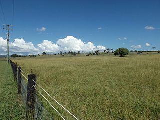
Dugandan is a rural town and locality in the Scenic Rim Region, Queensland, Australia. In the 2021 census, the locality of Dugandan had a population of 602 people.

<span class="mw-page-title-main">Warrill View, Queensland</span> Town in Queensland, Australia

Warrill View is a rural town and locality in the Scenic Rim Region, Queensland, Australia. In the 2021 census, the locality of Warrill View had a population of 203 people.

<span class="mw-page-title-main">Harrisville, Queensland</span> Town in Queensland, Australia

Harrisville is a rural town and locality in the Scenic Rim Region, Queensland, Australia. In the 2021 census, the locality of Harrisville had a population of 667 people.

<span class="mw-page-title-main">Peak Crossing, Queensland</span> Suburb of City of Ipswich, Queensland, Australia

Peak Crossing is a rural locality split between the City of Ipswich and the Scenic Rim Region of Queensland, Australia. In the 2021 census, Peak Crossing had a population of 1,016 people.

<span class="mw-page-title-main">Munbilla, Queensland</span> Town in Queensland, Australia

Munbilla is a rural town and locality in the Scenic Rim Region, Queensland, Australia. In the 2021 census, the locality of Munbilla had a population of 93 people.

<span class="mw-page-title-main">Tamborine, Queensland</span> Town in Queensland, Australia

Tamborine is a rural town in the Scenic Rim Region and a locality split between the Scenic Rim Region and the City of Logan in Queensland, Australia. In the 2021 census, the locality of Tamborine had a population of 4,388 people.

<span class="mw-page-title-main">Veresdale, Queensland</span> Suburb of Logan City, Queensland, Australia

Veresdale is a locality split between the City of Logan and the Scenic Rim Region, Queensland, Australia. In the 2021 census, Veresdale had a population of 414 people.

<span class="mw-page-title-main">Kents Lagoon, Queensland</span> Suburb of Scenic Rim Region, Queensland, Australia

Kents Lagoon is a rural locality in the Scenic Rim Region, Queensland, Australia. In the 2021 census, Kents Lagoon had a population of 60 people.

<span class="mw-page-title-main">Teviotville, Queensland</span> Town in Queensland, Australia

Teviotville is a rural locality in the Scenic Rim Region, Queensland, Australia. In the 2021 census, the locality of Teviotville had a population of 114 people.

<span class="mw-page-title-main">Innisplain, Queensland</span> Suburb of Scenic Rim Region, Queensland, Australia

Innisplain is a rural locality in the Scenic Rim Region, Queensland, Australia. In the 2021 census, Innisplain had a population of 79 people.

<span class="mw-page-title-main">Hoya, Queensland</span> Suburb of Scenic Rim Region, Queensland, Australia

Hoya is a rural locality in the Scenic Rim Region, Queensland, Australia. In the 2021 census, Hoya had a population of 251 people.

<span class="mw-page-title-main">Fassifern Valley, Queensland</span> Suburb of Scenic Rim Region, Queensland, Australia

Fassifern Valley is a rural locality in the Scenic Rim Region, Queensland, Australia. In the 2021 census, Fassifern Valley had a population of 112 people.

Croftby is a rural locality in the Scenic Rim Region, Queensland, Australia. The town of Teviot is within the locality. In the 2021 census, Croftby had a population of 129 people.

<span class="mw-page-title-main">Clumber, Queensland</span> Suburb of Scenic Rim Region, Queensland, Australia

Clumber is a rural locality in the Scenic Rim Region, Queensland, Australia. In the 2021 census, Clumber had a population of 91 people.

<span class="mw-page-title-main">Mount Edwards, Queensland</span> Suburb of Scenic Rim Region, Queensland, Australia

Mount Edwards is a rural locality in the Scenic Rim Region, Queensland, Australia. In the 2021 census, Mount Edwards had a population of 60 people.

Anthony is a rural locality in the Scenic Rim Region, Queensland, Australia. In the 2021 census, Anthony had a population of 133 people.

Kulgun is a locality in the Scenic Rim Region, Queensland, Australia. In the 2021 census, Kulgun had a population of 104 people.

Radford is a rural locality in the Scenic Rim Region, Queensland, Australia. In the 2021 census, Radford had a population of 31 people.

References

  1. 1 2 3 Australian Bureau of Statistics (28 June 2022). "Wilsons Plains (SAL)". 2021 Census QuickStats. Retrieved 28 February 2023. OOjs UI icon edit-ltr-progressive.svg
  2. "Wilsons Plains – locality in Scenic Rim Region (entry 49610)". Queensland Place Names. Queensland Government . Retrieved 29 December 2020.
  3. Google (15 September 2021). "Wilsons Plains, Queensland" (Map). Google Maps . Google. Retrieved 15 September 2021.
  4. Kerr, John (1990). Triumph of narrow gauge : a history of Queensland Railways. Boolarong Publications. pp. 57–58, 224. ISBN   978-0-86439-102-5.
  5. "Flinders" (Map). Queensland Government. 1927. Archived from the original on 29 May 2020. Retrieved 29 May 2020.
  6. Australian Bureau of Statistics (27 June 2017). "Wilsons Plains (SSC)". 2016 Census QuickStats. Retrieved 20 October 2018. OOjs UI icon edit-ltr-progressive.svg
  7. "Local Heritage Register" (PDF). Scenic Rim Regional Council. Archived from the original (PDF) on 24 September 2015. Retrieved 9 February 2015.