| Zhili | |||||||||
|---|---|---|---|---|---|---|---|---|---|
 | |||||||||
| Traditional Chinese | 直隸 | ||||||||
| Simplified Chinese | 直隶 | ||||||||
| Literal meaning | Directly Ruled [Region] | ||||||||
| |||||||||
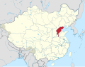
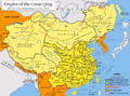
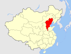
Zhili,alternately romanized as Chihli,was a northern administrative region of China since the 14th century that lasted through the Ming dynasty and Qing dynasty until 1911,when the region was dissolved,converted to a province,and renamed Hopei in 1928. The capital city of Imperial China,Beijing,was located within Zhili.