Aghanliss | |
---|---|
County | |
Country | Northern Ireland |
Sovereign state | United Kingdom |
Police | Northern Ireland |
Fire | Northern Ireland |
Ambulance | Northern Ireland |
EU Parliament | Northern Ireland |
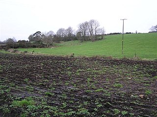
Aghanliss is a townland in County Antrim, Northern Ireland. It is situated in the historic barony of Massereene Upper and the civil parish of Ballinderry and covers an area of 341 acres [1]
A townland is a small geographical division of land used in Ireland and in the Western Isles in Scotland. The townland system is of Gaelic origin, pre-dating the Norman invasion, and most have names of Irish Gaelic origin. However, some townland names and boundaries come from Norman manors, plantation divisions, or later creations of the Ordnance Survey. The total number of inhabited townlands in Ireland was 60,679 in 1911. The total number recognised by the Irish Place Names database as of 2014 was 61,098, including uninhabited townlands, mainly small islands.
County Antrim is one of six counties that form Northern Ireland. Adjoined to the north-east shore of Lough Neagh, the county covers an area of 3,046 square kilometres (1,176 sq mi) and has a population of about 618,000. County Antrim has a population density of 203 people per square kilometre or 526 people per square mile. It is also one of the thirty-two traditional counties of Ireland, as well as part of the historic province of Ulster.
Northern Ireland is a part of the United Kingdom in the north-east of the island of Ireland, variously described as a country, province or region. Northern Ireland shares a border to the south and west with the Republic of Ireland. In 2011, its population was 1,810,863, constituting about 30% of the island's total population and about 3% of the UK's population. Established by the Northern Ireland Act 1998 as part of the Good Friday Agreement, the Northern Ireland Assembly holds responsibility for a range of devolved policy matters, while other areas are reserved for the British government. Northern Ireland co-operates with the Republic of Ireland in several areas, and the Agreement granted the Republic the ability to "put forward views and proposals" with "determined efforts to resolve disagreements between the two governments".
The population of the townland decreased during the 19th century: [2] [3]
Year | 1841 | 1851 | 1861 | 1871 | 1881 | 1891 |
---|---|---|---|---|---|---|
Population | 93 | 88 | 84 | 62 | 62 | 44 |
Houses | 17 | 17 | 15 | 11 | 13 | 11 |
Barmeen is a townland in County Antrim, Northern Ireland. It is located at the foot of Glendun, one of the nine Glens of Antrim, west of Cushendun and north of Knocknacarry. It is situated in the historic barony of Cary and the civil parish of Culfeightrin and covers 59 acres.
Groggan is a hamlet and townland near Randalstown in County Antrim, Northern Ireland. It is situated in the historic barony of Toome Upper and the civil parish of Drummaul and covers an area of 620 acres. It is within the Borough of Antrim. It had a population of 135 people in the 2011 Census.
Dooish is a village and townland near Drumquin in County Tyrone, Northern Ireland. The townland is situated in the historic barony of Omagh West and the civil parish of Longfield West and covers an area of 845 acres. In the 2001 Census it had a population of 93 people. It lies within the Omagh District Council area.
Drumnakilly is a small village and townland between Carrickmore and Omagh in County Tyrone, Northern Ireland. In the 2001 Census it had a population of 114 people. The townland is situated in the historic barony of Strabane Upper and the civil parish of Termonmaguirk and covers an area of 1,352 acres. It lies within the Omagh District Council area.
Brackaville or Bracaville is a village and townland near Coalisland in County Tyrone, Northern Ireland. It is situated in the historic barony of Dungannon Middle and the civil parish of Donaghenry and covers an area of 235 acres on the western side of Lough Neagh.
Acravally is a townland in County Antrim, Northern Ireland. It is situated in the historic barony of Cary and the civil parish of Culfeightrin and covers an area of 31 acres.
Aghaboy is a townland in County Antrim, Northern Ireland. It is situated in the historic barony of Toome Upper and the civil parish of Drummaul and covers an area of 286 acres
Aghacarnaghan is a townland in County Antrim, Northern Ireland. It is situated in the historic barony of Toome Upper and the civil parish of Duneane and covers an area of 279 acres
Aghadrumglasny is a townland in County Antrim, Northern Ireland. It is situated in the historic barony of Massereene Upper and the civil parishes of Aghagallon, in which it covers an area of 404 acres, and Aghalee, in which it covers an area of 37 aces.
Aghaloughan is a townland in County Antrim, Northern Ireland. It is situated in the historic barony of Toome Upper and the civil parish of Drummaul and covers an area of 286 acres
Aghancrossy is a townland in County Antrim, Northern Ireland, near Dervock. It is situated in the historic barony of Dunluce Lower and the civil parish of Derrykeighan and covers an area of 55 acres
Altigarron is a townland in County Antrim, Northern Ireland. It is situated in the historic barony of Belfast Upper and the civil parish of Shankill and covers an area of 694 acres
Antynanum is a townland in County Antrim, Northern Ireland. It is situated in the historic barony of Antrim Lower and the civil parish of Racavan and covers an area of 450 acres.
Appletee is a townland in County Antrim, Northern Ireland. It is situated in the historic barony of Antrim Lower and the civil parish of Connor and covers an area of 226 acres.
Araboy is a townland in County Antrim, Northern Ireland. It is situated in the historic barony of Cary and the civil parish of Ballintoy and covers an area of 430 acres.
Artibrannan is a townland in County Antrim, Northern Ireland, near Ballymena. It is situated in the historic barony of Toome Lower and the civil parishes of Ahoghill and Craigs and covers an area of 112 acres.
Aughalish is a townland in County Antrim, Northern Ireland. It is situated in the historic barony of Toome Upper and the civil parish of Drummaul and covers an area of 93 acres.
Ballaghbeddy is a townland of 164 acres in County Antrim, Northern Ireland, near Ballymoney. It is situated in the historic barony of Kilconway and the civil parish of Finvoy, on the eastern bank of the River Bann which forms the western boundary of the parish of Finvoy.
Ballinlea Upper is a townland in County Antrim, Northern Ireland, near to Straid. It is situated in the historic barony of Cary and the civil parish of Ballintoy and covers an area of 280 acres
Drummaul is a townland and civil parish in County Antrim, Northern Ireland. It is situated in the historic barony of Toome Upper and contains the town of Randalstown.
Wikimedia Commons has media related to Aghanliss . |