Scouting in Arizona has a long history, from the 1910s to the present day, serving thousands of youth in programs that suit the environment in which they live.

Douglas is a city in Cochise County, Arizona, United States that lies in the north-west to south-east running Sulphur Springs Valley. Douglas has a border crossing with Mexico at Agua Prieta and a history of mining.

Buckeye is a city in Maricopa County, Arizona, United States. It is Arizona's largest city by area, and it is the westernmost suburb in the Phoenix Metropolitan Area. As of the 2020 census, the population was 91,502, up from 50,876 in 2010, and 6,537 in 2000. It was the fastest-growing city in the United States for 2017, 2018, and 2021.

Gila Bend, founded in 1872, is a town in Maricopa County, Arizona, United States. The town is named for an approximately 90-degree bend in the Gila River, which is near the community's current location. As of the 2020 census, the population of the town was 1,892.

Glendale is a city in Maricopa County, Arizona, United States. Located about nine miles northwest of the state capital Phoenix, Glendale is known for State Farm Stadium, which is the home of the Arizona Cardinals football team. The city also contains the Arrowhead Towne Center shopping mall. As of the 2020 census, Glendale had a population of 248,325.

Scottsdale is a city in the eastern part of Maricopa County, Arizona, United States, and is part of the Phoenix metropolitan area. Named Scottsdale in 1894 after its founder Winfield Scott, a retired U.S. Army chaplain, the city was incorporated in 1951 with a population of 2,000. At the 2020 census, the population was 241,361, which had grown from 217,385 in 2010. Its slogan is "The West's Most Western Town". Over the past two decades, it has been one of the fastest growing cities in the United States.

Wickenburg is a town in Maricopa and Yavapai counties, Arizona, United States. The population was 7,474 at the 2020 census, and was estimated to be 7,920 in 2022.

Casas Adobes is an unincorporated community and census-designated place (CDP) located in the northern metropolitan area of Tucson, Arizona. The population was 66,795 at the 2010 census. Casas Adobes is situated south and southwest of the town of Oro Valley, and west of the community of Catalina Foothills.

Camp Verde is a town in Yavapai County, Arizona, United States. As of the 2010 census, the population of the town is 10,873.

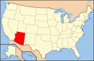
The following is an alphabetical list of articles related to the U.S. state of Arizona.

Kohls Ranch is a census-designated place (CDP) in Gila County, Arizona, United States. The population was 46 at the 2010 census.

Theba is an unincorporated community and census-designated place (CDP) in Maricopa County, Arizona, United States. Its elevation is 728 feet (222 m). Theba is located along Interstate 8 and is served by Exit 106. As of the 2020 census, it had a population of 111, down from 158 in 2010.

The Sunnyslope community is an established neighborhood within the borders of the city of Phoenix, Arizona. The geographic boundaries are 19th Avenue to the west, Cactus Road to the north, 16th Street to the east, and Northern Avenue to the south. This area covers approximately nine square miles (23 km2) and is divided into nine census tracts. The Sunnyslope community is included in parts of three zip code areas: 85020, 85021 and 85029.

Margaret Fulton Spencer (1882–1966) was a painter and early American woman architect who designed and built the architecturally unique dude ranch Las Lomas Estates outside of Tucson, Arizona. She was the second woman to become a member of the American Institute of Architects.

The Hassayampa River Preserve is a 770-acre riparian nature reserve owned by The Nature Conservancy in the US state of Arizona, near Wickenburg in Maricopa County. The Hassayampa River has mostly subterranean flows for most of its 113 miles (182 km) length, the stretch contained within the preserve has year-round flowing water.

Camp Harry J. Jones was an encampment of the United States Army. Located near Douglas, Arizona, it was active during the Pancho Villa Expedition and World War I.

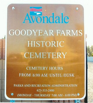
The Goodyear Farms Historic Cemetery is the official name given to a historic cemetery located at 3900 N Santa Fe Trail in the city of Avondale, Arizona. In the past the cemetery was known as the "Pioneer Cemetery" and also as the "Litchfield Cemetery". It is the final resting place of many Mexican migrants and Native-Americans who worked in the Goodyear Farms and the Wigwam Resort in Litchfield Park. The majority of the unmarked graves are of those who perished in the 1918 Spanish Influenza pandemic which spread throughout the entire globe. The Pioneers' Cemetery Association (PCA) defines an "historic cemetery" as one which has been in existence for more than fifty years.


