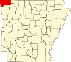
Avoca, Arkansas

Last updated

Avoca, Arkansas
US 62 in Avoca, AR.jpg
U.S. Highway 62 runs through Avoca.
Benton County Arkansas Incorporated and Unincorporated areas Avoca Highlighted 0503040.svg
Location of Avoca in Benton County, Arkansas.
Coordinates: 36°24′5″N94°4′15″W / 36.40139°N 94.07083°W / 36.40139; -94.07083
Country United States
State Arkansas
County Benton
Area
[1]
  Total1.88 sq mi (4.86 km2)
  Land1.88 sq mi (4.86 km2)
  Water0.00 sq mi (0.00 km2)
Elevation
[2]
1,345 ft (410 m)
Population
 (2020)
  Total487
  Density259.73/sq mi (100.30/km2)
Time zone UTC-6 (Central (CST))
  Summer (DST) UTC-5 (CDT)
ZIP code
72711
Area code 479
FIPS code 05-03040
GNIS feature ID2405190 [2]
Website www.avocaarkansas.info

Avoca is a town in Benton County, Arkansas, United States. The population was 487 at the 2020 census. [3] It is part of the Northwest Arkansas region.

Contents

It is named after the town of Avoca in Ireland.

History

Avoca was platted in 1881. [4] A post office called Avoca has been in operation since 1872. [5]

Geography

Avoca is located in east-central Benton County at 36°24′00″N94°04′24″W / 36.399971°N 94.073239°W / 36.399971; -94.073239 , [6] 6 miles (10 km) northeast of the center of Rogers. U.S. Route 62 passes through the town, leading southwest 7 miles (11 km) to Interstate 540 in Bentonville and northeast 11 miles (18 km) to Gateway near the Missouri border.

According to the United States Census Bureau, Avoca has a total area of 1.8 square miles (4.7 km2), all land. [3]

Demographics

Historical population
CensusPop.Note
1970 173
1980 25648.0%
1990 2695.1%
2000 42357.2%
2010 48815.4%
2020 487−0.2%
U.S. Decennial Census [7]
2018 Estimate [8]

As of the census [9] of 2000, there were 423 people, 162 households, and 121 families residing in the town. The population density was 233.7/mi² (90.2/km2). There were 168 housing units at an average density of 92.8/mi² 35.8/km2). The racial makeup of the town was 92.43% White, 1.65% Native American, 0.24% Asian, 0.71% Pacific Islander, 3.31% from other races, and 1.65% from two or more races. 6.15% of the population were Hispanic or Latino of any race.

There were 162 households, out of which 30.2% had children under the age of 18 living with them, 59.3% were married couples living together, 11.7% had a female householder with no husband present, and 25.3% were non-families. 19.8% of all households were made up of individuals, and 8.6% had someone living alone who was 65 years of age or older. The average household size was 2.61 and the average family size was 3.02.

In the town, the population was spread out, with 25.5% under the age of 18, 9.5% from 18 to 24, 26.5% from 25 to 44, 26.2% from 45 to 64, and 12.3% who were 65 years of age or older. The median age was 39 years. For every 100 females there were 94.9 males. For every 100 females age 18 and over, there were 88.6 males.

The median income for a household in the town was $41,964, and the median income for a family was $47,500. Males had a median income of $32,708 versus $25,167 for females. The per capita income for the town was $17,028. About 4.2% of families and 7.8% of the population were below the poverty line, including 5.9% of those under age 18 and 12.0% of those age 65 or over.

Education

Public education for early childhood, elementary and secondary school students is provided by the Rogers School District. [10]

Related Research Articles

<span class="mw-page-title-main">Benton County, Arkansas</span> County in Arkansas, United States

Benton County is a county within the Northwest Arkansas region with a culture, economy, and history that have transitioned from rural and agricultural to suburban and white collar since the growth of Walmart, which is headquartered in Benton County. Created as Arkansas's 35th county on September 30, 1836, Benton County contains thirteen incorporated municipalities, including Bentonville, the county seat, and Rogers, the most populous city. The county was named after Thomas Hart Benton, a U.S. Senator from Missouri influential in Arkansas statehood.

<span class="mw-page-title-main">Garfield, Arkansas</span> Town in Arkansas, United States

Garfield is a town in Benton County, Arkansas, United States. The population was 593 at the 2020 census. It is part of the Northwest Arkansas region.

<span class="mw-page-title-main">Gateway, Arkansas</span> Town in Arkansas, United States

Gateway is a town in Benton County, Arkansas, United States. The population was 436 at the 2020 census, up from 405 in 2010. It is part of the Northwest Arkansas region. The town's name reflects its situation as the "gateway" to and from Arkansas.

<span class="mw-page-title-main">Highfill, Arkansas</span> Town in Arkansas, United States

Highfill is a town in Benton County, Arkansas, United States. The population was 1,587 as of the 2020 census. It is home to the Northwest Arkansas National Airport, which serves all of the Northwest Arkansas region. In September 2023, officials of the airport voted to detach itself from the city over taxing and public service disputes.

<span class="mw-page-title-main">Pea Ridge, Arkansas</span> City in Arkansas

Pea Ridge is a city in Benton County, Arkansas, United States. The name Pea Ridge is derived from a combination of the physical location of the original settlement of the town, across the crest of a ridge of the Ozark Mountains, and for the hog peanuts or turkey peas that had been originally cultivated by Native American tribes centuries before European settlement, which later helped to provide basic subsistence once those pioneer settlers arrived.

<span class="mw-page-title-main">Prairie Creek, Arkansas</span> CDP in Arkansas, United States

Prairie Creek is a census-designated place (CDP) in Benton County, Arkansas, United States. Per the 2020 census, the population was 2,217. It is a lakefront community adjacent to Beaver Lake and Rogers within the Northwest Arkansas region.

<span class="mw-page-title-main">Springtown, Arkansas</span> Town in Arkansas, United States

Springtown is a town in Benton County, Arkansas, United States. The population was 83 at the 2020 census. It is part of the Northwest Arkansas region.

<span class="mw-page-title-main">Cedarville, Arkansas</span> City in Arkansas, United States

Cedarville is a city in Crawford County, Arkansas, United States. It is part of the Fort Smith, Arkansas-Oklahoma Metropolitan Statistical Area. The population was 1,410 at the 2020 census.

<span class="mw-page-title-main">Rudy, Arkansas</span> Town in Arkansas, United States

Rudy is a town in Crawford County, Arkansas, United States. It is part of the Fort Smith, Arkansas-Oklahoma Metropolitan Statistical Area. As of the 2020 Census the population was 130. The population was 72 at the 2000 census.

<span class="mw-page-title-main">Lonsdale, Arkansas</span> Town in Arkansas, United States

Lonsdale is a town in Garland County, Arkansas, United States. It is part of the Hot Springs Metropolitan Statistical Area. The population was 103 at the 2020 census.

<span class="mw-page-title-main">Tull, Arkansas</span> Town in Arkansas, United States

Tull is a town in Grant County, Arkansas, United States. The population was 448 at the 2010 census, up from 358 in 2000. It is part of the Central Arkansas region.

<span class="mw-page-title-main">Hindsville, Arkansas</span> Town in Arkansas, United States

Hindsville is a town in Madison County, Arkansas, United States. The population was 90 at the 2020 census. It is part of the Northwest Arkansas region.

<span class="mw-page-title-main">Salem, Saline County, Arkansas</span> CDP in Arkansas, United States

Salem is a census-designated place (CDP) in Saline County, Arkansas, United States. Per the 2020 census, the population was 2,544. It is part of the Little Rock–North Little Rock–Conway Metropolitan Statistical Area.

<span class="mw-page-title-main">Hackett, Arkansas</span> City in Arkansas, United States

Hackett is a city in Sebastian County, Arkansas, United States. It is part of the Fort Smith, Arkansas-Oklahoma Metropolitan Statistical Area. The population was 812 at the 2010 census.

<span class="mw-page-title-main">West Fork, Arkansas</span> City in Arkansas, United States

West Fork is a city in Washington County, Arkansas, United States. The population is 2,331 at the 2020 census. It is part of the Northwest Arkansas region.

<span class="mw-page-title-main">Avoca, Iowa</span> City in Iowa, United States

Avoca is a city in Pottawattamie County, Iowa, United States. The population was 1,683 at the 2020 census.

<span class="mw-page-title-main">Benton, Missouri</span> City in Missouri, United States

Benton is a city in Scott County, Missouri, United States. The population was 863 at the 2010 census. It is the county seat of Scott County.

<span class="mw-page-title-main">Avoca, Nebraska</span> Village in Nebraska, United States

Avoca is a village in Cass County, Nebraska, United States. The population was 178 at the 2020 census.

Avoca is a village located in the town of the same name in Steuben County, New York, United States. The population was 946 at the 2010 census. It is in the eastern part of the town, northwest of Bath.

<span class="mw-page-title-main">Avoca, New York</span> Town in New York, United States

Avoca is a town in Steuben County, New York, United States. The population was 1,996 at the 2020 census.

References

  1. "2020 U.S. Gazetteer Files". United States Census Bureau. Retrieved October 29, 2021.
  2. 1 2 U.S. Geological Survey Geographic Names Information System: Avoca, Arkansas
  3. 1 2 "Geographic Identifiers: 2010 Demographic Profile Data (G001): Avoca town, Arkansas". U.S. Census Bureau, American Factfinder. Archived from the original on February 12, 2020. Retrieved September 24, 2013.
  4. History of Benton, Washington, Carroll, Madison, Crawford, Franklin, and Sebastian Counties, Arkansas. Higginson Book Company. 1889. p. 95.
  5. "Post Offices". Jim Forte Postal History. Retrieved January 5, 2017.
  6. "US Gazetteer files: 2010, 2000, and 1990". United States Census Bureau. February 12, 2011. Retrieved April 23, 2011.
  7. "Census of Population and Housing". Census.gov. Retrieved June 4, 2015.
  8. "Population Estimates". United States Census Bureau . Retrieved June 8, 2018.
  9. "U.S. Census website". United States Census Bureau . Retrieved January 31, 2008.
  10. "2020 CENSUS - SCHOOL DISTRICT REFERENCE MAP: Benton County, AR" (PDF). U.S. Census Bureau . Retrieved May 25, 2022.