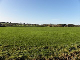
Donegore is the name of a hill, a townland, a small cluster of residences, and a civil parish in the historic barony of Antrim Upper, County Antrim, Northern Ireland. Donegore lies approximately 5 miles (8 km) east of Antrim town. 154 acres of the townland lies in the civil parish of Grange of Nilteen.

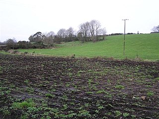
Tobergill is a townland of 1,044 acres in County Antrim, Northern Ireland. Lying on the western aspect of Donegore hill, it is situated in the civil parish of Donegore and the historic barony of Antrim Upper.

Dunadry is a small village and townland 3 miles (5km) from Antrim in County Antrim, Northern Ireland. It is situated in the civil parish of Grange of Nilteen and the historic barony of Antrim Upper. It is within the Borough of Antrim. It had a population of 430 people in the 2011 Census..
Dunamuggy is a townland of 172 acres in County Antrim, Northern Ireland. It is situated in the civil parish of Donegore and the historic barony of Antrim Upper.

Ballystrudder or Ballystruder is a small village and townland on Islandmagee in County Antrim, Northern Ireland. It is situated in the historic barony of Belfast Lower and the civil parish of Islandmagee. It is part of Mid and East Antrim Borough Council. It had a population of 992 people in the 2011 Census.
Barmeen is a townland in County Antrim, Northern Ireland. It is located at the foot of Glendun, one of the nine Glens of Antrim, west of Cushendun and north of Knocknacarry. It is situated in the historic barony of Cary and the civil parish of Culfeightrin and covers 59 acres.
Groggan is a hamlet and townland near Randalstown in County Antrim, Northern Ireland. It is situated in the historic barony of Toome Upper and the civil parish of Drummaul and covers an area of 620 acres. It is within the Borough of Antrim. It had a population of 135 people in the 2011 Census.
Ballymartin is one of at least five areas in Ireland, including:

Solar is a townland of 42 acres in County Antrim, Northern Ireland. It is situated in the civil parish of Carncastle and the historic barony of Glenarm Upper.
Whappstown is a townland of 634 acres in County Antrim, Northern Ireland. It is situated in the civil parish of Connor and the historic barony of Antrim Lower.

Ballyclaverty is a townland of 339 acres in County Antrim, Northern Ireland. It is situated in the civil parish of Donegore and the historic barony of Antrim Upper.
Ballyboley is a townland of 2,988 acres in County Antrim, Northern Ireland. It is situated in the civil parish of Ballycor and the historic barony of Antrim Upper.
Grange of Nilteen is a civil parish in County Antrim, Northern Ireland. It is situated in the historic barony of Antrim Upper. It is 3.5 miles east of Antrim on the Six Mile Water River.
Islandreagh is a townland of 392 acres in County Antrim, Northern Ireland. It is situated in the civil parish of Grange of Nilteen and the historic barony of Antrim Upper.
Loughermore is a townland of 142 acres in County Antrim, Northern Ireland. It is situated in the civil parish of Grange of Nilteen and the historic barony of Antrim Upper.
Moyadam is a townland of 685 acres in County Antrim, Northern Ireland. It is situated in the civil parish of Grange of Nilteen and the historic barony of Antrim Upper.
Rathbeg is a townland in County Antrim, Northern Ireland. It is situated in the civil parishes of Grange of Nilteen and Donegore, both in the historic barony of Antrim Upper.
Ballydown is a townland of 210 acres in County Antrim, Northern Ireland. It is situated in the civil parish of Islandmagee and the historic barony of Belfast Lower.

Derrykeighan is a hamlet, civil parish and townland in County Antrim, Northern Ireland, 4 miles (7.5km) north of Ballymoney. It is situated in the historic barony of Dunluce Lower.


