Brinsmead, Queensland

Last updated

Brinsmead
Cairns,  Queensland
Looking west down Meander Close, Brismead, 2018 03.jpg
Looking west down Meander Close, Brismead, 2018
Australia Queensland location map.svg
Red pog.svg
Brinsmead
Brinsmead, Queensland
Coordinates 16°54′05″S145°42′53″E / 16.9013°S 145.7147°E / -16.9013; 145.7147 (Brinsmead (centre of suburb))
Population5,537 (SAL 2021) [1]
Established1975
Postcode(s) 4870
Area5.1 km2 (2.0 sq mi)
Time zone AEST (UTC+10:00)
Location
LGA(s) Cairns Region
State electorate(s) Cairns
Federal division(s) Leichhardt [2]
Suburbs around Brinsmead:
Redlynch Freshwater Stratford
Redlynch Brinsmead Whitfield
Redlynch Redlynch Kanimbla

Brinsmead is a suburb of Cairns in the Cairns Region, Far North Queensland, Australia. [3] In the 2021 census, Brinsmead had a population of 5,537 people. [4]

Contents

Geography

Brinsmead is located 8.5 km (5.3 mi) by road north-west of the city centre of Cairns. [5]

The north-east of the locality is within Mount Whitfield Conservation Park which extends into the neighbouring locality of Mount Whitfield to the north-east. Apart from this protected area, the land use is predominantly residential. [6]

History

Brinsmead is situated in the Yidinji traditional Aboriginal country. [7] The suburb takes its name from the Brinsmead Gap, a topographical feature between the hills of the Whitfield Range, in turn named after Horace George Brinsmead, a sugar plantation owner at Freshwater who guided groups to see the Barron Falls, one of the first tourism ventures in the district. [8] [9]

Cairns Christian College opened on 25 January 1983. It was later renamed Freshwater Christian College. [10] [11]

Demographics

In the 2016 census, Brinsmead had a population of 5,362 people. [12]

In the 2021 census, Brinsmead had a population of 5,537 people. [4]

Education

Freshwater Christian College is a private primary and secondary (Prep-12) school for boys and girls at 369-401 Brinsmead Road ( 16°53′33″S145°42′30″E / 16.8925°S 145.7082°E / -16.8925; 145.7082 (Freshwater Christian College) ). [13] [14] It is owned by the Freshwater Church, which is affiliated with the Australian Christian Churches. [15] [16] In 2018, the school had an enrolment of 580 students with 46 teachers (40 full-time equivalent) and 52 non-teaching staff (42 full-time equivalent). [17]

There are no government schools in Brinsmead. The nearest government primary schools are Freshwater State School in neighbouring Freshwater to the north and Whitfield State School in neighbouring Whitfield to the east. The nearest government secondary schools are Redlynch State College in neighbouring Redlynch to the south-west and Trinity Bay State High School in Manunda to the south-east. [18]

Amenities

Brinsmead Community Hall is at 85 Loridan Drive ( 16°53′53″S145°42′51″E / 16.89810°S 145.71413°E / -16.89810; 145.71413 (Brinsmead Community Hall) ). It is capable of seating up to 80 people and is operated by the Cairns Regional Council. [19] [20]

There are a number of parks in the area:

Facilities

There is a sewage treatment plant at the top of the hill on Brinsmead Terrace ( 16°54′38″S145°42′37″E / 16.9106°S 145.7103°E / -16.9106; 145.7103 (sewage treatment plant) ). [22]

Related Research Articles

<span class="mw-page-title-main">Gordonvale, Queensland</span> Suburb of Cairns, Queensland, Australia

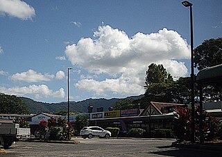
Gordonvale is a rural sugar-growing town and locality situated on the southern side of Cairns in the Cairns Region, Queensland, Australia. In the 2021 census, the locality of Gordonvale had a population of 6,944 people.

<span class="mw-page-title-main">Woree, Queensland</span> Suburb of Cairns, Queensland, Australia

Woree is a suburb of Cairns in the Cairns Region, Queensland, Australia. In the 2016 census, Woree had a population of 4,821 people.

<span class="mw-page-title-main">Kuranda, Queensland</span> Town in Queensland, Australia

Kuranda is a rural town and locality on the Atherton Tableland in the Shire of Mareeba, Queensland, Australia. In the 2016 census, Kuranda had a population of 3,008 people. It is 25 kilometres (16 mi) from Cairns, via the Kuranda Range road. It is surrounded by tropical rainforest and adjacent to the Wet Tropics of Queensland World Heritage listed Barron Gorge National Park.

<span class="mw-page-title-main">Mount Molloy, Queensland</span> Town in Queensland, Australia

Mount Molloy is a rural town and locality in the Shire of Mareeba, Queensland, Australia. It is a historic mining and timber town, 55 kilometres (34 mi) north of Cairns. The dominant industry in the area is cattle grazing; the town itself consists of a few shops and an old hotel. In the 2021 census, the locality of Mount Molloy had a population of 266 people.

<span class="mw-page-title-main">Holloways Beach, Queensland</span> Suburb of Cairns, Queensland, Australia

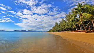
Holloways Beach is a residential coastal suburb of Cairns, Queensland, Australia. In the 2021 census, Holloways Beach had a population of 2,398 people. II is located about 10 kilometres north of the city of Cairns between the suburbs of Machans Beach and Yorkeys Knob.

<span class="mw-page-title-main">Freshwater, Queensland</span> Suburb of Cairns, Queensland, Australia

Freshwater is a suburb of Cairns, Queensland, Australia. In the 2016 census, Freshwater had a population of 2,023 people.

<span class="mw-page-title-main">Stratford, Queensland</span> Suburb of Cairns, Queensland, Australia

Stratford is a suburb of Cairns in the Cairns Region, Queensland, Australia. In the 2016 census, Stratford had a population of 1,138 people.

<span class="mw-page-title-main">Aeroglen</span> Suburb of Cairns, Queensland, Australia

Aeroglen is a coastal suburb of Cairns in the Cairns Region, Queensland, Australia. In the 2016 census, Aeroglen had a population of 403 people.

<span class="mw-page-title-main">Manoora, Queensland</span> Suburb of Cairns, Queensland, Australia

Manoora is a suburb of Cairns in the Cairns Region, Queensland, Australia. In the 2016 census, Manoora had a population of 6,027 people.

<span class="mw-page-title-main">Kamerunga, Queensland</span> Suburb of Cairns, Queensland, Australia

Kamerunga is a suburb of Cairns in the Cairns Region, Queensland, Australia. In the 2016 census, Kamerunga had a population of 1,049 people.

<span class="mw-page-title-main">Edge Hill, Queensland</span> Suburb of Cairns Region, Queensland, Australia

Edge Hill is an inner suburb of the city of Cairns in Far North Queensland, Australia located approximately four kilometres north west of the city centre. In the 2021 census, Edge Hill had a population of 4,088 people.

<span class="mw-page-title-main">Whitfield, Queensland</span> Suburb of Cairns, Queensland, Australia

Whitfield is a suburb of Cairns in the Cairns Region, Queensland, Australia. In the 2016 census, Whitfield had a population of 4,275 people.

<span class="mw-page-title-main">Redlynch, Queensland</span> Suburb of Cairns, Queensland, Australia

Redlynch is a semi-rural town and suburb of Cairns in the Cairns Region, Queensland, Australia. In the 2016 census, the suburb of Redlynch had a population of 9,728 people.

<span class="mw-page-title-main">Earlville, Queensland</span> Suburb of Cairns, Queensland, Australia

Earlville is a suburb of Cairns in the Cairns Region, Queensland, Australia. In the 2016 census, Earlville had a population of 4,030 people.

Biboohra is a rural town and locality in the Shire of Mareeba, Queensland, Australia. In the 2021 census, the locality of Biboohra had a population of 561 people.

<span class="mw-page-title-main">Euramo, Queensland</span> Suburb of Cassowary Coast Region, Queensland, Australia

Euramo is a rural locality in the Cassowary Coast Region, Queensland, Australia. In the 2016 census, Euramo had a population of 147 people.

<span class="mw-page-title-main">Barron, Queensland</span> Suburb of Cairns, Queensland, Australia

Barron is a suburb of Cairns in the Cairns Region, Queensland, Australia. In the 2016 census Barron had a population of 42 people.

<span class="mw-page-title-main">Barron Gorge, Queensland</span> Suburb of Cairns Region, Queensland, Australia

Barron Gorge is a rural locality in the Cairns Region, Queensland, Australia. In the 2016 census Barron Gorge had a population of 0 people.

<span class="mw-page-title-main">Portsmith</span> Suburb of Cairns, Queensland, Australia

Portsmith is a suburb of Cairns in the Cairns Region, Queensland, Australia. In the 2021 census, Portsmith had a population of 314 people.

<span class="mw-page-title-main">Macalister Range, Queensland</span> Suburb of Cairns Region, Queensland, Australia

Macalister Range is a coastal locality in the Cairns Region, Queensland, Australia. In the 2021 census, Macalister Range had a population of 0 people.

References

  1. Australian Bureau of Statistics (28 June 2022). "Brinsmead (suburb and locality)". Australian Census 2021 QuickStats. Retrieved 28 June 2022.  OOjs UI icon edit-ltr-progressive.svg
  2. "Profile of the electoral division of Leichhardt (Qld)". 23 September 2013. Archived from the original on 9 March 2018. Retrieved 22 December 2014.
  3. "Brinsmead – suburb (entry 48544)". Queensland Place Names. Queensland Government . Retrieved 25 June 2017.
  4. 1 2 Australian Bureau of Statistics (28 June 2022). "Brinsmead (SAL)". 2021 Census QuickStats. Retrieved 28 February 2023. OOjs UI icon edit-ltr-progressive.svg
  5. Google (24 April 2024). "Cairns CBD to Brinsmead" (Map). Google Maps . Google. Retrieved 24 April 2024.
  6. "Layers: Locality; Protected areas and forests; Land use". Queensland Globe. Queensland Government. Archived from the original on 19 December 2017. Retrieved 24 April 2024.
  7. "First people cultural history". Cairns Regional Council. Archived from the original on 21 April 2017. Retrieved 23 June 2020.
  8. "Cairns Suburbs". University of Queensland Centre for the Government of Queensland. Archived from the original on 29 July 2017.
  9. "Horace George Brinsmead". The Brinsmeads Down Under. 2011. Archived from the original on 13 May 2018. Retrieved 13 May 2018.
  10. Queensland Family History Society (2010), Queensland schools past and present (Version 1.01 ed.), Queensland Family History Society, ISBN   978-1-921171-26-0
  11. "About". Freshwater Christian College. Archived from the original on 24 April 2024. Retrieved 24 April 2024.
  12. Australian Bureau of Statistics (27 June 2017). "Brinsmead (SSC)". 2016 Census QuickStats. Retrieved 20 October 2018. OOjs UI icon edit-ltr-progressive.svg
  13. "State and non-state school details". Queensland Government. 9 July 2018. Archived from the original on 21 November 2018. Retrieved 21 November 2018.
  14. "Freshwater Christian College". Archived from the original on 3 December 2018. Retrieved 21 November 2018.
  15. "About". Freshwater Christian College. Archived from the original on 24 April 2024. Retrieved 24 April 2024.
  16. "Freshwater Church Home Page". Freshwater Church. Archived from the original on 24 April 2024. Retrieved 24 April 2024.
  17. "ACARA School Profile 2018". Australian Curriculum, Assessment and Reporting Authority. Archived from the original on 27 August 2020. Retrieved 28 January 2020.
  18. "Layers: Locality; Schools and school catchments". Queensland Globe. Queensland Government. Archived from the original on 19 December 2017. Retrieved 24 April 2024.
  19. "Community Halls". Cairns Regional Council. 30 May 2022. Archived from the original on 29 March 2024. Retrieved 24 April 2024.
  20. "Brinsmead Community Hall". Arts and Culture Map. Cairns Regional Council. Archived from the original on 24 March 2021. Retrieved 24 April 2024.
  21. 1 2 3 "Land for public recreation - Queensland". Queensland Open Data. Queensland Government. 20 November 2020. Archived from the original on 22 November 2020. Retrieved 22 November 2020.
  22. "Building areas - Queensland". Queensland Open Data. Queensland Government. 17 November 2020. Archived from the original on 23 October 2020. Retrieved 17 November 2020.

Commons-logo.svg Media related to Brinsmead, Queensland at Wikimedia Commons