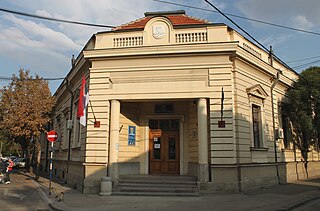
Akdağmadeni is a town and district in the Yozgat Province in the Central Anatolia region of Turkey. According to the 2000 census, population of the district is 61,373 of which 20,312 live in the town of Akdağmadeni. The district of Akdağmadeni is located in the east of the Yozgat province. It is surrounded to the north by the district of Kadışehri, in the south by Çayıralan, Sarikaya and Saraykent in the west and the Sarkisla district in the east.

Nowy Kawęczyn is a village in Skierniewice County, Łódź Voivodeship, in central Poland. It is the seat of the gmina called Gmina Nowy Kawęczyn. It lies approximately 11 kilometres (7 mi) south-east of Skierniewice and 55 km (34 mi) east of the regional capital Łódź.

Wiśniowa is a village in the administrative district of Gmina Świdnica, within Świdnica County, Lower Silesian Voivodeship, in south-western Poland. Prior to 1945 it was in Germany.

Jamno is a village in the administrative district of Gmina Szadek, within Zduńska Wola County, Łódź Voivodeship, in central Poland. It lies approximately 7 kilometres (4 mi) west of Szadek, 13 km (8 mi) north-west of Zduńska Wola, and 42 km (26 mi) west of the regional capital Łódź.

Fanisławiczki is a village in the administrative district of Gmina Łopuszno, within Kielce County, Świętokrzyskie Voivodeship, in south-central Poland. It lies approximately 9 kilometres (6 mi) south-east of Łopuszno and 22 km (14 mi) west of the regional capital Kielce.

Nowy Dwór is a village in the administrative district of Gmina Krasocin, within Włoszczowa County, Świętokrzyskie Voivodeship, in south-central Poland. It lies approximately 1 kilometre (1 mi) south-west of Krasocin, 11 km (7 mi) east of Włoszczowa, and 36 km (22 mi) west of the regional capital Kielce.

Palędzie is a village in the administrative district of Gmina Grębów, within Tarnobrzeg County, Subcarpathian Voivodeship, in south-eastern Poland. It lies approximately 2 kilometres (1 mi) east of Grębów, 15 km (9 mi) east of Tarnobrzeg, and 60 km (37 mi) north of the regional capital Rzeszów.

Witaszyn is a village in the administrative district of Gmina Wyśmierzyce, within Białobrzegi County, Masovian Voivodeship, in east-central Poland. It lies approximately 5 kilometres (3 mi) east of Wyśmierzyce, 6 km (4 mi) south-west of Białobrzegi, and 67 km (42 mi) south of Warsaw.
Leszczyna is a village in the administrative district of Gmina Strzegowo, within Mława County, Masovian Voivodeship, in east-central Poland.

Zapiecki is a village in the administrative district of Gmina Pomiechówek, within Nowy Dwór Mazowiecki County, Masovian Voivodeship, in east-central Poland. It lies approximately 10 kilometres (6 mi) east of Brody-Parcele, 16 km (10 mi) north-east of Nowy Dwór Mazowiecki, and 34 km (21 mi) north of Warsaw.
Słowików is a village in the administrative district of Gmina Przytyk, within Radom County, Masovian Voivodeship, in east-central Poland.
Baby is a village in the administrative district of Gmina Ostrów Wielkopolski, within Ostrów Wielkopolski County, Greater Poland Voivodeship, in west-central Poland.
Smardowskie Olendry is a village in the administrative district of Gmina Ostrów Wielkopolski, within Ostrów Wielkopolski County, Greater Poland Voivodeship, in west-central Poland.

Kiełpin is a village in the administrative district of Gmina Konarzyny, within Chojnice County, Pomeranian Voivodeship, in northern Poland. It lies approximately 8 kilometres (5 mi) north-west of Konarzyny, 26 km (16 mi) north-west of Chojnice, and 102 km (63 mi) south-west of the regional capital Gdańsk.

Mniszek is a village in the administrative district of Gmina Karsin, within Kościerzyna County, Pomeranian Voivodeship, in northern Poland. It lies approximately 4 kilometres (2 mi) south-east of Karsin, 27 km (17 mi) south of Kościerzyna, and 70 km (43 mi) south-west of the regional capital Gdańsk.

Leszczno is a village in the administrative district of Gmina Przybiernów, within Goleniów County, West Pomeranian Voivodeship, in north-western Poland. It lies approximately 10 kilometres (6 mi) north-east of Przybiernów, 28 km (17 mi) north of Goleniów, and 47 km (29 mi) north-east of the regional capital Szczecin.
Babin is a village in the administrative district of Gmina Trzcińsko-Zdrój, within Gryfino County, West Pomeranian Voivodeship, in north-western Poland.
Kirna is a village in Lääne-Nigula Parish, Lääne County, in western Estonia.

Idbar is a village in the municipality of Konjic, Bosnia and Herzegovina.

Dobroslavice is a village in the Moravian-Silesian Region of the Czech Republic. On March 7, 2008, the population was 709.


