
The Barrington Tops National Park is a protected national park located in the Hunter Valley, approximately 200 kilometres (120 mi) north of Sydney in New South Wales, Australia. Gazetted in 1969, the 76,512-hectare (189,070-acre) park is situated between Scone, Singleton, Dungog, Gloucester and East Gresford.

The New England National Park is a protected national park located on the Northern Tablelands in the New England region of New South Wales, Australia. The 67,303-hectare (166,310-acre) park was created in May 1935 and is situated approximately 560 kilometres (350 mi) north of Sydney, and 10 kilometres (6.2 mi) south of Waterfall Way, just 85 kilometres (53 mi) east of Armidale and 65 kilometres (40 mi) west of Coffs Harbour. The closest village to New England National Park is Ebor, located 20 kilometres (12 mi) away.

The Werrikimbe National Park is a protected national park located in the catchment zone of the Upper Hastings River in New South Wales, Australia. Gazetted in 1975, the 33,309-hectare (82,310-acre) park is situated approximately 486 kilometres (302 mi) north of Sydney, 65 kilometres (40 mi) north-west of Wauchope, and 90 kilometres (56 mi) east of Walcha on the eastern escarpment of the Great Dividing Range.

The Queensland tropical rain forests are a terrestrial ecoregion located in northeastern Australia and belonging to the Australasian realm. The forest contains the world's best living record of the major stages in the evolutionary history of the world’s land plants. The history of the evolution of marsupials and songbirds is also well represented.
The Antarctic flora is a distinct community of vascular plants which evolved millions of years ago on the supercontinent of Gondwana. It is now found on several separate areas of the Southern Hemisphere, including southern South America, southernmost Africa, New Zealand, Australia and New Caledonia. Joseph Dalton Hooker was the first to notice similarities in the flora and speculated that Antarctica had served as either a source or a transitional point, and that land masses now separated might formerly have been adjacent.

Temperate rainforests are coniferous or broadleaf forests that occur in the temperate zone and receive heavy rainfall.

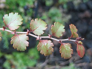
Nothofagus moorei, commonly known as Antarctic beech, is an important Gondwana relict of the rainforests of the southern hemisphere. It occurs in wet, fire-free areas at high altitude in eastern Australia.

The Mount Royal Range is a mountain range in the Hunter region of New South Wales, Australia.

Mount Banda Banda, a mountain of the Mid North Coast region of New South Wales, Australia, is situated 320 kilometres (200 mi) from Sydney within the Willi Willi National Park. Banda Banda can be seen on the north western horizon from Port Macquarie. And seen on the south western horizon 39km from the town of Kempsey. At 1,258 metres (4,127 ft) AHD it is the highest mountain in the region.
The Boorganna Nature Reserve is a protected nature reserve located northwest of Taree on the Comboyne Plateau in New South Wales, Australia. The 396-hectare (980-acre) reserve, managed by the NSW National Parks & Wildlife Service, was gazetted in 1904 and is the second oldest nature reserve in the state. The reserve features various forest types, including stands of sub tropical rainforest of which the large rosewood, yellow carabeen and small leaf fig are particularly noteworthy. The reserve is a remnant of the former extensive rainforest on the Comboyne Plateau. The plateau was cleared between 1900 and 1925. Australian red cedar was logged in the area in the nineteenth century. Originally proposed to be part of the world heritage rainforest group. The exploration, knowledge, uses and history of this area by Indigenous Australians is not well known in the present day.

Gloucester River, a perennial river and major tributary of the Manning River catchment, is located in the Mid North Coast hinterland New South Wales, Australia.

Numinbah Nature Reserve is a protected nature reserve that is located in the Northern Rivers region of New South Wales, in eastern Australia. The reserve was gazetted in December 1981 with a further addition made in 1989 to make the reserve to its current area of 858 hectares. The reserve is situated north-east of the rural locality of Numinbah, and south of the Queensland town of Springbrook and defines part of the state border between New South Wales and Queensland.

The Eastern Australian temperate forests, or temperate eucalypt forests, are an ecoregion of open forest on uplands starting from the east coast of New South Wales in the South Coast to southern Queensland, Australia. Four distinguishable communities are found within this ecoregion: subtropical rainforest, subtropical dry rainforest, warm temperate rainforest, and cool temperate rainforest, where they may also grade to other biomes, depending on the location.

Mount Cabrebald is a mountain located within the Barrington Tops National Park, in the Upper Hunter region of New South Wales, Australia. With an elevation of 1,017 metres (3,337 ft) above sea level, the mountain is situated 200 kilometres (120 mi) north of Sydney, near Singleton.

Allyn River, a perennial stream of the Hunter River catchment, is located in the Hunter region of New South Wales, Australia.

The Wingham Brush Nature Reserve is a protected nature reserve that is located in the Mid North Coast region of New South Wales, in eastern Australia. The 8-hectare (20-acre) reserve is a rare example of sub tropical lowland rainforest and is situated on the Manning River.

Careys Peak is a peak in the Williams Range, part of the Mount Royal Range, located in the Upper Hunter region of New South Wales, Australia. At 1,544 metres (5,066 ft) above sea level, it is one of the higher points in Barrington Tops National Park, some 200 kilometres (120 mi) north of Sydney. The peak is at the edge of the Barrington Tops plateau, within the declared wilderness of the World Heritage Gondwana Rainforests of Australia.

Mount Royal is situated at the southern end of the Mount Royal Range in the Barrington Tops region of eastern Australia. It is part of the World Heritage Gondwana Rainforests of Australia.

The Allyn Range is a mountain range in New South Wales, Australia. It is part of the Barrington Tops region and joins the Mount Royal Range on the Barrington Tops plateau to the north. High points on the range include Eremeren Point, Ben Bullen, Mount Gunama, Mount Lumeah and Mount Allyn.

The Copeland Tops State Conservation Area is a protected conservation area located near the Barrington Tops in the Hunter Region of New South Wales, Australia. The 2,201-hectare (5,440-acre) is situated 12 km (7 mi) west of Gloucester.
