Dome Mountain, elevation 9,903 feet (3,018 m), is a mountain peak in the southern section of the Gallatin Range in Yellowstone National Park, in the U.S. state of Wyoming.

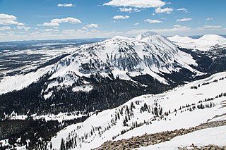
Bannock Peak is a 10,329-foot (3,148-metre) mountain summit in the southern section of the Gallatin Range in Yellowstone National Park, in the U.S. state of Wyoming. The peak ranks as the sixth-highest peak in the Gallatin Range. Precipitation runoff from the mountain drains west into headwaters of the Gallatin River and east into Panther Creek which is a tributary of the Gardner River. Topographic relief is significant as the summit rises nearly 2,000 feet above Panther Creek in one mile (1.6 km). This mountain's toponym was officially adopted in 1897 by the United States Board on Geographic Names.

Three Rivers Peak is a 9,958-foot (3,035 m) mountain summit in the southern section of the Gallatin Range in Yellowstone National Park, in the U.S. state of Wyoming.

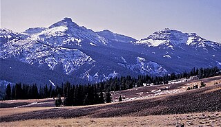
Hoyt Peak is a 10,506 feet (3,202 m) summit located on the shared border of Yellowstone National Park and North Absaroka Wilderness, in Park County, Wyoming.

Ramshorn Peak is an 11,635-foot-elevation (3,546-meter) mountain summit located in Fremont County of Wyoming, United States.

Amphitheater Mountain is a prominent 11,042-foot-elevation (3,366-meter) mountain summit located in Park County, Wyoming, United States.
Pollux Peak is an 11,063-foot-elevation (3,372-meter) mountain summit located in Yellowstone National Park, in Park County, Wyoming, United States.

Saddle Mountain is a 10,670-foot-elevation (3,250-meter) mountain summit located in Yellowstone National Park, in Park County, Wyoming, United States.

Top Notch Peak is a 10,245-foot-elevation (3,123 meter) mountain summit located in Yellowstone National Park, in Park County, Wyoming, United States.

Hoodoo Peak is a 10,571-foot-elevation (3,222-meter) mountain summit located in Park County, Wyoming, United States.

Crystal Peak is a 6,896-foot-elevation (2,102-meter) mountain summit located within Olympic National Park in Jefferson County of Washington state. Crystal Peak is situated two miles north of Enchanted Valley, near the heads of Hayes River and Quinault River. Topographic relief is significant as the northeast aspect rises 3,300 feet above Hayes River in less than one mile. Precipitation runoff from the mountain drains north to the Elwha River via Hayes River and Godkin Creek. Neighbors include line parent Chimney Peak, 2.2 mi (3.5 km) to the south, and proximate parent West Peak, 2.0 mi (3.2 km) to the east. The lower slopes of the mountain are surrounded by Western Red Cedar, Sitka Spruce, Western Hemlock, Alaskan Cedar, Mountain Hemlock, and Douglas-fir of the Quinault Rainforest.

Explorer Peak is a 12,708-foot elevation (3,873 m) mountain summit located in Duchesne County, Utah, United States.

Twin Peaks is a 10,970-foot-elevation (3,340-meter) double summit mountain located in Ouray County, Colorado, United States.
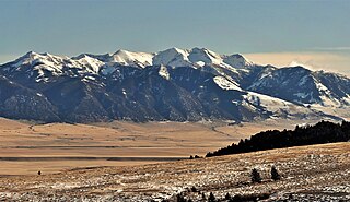
Cedar Mountain is a 10,780-foot (3,286-metre) summit located in Madison County, Montana, United States.
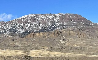
Jim Mountain is a 10,430-foot-elevation (3,179-meter) summit in Park County, Wyoming, United States.
Loaf Mountain is a 11,722-foot-elevation (3,573-meter) summit in Johnson County, Wyoming, United States.

Ramshorn Peak is a 10,296-foot (3,138-metre) mountain summit in Gallatin County, Montana, United States.

Indian Peak is a 10,929-foot-elevation (3,331-meter) mountain summit in Park County, Wyoming, United States.

Hurricane Mesa is an 11,069-foot-elevation (3,374-meter) mountain summit in Park County, Wyoming, United States.

Mount Humphreys is an 11,019-foot-elevation (3,359-meter) mountain summit in Park County, Wyoming, United States.


