
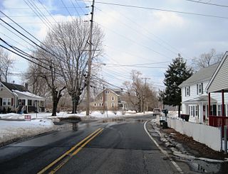
Stoutsburg is an unincorporated community located along the border of Hopewell Township in Mercer County and Montgomery Township in Somerset County, New Jersey, United States. County Route 518 passes through the community from the east and west, while Province Line Road passes through north and south. Province Line Road follows the Keith line which formerly separated the provinces of West Jersey and East Jersey, now parts of Hopewell and Montgomery townships respectively.
Etra is an unincorporated community located within East Windsor Township, in Mercer County, New Jersey, United States. The surroundings of Etra is mostly residential homes and farmland. East Windsor's largest park, Etra Lake Park, is located just east of the community.
Montrose is an unincorporated community located near the intersection of Dutch Lane Road and Boundary Road along the border of Colts Neck and Marlboro townships in Monmouth County, New Jersey, United States. The historic one-room Montrose Schoolhouse, built before 1820, is located in the Colts Neck portion of the community.

Prospertown is an unincorporated community located within the New Jersey townships of Jackson and Plumsted in Ocean County and Upper Freehold in Monmouth County. The community is home to Prospertown Lake and is adjacent to Six Flags Great Adventure, both located on County Route 537. The center of the community is located at the intersection of CR 537, Hawkin Road, and Emleys Hill Road. Most of the area consists of pine forests but there are some homes along the roads in the area.

Harbourton is a historic unincorporated community located within Hopewell Township in Mercer County, New Jersey, United States. It is located along County Route 579 at the intersection with Harbourton-Mount Airy Road. The community was added to the National Register of Historic Places in 1974.

Harts Corner is an unincorporated community located within Hopewell Township in Mercer County, New Jersey, United States. The center of the settlement is located about the intersection of Washington Crossing-Pennington Road and Scotch Road. Three of the four quadrants of the intersection contain farmland and Hopewell Township Municipal Offices, township public works, and recreational facilities occupy the remaining quadrant.
Marshalls Corner is an unincorporated community located within Hopewell Township in Mercer County, New Jersey, United States. and is centered about the intersection of Pennington-Hopewell Road and Woodsville-Marshalls Corner Road. The community has many residences, a Kooltronic manufacturing facility, and is the site of the vacant Pennytown Shopping Center. The proposed redevelopment of Pennytown as a housing complex is controversial to residents due to concerns about increased traffic and site drainage.

Coopers Corner is an unincorporated community located within Hopewell Township in Mercer County, New Jersey, United States. The settlement is centered about the intersection of County Routes 518 and 579.

Ackors Corner is an unincorporated community located within Hopewell Township in Mercer County, New Jersey, United States. The settlement is located at the intersection of Bear Tavern Road / Trenton-Harbourton Road, Pennington-Harbourton Road and Pleasant Valley Road. It is named for the Ackors family which owned land near the current intersection. Small residences and farmland make up the area surrounding Ackors Corner but the area rises in elevation from east to west as one approaches Baldpate Mountain, part of the Sourland Mountain range.

Glenmoore is an unincorporated community located within Hopewell Township in Mercer County, New Jersey, United States. Single-family homes make up most of the land in the area though two golf courses, the Hopewell Valley Golf Club and the Stonybrook Golf Club, are located in Glenmoore. The settlement is centered about the intersection of Pennington-Hopewell Road and Moores Mill-Mount Rose Road.
Moore is an unincorporated community located within Hopewell Township in Mercer County, New Jersey, United States.

New Canton is an unincorporated community located along the border of Robbinsville Township in Mercer County and Upper Freehold Township in Monmouth County, New Jersey, United States. The area was once known as Cabbagetown and has been settled since the 18th century. The settlement is located at the intersection of Old York Road and New Canton-Stone Tavern Road just north of Interstate 195's interchange 8. The Upper Freehold side of the area contains farmland and new housing developments while the Robbinsville side features new commercial warehouse buildings including an Amazon.com Fulfillment Center opened in July 2014.
Zion is an unincorporated community along the border of Hillsborough Township and Montgomery Township in Somerset County, New Jersey, United States. It is located on Rock Brook, approximately 3 mi (4.8 km) north of Hopewell.

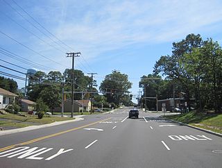
East Spotswood, also known as the settlement of Old Bridge, is an unincorporated community located within East Brunswick, New Jersey and Old Bridge townships in Middlesex County, New Jersey, United States. The area is made up of homes, businesses, and wetlands for the South River. The area is located at the junction of New Jersey Route 18, County Route 527, the western end of CR 516, and the Bordentown and South Amboy Turnpike. The still-active Jamesburg Branch of the former Camden & Amboy Railroad also runs through the community.

Centerville is an unincorporated community located along the border of Hazlet and Holmdel townships in Monmouth County, New Jersey, United States.

Oak Glen is an unincorporated community located within Howell Township in Monmouth County, New Jersey, United States. The area consists mostly of forest and single-family homes along the four roads that run through the area; Oak Glen Road, Old Tavern Road, Aldrich Road, and Windeler Road. The settlement is located between Interstate 195 and Manasquan Reservoir County Park.
North Centerville is an unincorporated community located within Hazlet Township in Monmouth County, New Jersey, United States. Like most of Hazlet, North Centerville is largely suburban. The settlement is located at the intersection of Middle Road and Union Avenue in the center of the township.

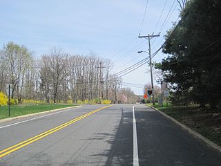
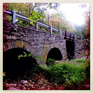
Spring Mill is an unincorporated community located within Upper Freehold Township in Monmouth County, New Jersey, United States. The settlement is located along County Route 524 between Hamilton Township and Allentown on a commercialized segment of the road originally built as New Jersey Route 37. A vestige of the state construction remains along the road through a wide right-of-way and a bridge crossing Doctor's Creek stating that it was constructed by the state in 1940 for State Highway Route 37.
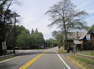
Stone Church is an unincorporated community located in Middletown Township in Monmouth County, New Jersey, United States, within the census-designated place of Navesink. The settlement is located at the intersection of Valley Road and Locust Avenue, Navesink Avenue, and Monmouth Avenue. In the center of the community, the historic All Saint's Memorial Episcopal Church built in 1864 sits at the main intersection. The remainder of the area consists of single-family houses and forests on the slopes of nearby Mount Mitchill.

Ellisdale is an unincorporated community located along the border of North Hanover Township in Burlington County and Upper Freehold Township in Monmouth County, in New Jersey, United States. The community is centered about the intersection of Province Line Road and Hill Road / Ellisdale-Crosswicks Road. The Crosswicks Creek runs to the north of the settlement and the nearby Ellisdale Fossil Site takes its name from Ellisdale.


