
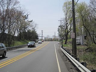
Stoutsburg is an unincorporated community located along the border of Hopewell Township in Mercer County and Montgomery Township in Somerset County, New Jersey, United States. County Route 518 passes through the community from the east and west, while Province Line Road passes through north and south. Province Line Road follows the Keith line which formerly separated the provinces of West Jersey and East Jersey, now parts of Hopewell and Montgomery townships respectively.

Holmeson is an unincorporated community located within Millstone Township in Monmouth County, New Jersey, United States. As it is located along County Route 537 through which the Monmouth–Ocean county line runs down the center, portions of the community are also located in Jackson Township. Owing to its location near Interstate 195 and Six Flags Great Adventure, the community is mostly made up of gas stations, restaurants, and small businesses though the Jackson Premium Outlets occupies land just south of the community.
Smithburg is an unincorporated community located where the municipal boundaries of Freehold, Manalapan and Millstone townships intersect in Monmouth County, New Jersey, United States. County Route 527 and Monmouth Road pass through the center of the quaint village of Smithburg.

Extonville is an unincorporated community located within Hamilton Township in Mercer County, New Jersey, United States. Most of the area is farmland though there are some residential homes in the area. The community is centered about the intersection of Extonville Road and Ellisdale Road.
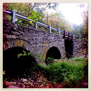
North Crosswicks is an unincorporated community located within Hamilton Township in Mercer County, New Jersey, United States. Residential homes, a cemetery, and farmland make up the area around North Crosswicks. Located across the Crosswicks Creek from the Chesterfield Township settlement of Crosswicks, a covered bridge formerly connected the two localities.
Millstone is an unincorporated community located within East Windsor Township in Mercer County, New Jersey, United States. Located in the northern portion of the township near Old Cranbury Road, U.S. Route 130, and New Jersey Route 133, it is a planned community constructed in the 1960s.

Glenmoore is an unincorporated community located within Hopewell Township in Mercer County, New Jersey, United States. Single-family homes make up most of the land in the area though two golf courses, the Hopewell Valley Golf Club and the Stonybrook Golf Club, are located in Glenmoore. The settlement is centered about the intersection of Pennington-Hopewell Road and Moores Mill-Mount Rose Road.

Hillside Terrace is an unincorporated community located within Robbinsville Township in Mercer County, New Jersey, United States. The community consists of single-family houses on both sides of Robbinsville-Allentown Road between U.S. Route 130 and the New Jersey Turnpike. The original section of the neighborhood near the intersection of CR 526 and Spring Garden Road was constructed between the late 1950s and the early 1960s. A more modern subdivision was constructed on the southwestern side of CR 526 by 1995 consisting of larger homes.
Carsons Mills is an unincorporated community located within Robbinsville Township in Mercer County, New Jersey, United States. The community is located at the junctions of the Assunpink Creek and the New Sharon Branch creek and Sharon Road and Windsor Road southeast of the New Jersey Turnpike. Developed areas nearby include small residences and farmland while the undeveloped areas are forest and floodplains as a part of the Assunpink Wildlife Management Area.

New Canton is an unincorporated community located along the border of Robbinsville Township in Mercer County and Upper Freehold Township in Monmouth County, New Jersey, United States. The area was once known as Cabbagetown and has been settled since the 18th century. The settlement is located at the intersection of Old York Road and New Canton-Stone Tavern Road just north of Interstate 195's interchange 8. The Upper Freehold side of the area contains farmland and new housing developments while the Robbinsville side features new commercial warehouse buildings including an Amazon.com Fulfillment Center opened in July 2014.

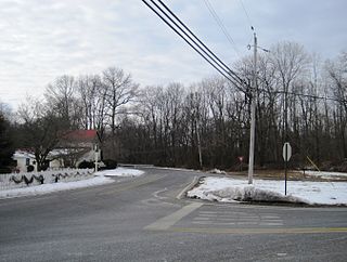
Pages Corners or Pages Corner is an unincorporated community located within Robbinsville Township in Mercer County, New Jersey, United States. The intersection defining the corners is at Sharon Road and Gordon Road. The intersection is at a skewed angle which led to numerous accidents. The township installed a traffic signal at the intersection and activated it on September 25, 2015.
Quaker Bridge is an unincorporated community located along the border of Hamilton Township and Lawrence Township in Mercer County, New Jersey, United States. The Quaker Bridge Mall is located nearby.
Zion is an unincorporated community along the border of Hillsborough Township and Montgomery Township in Somerset County, New Jersey, United States. It is located on Rock Brook, approximately 3 mi (4.8 km) north of Hopewell.

Emleys Hill is an unincorporated community located within Upper Freehold Township in Monmouth County, New Jersey, United States. The settlement is located at the intersection of Emleys Hill Road and Burlington Path Road.
Croton is an unincorporated community located along the border of Delaware and Raritan townships in Hunterdon County, New Jersey, United States. County Route 579 is the main north–south road through the area which consists of mostly forest within the Hunterdon Plateau and some houses and businesses along Route 579 and nearby New Jersey Route 12. The headwaters of the Wickecheoke Creek are located northeast of Croton before it heads downstream through the community on its way to the Delaware River.

McCrea Mills is an unincorporated community located within Readington Township in Hunterdon County, New Jersey, United States.
Scrappy Corner is an unincorporated community located along the border of Lebanon Township in Hunterdon County and Washington Township in Morris County, New Jersey, United States.

Fairfield is an unincorporated community located within Howell Township in Monmouth County, New Jersey, United States. The community is centered on the intersection of County Route 524 (CR 524) and Ketchum Road, where the Colonial Era Our House Tavern is located. The area includes several small businesses, township offices and schools. There are also small farms and residential developments in the area. Fairfield was a stop on the Freehold and Jamesburg Agricultural Railroad

Sharon is an unincorporated community located within Upper Freehold Township in Monmouth County, New Jersey, United States. Located at the intersection of Herbert Road and Sharon Station Road, the settlement is the site of a former stop on the Pemberton and Hightstown Railroad. Except for a few single-family homes in the area, most of the area is farmland. The railroad has since been abandoned and is being converted to the Union Transportation Trail, a rail trail. Sharon is the current northern terminus of the trail.

Ellisdale is an unincorporated community located along the border of North Hanover Township in Burlington County and Upper Freehold Township in Monmouth County, in New Jersey, United States. The community is centered about the intersection of Province Line Road and Hill Road / Ellisdale-Crosswicks Road. The Crosswicks Creek runs to the north of the settlement and the nearby Ellisdale Fossil Site takes its name from Ellisdale.


