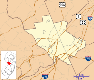
Ewing Township is a township in Mercer County, New Jersey, United States. The township is within the New York metropolitan area as defined by the United States Census Bureau. It also directly borders the Philadelphia metropolitan area and is part of the Federal Communications Commission's Philadelphia Designated Market Area. As of the 2010 United States Census, the township's population was 35,790, reflecting an increase of 83 (+0.2%) from the 35,707 counted in the 2000 Census, which had increased by 1,522 (+4.5%) from the 34,185 counted in the 1990 Census.

Mercerville is an unincorporated community and census-designated place (CDP) located within Hamilton Township, in Mercer County, New Jersey, United States. As of the 2010 United States Census, the CDP's population was 13,230. Until after the 2000 Census, the area was part of the Mercerville-Hamilton Square CDP. For the 2010 Census it was split into two CDPs, Mercerville and Hamilton Square.

Stoutsburg is an unincorporated community located along the border of Hopewell Township in Mercer County and Montgomery Township in Somerset County, New Jersey, United States. County Route 518 passes through the community from the east and west, while Province Line Road passes through north and south. Province Line Road follows the Keith line which formerly separated the provinces of West Jersey and East Jersey, now parts of Hopewell and Montgomery townships respectively.
Etra is an unincorporated community located within East Windsor Township, in Mercer County, New Jersey, United States. It consists mostly of residential homes and farmland. East Windsor's largest park, Etra Lake Park, is located just east of the community.
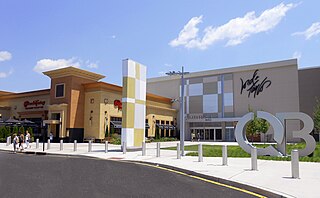
Clarksville is an unincorporated community partially in Lawrence Township, and partially in West Windsor Township, in Mercer County, New Jersey, United States. It was historically centered at the intersection of the Trenton-New Brunswick Turnpike, Quakerbridge Road and Province Line Road, and had a blacksmith shop, saloon, store, hotel and school. Today, Clarksville is dominated by several large shopping centers, including the Quaker Bridge Mall.

Yardville Heights is an unincorporated community located within the Yardville CDP of Hamilton Township in Mercer County, New Jersey, United States. It is mostly a residential development located along South Broad Street (County Route 524 west of downtown Yardville. There are some businesses located along South Broad Street in addition to the Hamilton Township School District's Yardville Heights Elementary School.

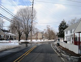
Centerville is an unincorporated community located within Hopewell Township in Mercer County, New Jersey, United States. The community is located at the intersection of Pennington-Rocky Hill Road and Titus Mill Road. Bristol-Myers Squibb's Hopewell Campus is located in Centerville.

Harneys Corner is an unincorporated community located within Lawrence Township in Mercer County, New Jersey, United States. It is located at the intersection of Lawrence Road and Princeton Pike / Avenue. Located in the southern portion of the township close to the Trenton and Ewing borders, the area consists of small houses on nearby side streets and businesses along the aforementioned arterial roads. The intersection itself is located about 0.3 miles (0.48 km) north of the Brunswick Circle.

Lewisville is an unincorporated community located within Lawrence Township in Mercer County, New Jersey, United States. The settlement is located along Lewisville Road near its intersection with Franklin Corner Road. A portion of The Lawrenceville School campus is within Lewisville as are residences and small office buildings.
Millstone is an unincorporated community located within East Windsor Township in Mercer County, New Jersey, United States. Located in the northern portion of the township near Old Cranbury Road, U.S. Route 130, and New Jersey Route 133, it is a planned community constructed in the 1960s.

Ackors Corner is an unincorporated community located within Hopewell Township in Mercer County, New Jersey, United States. The settlement is located at the intersection of Bear Tavern Road / Trenton-Harbourton Road, Pennington-Harbourton Road and Pleasant Valley Road. It is named for the Ackors family which owned land near the current intersection. Small residences and farmland make up the area surrounding Ackors Corner but the area rises in elevation from east to west as one approaches Baldpate Mountain, part of the Sourland Mountain range.

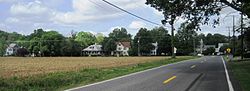
New Canton is an unincorporated community located along the border of Robbinsville Township in Mercer County and Upper Freehold Township in Monmouth County, New Jersey, United States. The area was once known as Cabbagetown and has been settled since the 18th century. The settlement is located at the intersection of Old York Road and New Canton-Stone Tavern Road just north of Interstate 195's interchange 8. The Upper Freehold side of the area contains farmland and new housing developments while the Robbinsville side features new commercial warehouse buildings including an Amazon.com Fulfillment Center opened in July 2014.

New Sharon is an unincorporated community located along the border of Robbinsville Township in Mercer County and Upper Freehold Township in Monmouth County, New Jersey, United States. Old York Road passes through the center of the community.

Pages Corners or Pages Corner is an unincorporated community located within Robbinsville Township in Mercer County, New Jersey, United States. The intersection defining the corners is at Sharon Road and Gordon Road. The intersection is at a skewed angle which led to numerous accidents. The township installed a traffic signal at the intersection and activated it on September 25, 2015.
Quaker Bridge is an unincorporated community located along the border of Hamilton Township and Lawrence Township in Mercer County, New Jersey, United States. The Quaker Bridge Mall is located nearby.
Lawrence Station is an unincorporated community located within Lawrence Township in Mercer County, New Jersey, United States. The settlement is named for a former railroad station on the Pennsylvania Railroad's New York Division line, now a part of the Northeast Corridor. Today, some wooded areas and buildings from the time of the station remain but more townhouse developments, cultural centers, and industrial facilities are located along the main road through the area, Lawrence Station Road.
Zion is an unincorporated community along the border of Hillsborough Township and Montgomery Township in Somerset County, New Jersey, United States. It is located on Rock Brook, approximately 3 mi (4.8 km) north of Hopewell.

Rockefellows Mills is an unincorporated community located within Raritan Township in Hunterdon County, New Jersey, United States. The settlement is located along the South Branch Raritan River near Three Bridges. The river is spanned in the area by a 1910-constructed Pratt through truss bridge. Most of the area within the Raritan Township side of the river is forested however on the north side of the river in Readington Township, some farmland dots the area.

Sharon is an unincorporated community located within Upper Freehold Township in Monmouth County, New Jersey, United States. Located at the intersection of Herbert Road and Sharon Station Road, the settlement is the site of a former stop on the Pemberton and Hightstown Railroad. Except for a few single-family homes in the area, most of the area is farmland. The railroad has since been abandoned and is being converted to the Union Transportation Trail, a rail trail. Sharon is the current northern terminus of the trail.

Ellisdale is an unincorporated community located along the border of North Hanover Township in Burlington County and Upper Freehold Township in Monmouth County, in New Jersey, United States. The community is centered about the intersection of Province Line Road and Hill Road / Ellisdale-Crosswicks Road. The Crosswicks Creek runs to the north of the settlement and the nearby Ellisdale Fossil Site takes its name from Ellisdale.