East Windsor Township, New Jersey | |
---|---|
Township of East Windsor | |
Coordinates: 40°15′33″N74°32′01″W / 40.259139°N 74.533576°W Coordinates: 40°15′33″N74°32′01″W / 40.259139°N 74.533576°W [1] [2] | |
Country | United States |
State | New Jersey |
County | Mercer |
Formed | February 9, 1797 |
Incorporated | February 21, 1798 |
Named for | Windsor, England / Windsor Township |
Government | |
• Type | Faulkner Act (council–manager) |
• Body | Township Council |
• Mayor | Janice S. Mironov (D, term ends December 31, 2020) [4] [5] |
• Manager | James Brady [6] |
• Municipal clerk | Kelly Lettera [6] |
Area | |
• Total | 15.66 sq mi (40.55 km2) |
• Land | 15.57 sq mi (40.32 km2) |
• Water | 0.09 sq mi (0.23 km2) 0.57% |
Area rank | 172nd of 565 in state 7th of 12 in county [1] |
Elevation | 102 ft (31 m) |
Population | |
• Total | 27,190 |
• Estimate (2019) [11] | 27,288 |
• Rank | 86th of 565 in state 5th of 13 in county [12] |
• Density | 1,737.6/sq mi (670.9/km2) |
• Density rank | 308th of 565 in state 7th of 12 in county [12] |
Time zone | UTC−05:00 (Eastern (EST)) |
• Summer (DST) | UTC−04:00 (Eastern (EDT)) |
ZIP Code | 08512 & 08520 [13] |
Area code(s) | 609 [14] |
FIPS code | 3402119780 [1] [15] [16] |
GNIS feature ID | 0882123 [1] [17] |
Website | www |
East Windsor Township is a township in Mercer County, New Jersey, United States. Located within the Raritan Valley region, the township is an outer-ring suburb of New York City in the New York Metropolitan area, as defined by the United States Census Bureau, [18] but directly borders the Philadelphia metropolitan area and is part of the Federal Communications Commission's Philadelphia Designated Market Area. [19] As of the 2010 United States Census, the township's population was 27,190, [8] [9] reflecting an increase of 2,271 (+9.1%) from the 24,919 counted in the 2000 Census, which had in turn increased by 2,566 (+11.5%) from the 22,353 counted in the 1990 Census. [20]
Both East Windsor Township and West Windsor Township were formed when Windsor Township was split on February 9, 1797, while the area was still part of Middlesex County. It was incorporated by an act of the New Jersey Legislature on February 21, 1798, as one of New Jersey's initial group of 104 townships. Portions of the township were taken to form Hightstown borough (March 5, 1853, within East Windsor; became independent c. 1894) and Washington Township (March 11, 1860, and known as Robbinsville Township since 2007). [21] The township was named for Windsor Township, which was named for Windsor, England. [22]
According to the United States Census Bureau, the township had a total area of 15.66 square miles (40.55 km2), including 15.57 square miles (40.32 km2) of land and 0.09 square miles (0.23 km2) of water (0.57%). [1] [2]
Twin Rivers (2010 Census population of 7,443 [23] ) is an unincorporated community and census-designated place (CDP) located within East Windsor Township. [24] According to "New Jersey: A Guide to the State" by Barbara Westergaard, Twin Rivers was "New Jersey's first planned unit development" and "has attracted the scrutiny of countless researchers, from sociologists and anthropologists to specialists in energy conservation." Other unincorporated communities, localities and place names located completely or partially within East Windsor include Allens Station,[ citation needed ] Eilers Corner, Etra, Hickory Corner, Locust Corner, Millstone [ citation needed ] and Washington Oak. [25]
The township borders Robbinsville Township and West Windsor Township in Mercer County; Cranbury Township, Monroe Township and Plainsboro Township in Middlesex County; and both Millstone Township and Upper Freehold Township in Monmouth County. [26] [27] [28] East Windsor completely surrounds the independent borough of Hightstown, making it part one of 21 pairs of "doughnut towns" in the state, where one municipality entirely surrounds another. [29]
The Meadow Lakes continuing care retirement community occupies a 100-acre (40 ha) site that straddles the East Windsor-Hightstown boundary line. [30]
According to the A. W. Kuchler U.S. potential natural vegetation types, East Windsor Township, New Jersey would have an Appalachian Oak (104) vegetation type with an Eastern Hardwood Forest (25) vegetation form. [31]
According to the Köppen climate classification system, East Windsor Township, New Jersey has a hot-summer, wet all year, humid continental climate (Dfa). Dfa climates are characterized by at least one month having an average mean temperature ≤ 32.0 °F (≤ 0.0 °C), at least four months with an average mean temperature ≥ 50.0 °F (≥ 10.0 °C), at least one month with an average mean temperature ≥ 71.6 °F (≥ 22.0 °C), and no significant precipitation difference between seasons. During the summer months, episodes of extreme heat and humidity can occur with heat index values ≥ 100 °F (≥ 38 °C). On average, the wettest month of the year is July which corresponds with the annual peak in thunderstorm activity. During the winter months, episodes of extreme cold and wind can occur with wind chill values < 0 °F (< -18 °C). The plant hardiness zone at the East Windsor Township Municipal Court is 7a with an average annual extreme minimum air temperature of 0.0 °F (-17.8 °C). [32] The average seasonal (November–April) snowfall total is 24 to 30 inches (610 to 760 mm), and the average snowiest month is February which corresponds with the annual peak in nor'easter activity.
Climate data for East Windsor Township Municipal Court, Mercer County, NJ (1981-2010 Averages) | |||||||||||||
---|---|---|---|---|---|---|---|---|---|---|---|---|---|
Month | Jan | Feb | Mar | Apr | May | Jun | Jul | Aug | Sep | Oct | Nov | Dec | Year |
Average high °F (°C) | 39.7 (4.3) | 43.0 (6.1) | 51.1 (10.6) | 62.7 (17.1) | 72.6 (22.6) | 81.7 (27.6) | 86.1 (30.1) | 84.4 (29.1) | 77.5 (25.3) | 66.3 (19.1) | 55.5 (13.1) | 44.3 (6.8) | 63.8 (17.7) |
Daily mean °F (°C) | 31.3 (−0.4) | 34.0 (1.1) | 41.3 (5.2) | 51.6 (10.9) | 61.3 (16.3) | 70.7 (21.5) | 75.4 (24.1) | 73.8 (23.2) | 66.6 (19.2) | 55.1 (12.8) | 45.7 (7.6) | 36.0 (2.2) | 53.7 (12.1) |
Average low °F (°C) | 22.9 (−5.1) | 24.9 (−3.9) | 31.5 (−0.3) | 40.6 (4.8) | 49.9 (9.9) | 59.7 (15.4) | 64.6 (18.1) | 63.3 (17.4) | 55.6 (13.1) | 44.0 (6.7) | 35.9 (2.2) | 27.6 (−2.4) | 43.5 (6.4) |
Average precipitation inches (mm) | 3.38 (86) | 2.63 (67) | 4.10 (104) | 4.03 (102) | 4.09 (104) | 4.32 (110) | 5.05 (128) | 4.12 (105) | 4.18 (106) | 3.74 (95) | 3.56 (90) | 3.85 (98) | 47.05 (1,195) |
Average relative humidity (%) | 65.6 | 62.4 | 58.6 | 58.7 | 63.0 | 67.5 | 67.5 | 70.2 | 71.0 | 70.3 | 68.2 | 67.5 | 65.9 |
Average dew point °F (°C) | 21.1 (−6.1) | 22.5 (−5.3) | 27.9 (−2.3) | 37.6 (3.1) | 48.6 (9.2) | 59.4 (15.2) | 63.9 (17.7) | 63.5 (17.5) | 56.9 (13.8) | 45.6 (7.6) | 35.8 (2.1) | 26.3 (−3.2) | 42.5 (5.8) |
Source: PRISM Climate Group [33] |
Historical population | |||
---|---|---|---|
Census | Pop. | %± | |
1810 | 1,747 | — | |
1820 | 1,710 | −2.1% | |
1830 | 1,903 | 11.3% | |
1840 | 1,989 | 4.5% | |
1850 | 2,596 | 30.5% | |
1860 | 943 | * | −63.7% |
1870 | 1,036 | 9.9% | |
1880 | 916 | −11.6% | |
1890 | 881 | −3.8% | |
1900 | 894 | 1.5% | |
1910 | 941 | 5.3% | |
1920 | 733 | −22.1% | |
1930 | 922 | 25.8% | |
1940 | 845 | −8.4% | |
1950 | 1,284 | 52.0% | |
1960 | 2,298 | 79.0% | |
1970 | 11,736 | 410.7% | |
1980 | 21,041 | 79.3% | |
1990 | 22,353 | 6.2% | |
2000 | 24,919 | 11.5% | |
2010 | 27,190 | 9.1% | |
2020 | 30,045 | 10.5% | |
Population sources: 1810-1920 [34] 1840 [35] 1850-1870 [36] 1850 [37] 1870 [38] 1880-1890 [39] 1890-1910 [40] 1910-1930 [41] 1930-1990 [42] 2000 [43] [44] 2010 [8] [9] [10] * = Lost territory in previous decade [21] 2020 [45] |
The 2010 United States census counted 27,190 people, 10,224 households, and 7,167 families in the township. The population density was 1,737.6 per square mile (670.9/km2). There were 10,851 housing units at an average density of 693.4 per square mile (267.7/km2). The racial makeup was 62.08% (16,880) White, 8.62% (2,343) Black or African American, 0.53% (145) Native American, 17.66% (4,802) Asian, 0.06% (16) Pacific Islander, 8.31% (2,260) from other races, and 2.74% (744) from two or more races. Hispanic or Latino of any race were 19.64% (5,340) of the population. [8]
Of the 10,224 households, 34.7% had children under the age of 18; 56.3% were married couples living together; 10.1% had a female householder with no husband present and 29.9% were non-families. Of all households, 25.0% were made up of individuals and 9.5% had someone living alone who was 65 years of age or older. The average household size was 2.65 and the average family size was 3.18. [8]
24.2% of the population were under the age of 18, 6.7% from 18 to 24, 30.7% from 25 to 44, 26.8% from 45 to 64, and 11.6% who were 65 years of age or older. The median age was 38.2 years. For every 100 females, the population had 95.2 males. For every 100 females ages 18 and older there were 92.1 males. [8]
The Census Bureau's 2006-2010 American Community Survey showed that (in 2010 inflation-adjusted dollars) median household income was $84,503 (with a margin of error of +/- $4,345) and the median family income was $100,411 (+/- $4,485). Males had a median income of $70,057 (+/- $6,291) versus $44,089 (+/- $2,948) for females. The per capita income for the borough was $37,876 (+/- $1,490). About 3.0% of families and 5.0% of the population were below the poverty line, including 4.2% of those under age 18 and 5.4% of those age 65 or over. [46]
As of the 2000 United States Census [15] there were 24,919 people, 9,448 households, and 6,556 families residing in the township. The population density was 1,592.8 people per square mile (614.8/km2). There were 9,880 housing units at an average density of 631.5 per square mile (243.8/km2). The racial makeup of the township was 74.42% White, 8.90% African American, 0.20% Native American, 9.55% Asian, 0.12% Pacific Islander, 4.61% from other races, and 2.20% from two or more races. Hispanic or Latino of any race were 14.28% of the population. [43] [44]
There were 9,448 households, out of which 34.2% had children under the age of 18 living with them, 55.6% were married couples living together, 9.6% had a female householder with no husband present, and 30.6% were non-families. 24.6% of all households were made up of individuals, and 6.6% had someone living alone who was 65 years of age or older. The average household size was 2.61 and the average family size was 3.12. [43] [44]
The population of the township was spread out, with 24.0% under the age of 18, 7.6% from 18 to 24, 35.2% from 25 to 44, 24.9% from 45 to 64, and 8.3% who were 65 years of age or older. The median age was 36 years. For every 100 females, there were 95.2 males. For every 100 females age 18 and over, there were 91.6 males. [43] [44]
The median income for a household in the township was $63,616, and the median income for a family was $73,461. Males had a median income of $50,875 versus $35,260 for females. The per capita income for the township was $28,695. About 2.8% of families and 5.3% of the population were below the poverty line, including 4.3% of those under age 18 and 8.1% of those age 65 or over. [43] [44]
Pharmaceutical firms located in East Windsor include Hovione, CoreTech, Aprecia, Sabinsa, Novotec and Windsor Labs. [47]
Working Dog Winery is a vineyard and winery that dates back to a group established in 2001 that began with 3 acres (1.2 ha) of land planted with Cabernet Franc and Chardonnay grapes. [48]
East Windsor Township has been governed since 1970 [49] within the Faulkner Act, formally known as the Optional Municipal Charter Law, under the Council-Manager form of government. The township is one of 42 municipalities (of the 565) statewide that use this form of government. [50] The Council is comprised of seven members elected at-large for four-year terms of office on a staggered basis, with either three or four seats up for vote in odd-numbered years as part of the November general election. [49] In a reorganization meeting held each January, the council selects a mayor and a deputy mayor from among its members for a one-year term. [49] [3] [51]
As of 2020 [update] , members of the East Windsor Township Council are Mayor Janice S. Mironov (D, term on council ends December 31, 2023; term as mayor ends 2020), Deputy Mayor Marc Lippman (D, term on council ends 2023; term as deputy mayor ends 2020), Denise Daniels (D, 2021), Alan Rosenberg (D, 2021), Perry M. Shapiro (D, 2021), Peter V. Yeager (D, 2023) and John Zoller (D, 2023). [4] [52] [53] [54] [55]
In December 2015, the Township Council appointed Denise Daniels to fill the seat expiring in December 2017 that became vacant following the death of Hector Duke earlier that month. [56]
Designed during the 1970s energy crisis and constructed in 1982, the township's municipal building was erected within a landscaped man-made hill, with only its south side exposed. The design allows the building to maintain a comfortable climate inside for most of the year, with greatly reduced energy needs. [57] The passive solar design allows the building to reduce energy consumption by 60% compared to conventional office buildings of the same size. [58]
East Windsor is served by East Windsor Rescue Squad District I (Squad 142) [59] and Rescue Squad District II (Squad 146). [60] Fire protection is provided by East Windsor Volunteer Fire Department 1 (Station 42) [61] and Volunteer Fire Department 2 (Station 46). [62] The Township is split for faster response times, with Rescue Squad District II and Fire Department 2 serving Twin Rivers and the eastern portion of the Township. [63]
The East Windsor Police Department, located on One Mile Road, is led by Chief James A. Geary, [64] and employs 37 uniformed patrol and Traffic Enforcement Officers, 9 Detectives, 7 Dispatchers and Communications Officers and one Animal Control Officer, for a total of 47 sworn officers. [65]
East Windsor Township is located in the 12th Congressional District [66] and is part of New Jersey's 14th state legislative district. [9] [67] [68] Prior to the 2011 reapportionment following the 2010 Census, East Windsor Township had been in the 12th state legislative district. [69] Prior to the 2010 Census, East Windsor Township had been part of the 4th Congressional District , a change made by the New Jersey Redistricting Commission that took effect in January 2013, based on the results of the November 2012 general elections. [69]
For the 117th United States Congress , New Jersey's Twelfth Congressional District is represented by Bonnie Watson Coleman ( D , Ewing Township ). [70] [71] New Jersey is represented in the United States Senate by Democrats Cory Booker ( Newark , term ends 2027) [72] and Bob Menendez ( Harrison , term ends 2025). [73] [74]
For the 2020–2021 session , the 14th Legislative District of the New Jersey Legislature is represented in the State Senate by Linda R. Greenstein ( D , Plainsboro Township ) and in the General Assembly by Daniel R. Benson (D, Hamilton Township, Mercer County ) and Wayne DeAngelo (D, Hamilton Township, Mercer County). [75] [76]
Mercer County is governed by a County Executive who oversees the day-to-day operations of the county and by a seven-member Board of Chosen Freeholders that acts in a legislative capacity, setting policy. All officials are chosen at-large in partisan elections, with the executive serving a four-year term of office while the freeholders serve three-year terms of office on a staggered basis, with either two or three seats up for election each year. [77] As of 2014 [update] , the County Executive is Brian M. Hughes ( D , term ends December 31, 2015; Princeton ). [78] Mercer County's Freeholders are Freeholder Chair Andrew Koontz (D, 2016; Princeton), [79] Freeholder Vice Chair Samuel T. Frisby, Sr. (2015; Trenton ), [80] Ann M. Cannon (2015; East Windsor Township ), [81] Anthony P. Carabelli (2016; Trenton), [82] John A. Cimino (2014, Hamilton Township ), [83] Pasquale "Pat" Colavita, Jr. (2015; Lawrence Township ) [84] and Lucylle R. S. Walter (2014; Ewing Township ) [85] [86] [87] Mercer County's constitutional officers are County Clerk Paula Sollami-Covello (D, 2015), [88] Sheriff John A. Kemler (D, 2014) [89] and Surrogate Diane Gerofsky (D, 2016). [90] [91]
As of March 23, 2011, there were a total of 14,729 registered voters in East Windsor Township, of which 5,194 (35.3%) were registered as Democrats, 2,120 (14.4%) were registered as Republicans and 7,396 (50.2%) were registered as Unaffiliated. There were 19 voters registered to other parties. [92]
Year | Republican | Democratic | Third Parties |
---|---|---|---|
2016 [93] | 30.6% 3,609 | 65.9%7,779 | 3.6% 424 |
2012 [94] | 32.7% 3,548 | 66.0%7,156 | 1.3% 143 |
2008 [95] | 31.4% 3,624 | 66.5%7,659 | 1.2% 136 |
2004 [96] | 37.7% 3,923 | 59.5%6,180 | 0.7% 93 |
In the 2012 presidential election, Democrat Barack Obama received 66.0% of the vote (7,156 cast), ahead of Republican Mitt Romney with 32.7% (3,548 votes) and other candidates with 1.3% (143 votes), among the 11,821 ballots cast by the township's 15,852 registered voters (974 ballots were spoiled), for a turnout of 74.6%. [94] [97] In the 2008 presidential election, Democrat Barack Obama received 66.5% of the vote (7,659 cast), ahead of Republican John McCain with 31.4% (3,624 votes) and other candidates with 1.2% (136 votes), among the 11,524 ballots cast by the township's 15,401 registered voters, for a turnout of 74.8%. [95] In the 2004 presidential election, Democrat John Kerry received 59.5% of the vote (6,180 ballots cast), outpolling Republican George W. Bush with 37.7% (3,923 votes) and other candidates with 0.7% (93 votes), among the 10,394 ballots cast by the township's 14,028 registered voters, for a turnout percentage of 74.1. [96]
Year | Republican | Democratic | Third Parties |
---|---|---|---|
2017 [98] | 35.7% 2,321 | 62.3%4,050 | 2.1% 134 |
2013 [99] | 58.4%3,736 | 39.7% 2,537 | 1.9% 119 |
2009 [100] | 45.5% 3,319 | 47.2%3,439 | 6.7% 490 |
2005 [101] | 39.1% 2,602 | 56.0%3,722 | 4.8% 323 |
In the 2013 gubernatorial election, Republican Chris Christie received 58.4% of the vote (3,736 cast), ahead of Democrat Barbara Buono with 39.7% (2,537 votes) and other candidates with 1.9% (119 votes), among the 6,536 ballots cast by the township's 15,663 registered voters (144 ballots were spoiled), for a turnout of 41.7%. [99] [102] In the 2009 gubernatorial election, Democrat Jon Corzine received 47.2% of the vote (3,439 ballots cast), ahead of Republican Chris Christie with 45.5% (3,319 votes), Independent Chris Daggett with 5.6% (411 votes) and other candidates with 1.1% (79 votes), among the 7,288 ballots cast by the township's 14,999 registered voters, yielding a 48.6% turnout. [100]
Students in public school for pre-kindergarten through twelfth grade attend the East Windsor Regional School District. [103] The comprehensive school district serves students from East Windsor Township and Hightstown, along with students in grades 7 - 12 from Roosevelt (in Monmouth County) who attend as part of a sending/receiving relationship. [104] As of the 2017–18 school year, the district, comprised of six schools, had an enrollment of 5,231 students and 427.9 classroom teachers (on an FTE basis), for a student–teacher ratio of 12.2:1. [105]
Schools in the district (with 2017–18 enrollment data from the National Center for Education Statistics [106] ) are Walter C. Black Elementary School [107] (557; K-2), Ethel McKnight Elementary School [108] (493; K-2), Perry L. Drew Elementary School [109] (659; 3-5), Grace N. Rogers Elementary School [110] (594; PreK-5), Melvin H. Kreps Middle School [111] (1,228; 6-8) and Hightstown High School [112] (1,616, 9-12). [113]
Eighth grade students from all of Mercer County are eligible to apply to attend the high school programs offered by the Mercer County Technical Schools, a county-wide vocational school district that offers full-time career and technical education at its Health Sciences Academy, STEM Academy and Academy of Culinary Arts, with no tuition charged to students for attendance. [114] [115]
As of May 2010 [update] , the township had a total of 93.45 miles (150.39 km) of roadways, of which 68.99 miles (111.03 km) were maintained by the municipality, 10.71 miles (17.24 km) by Mercer County, 9.80 miles (15.77 km) by the New Jersey Department of Transportation and 3.95 miles (6.36 km) by the New Jersey Turnpike Authority. [116]
Several major highways serve East Windsor. [117] The most prominent among them is the New Jersey Turnpike (Interstate 95). [118] One exit, Exit 8, is located within East Windsor, connecting the turnpike to Route 33 [119] and Route 133 ("Hightstown Bypass"). [120] Route 33 runs east to west across the southern and eastern portions of the township while Route 133 forms a bypass of Hightstown, connecting Route 33 on the east side of East Windsor to County Route 571 on the west side. [121] U.S. Route 130 crosses the western portions of East Windsor with a north–south orientation parallel to the turnpike, forming a concurrency with Route 33 in the southern portion of the township. [122] The township is also served by County Route 535 [123] and County Route 539. [124]
Suburban Transit offeres commuter service to and from the Port Authority Bus Terminal in Midtown Manhattan on the 300 Route [125] and to and from Wall Street in Downtown Manhattan on the 600 Route. [126]
The nearest NJ Transit rail service is available at the Princeton Junction station. [127] Shuttle bus service to the Princeton Junction station is available during rush hour. [128] [129]
Mercer County offers a shuttle service providing access to major businesses and transportation hubs in the area along Route 130 [130] as well as a local shuttle within the area. [131]
East Windsor is served by CentraState Healthcare System, which is affiliated with Rutgers Robert Wood Johnson Medical School, located in nearby Freehold Township. The regional hospital is a 287-bed medical facility. CentraState Healthcare system also provides healthcare through its various family practices in communities across central New Jersey. One of those six family practices has an office located in East Windsor on U.S. Route 130. [132] [133] The next closest hospitals to the township include the Hamilton Division of Robert Wood Johnson University Hospital in nearby Hamilton and Penn Medicine Princeton Medical Center in nearby Plainsboro.
People who were born in, residents of, or otherwise closely associated with East Windsor Township include:
Trenton is the capital city of the U.S. state of New Jersey and the county seat of Mercer County. It briefly served as the capital of the United States in 1784. The city's metropolitan area, consisting of Mercer County, is grouped with the New York Combined Statistical Area by the United States Census Bureau, but it directly borders the Philadelphia metropolitan area and was from 1990 until 2000 part of the Philadelphia Combined Statistical Area. As of the 2010 United States Census, Trenton had a population of 84,913, making it the state's 10th-largest municipality after having been the state's ninth-largest municipality in 2000. The population declined by 490 (-0.6%) from the 85,403 counted in the 2000 Census, which had in turn declined by 3,272 (-3.7%) from the 88,675 counted in the 1990 Census. The Census Bureau's Population Estimates Program calculated that the city's population was 83,203 in 2019, ranking the city the 413th-most-populous in the country.
Mercer County is a county located in the U.S. state of New Jersey. Its county seat is Trenton, also the state capital, prompting the nickname The Capital County. Mercer County alone constitutes the Trenton–Princeton Metropolitan Statistical Area and is considered part of the New York Combined Statistical Area by the United States Census Bureau, but also directly borders the Philadelphia metropolitan area and is included within the Federal Communications Commission's Philadelphia Designated Market Area. As of the 2020 United States Census, Mercer County's population was 387,340, making it the state's 12th-most populous county, an increase of 20,827 (5.7%) enumerated at the 2010 U.S. Census, when its population was enumerated at 366,513, in turn an increase of 15,752 (4.5%) from the 350,761 counted at the 2000 Census, retaining its position as the 12th-most populous county in the state.
East Amwell Township is a township in Hunterdon County, New Jersey, United States. As of the 2010 United States Census, the township's population was 4,013, reflecting a decline of 442 (-9.9%) from the 4,455 counted in the 2000 Census, which had in turn increased by 123 (+2.8%) from the 4,332 counted in the 1990 Census.
Ewing Township is a township in Mercer County, New Jersey, United States. The township is within the New York metropolitan area as defined by the United States Census Bureau. It also directly borders the Philadelphia metropolitan area and is part of the Federal Communications Commission's Philadelphia Designated Market Area. As of the 2010 United States Census, the township's population was 35,790, reflecting an increase of 83 (+0.2%) from the 35,707 counted in the 2000 Census, which had increased by 1,522 (+4.5%) from the 34,185 counted in the 1990 Census.
Hamilton Township is a township in Mercer County, New Jersey, United States. It is the largest suburb of Trenton, New Jersey. The township is within the New York metropolitan area as defined by the United States Census Bureau, but directly borders the Philadelphia metropolitan area and is part of the Federal Communications Commission's Philadelphia Designated Market Area. As of the 2010 United States Census, the township had a total population of 88,464, reflecting an increase of 1,355 (+1.6%) from the 87,109 counted in the 2000 Census, which had in turn increased by 556 (+0.6%) from the 86,553 counted in the 1990 Census. The township was the state's 9th-largest municipality, after having been ranked 10th in 2000. The township is located immediately east of the city of Trenton, the state's capital.
Hightstown is a borough in Mercer County, New Jersey, United States. As of the 2010 United States Census, the borough's population was 5,494, reflecting an increase of 278 (+5.3%) from the 5,216 counted in the 2000 Census, which had in turn increased by 90 (+1.8%) from the 5,126 counted in the 1990 Census.
Hopewell is a borough in Mercer County, New Jersey, United States. This historical settlement is located within the heart of the Raritan Valley region. As of the 2010 United States Census, the borough's population was 1,922, reflecting a decline of 113 (-5.6%) from the 2,035 counted in the 2000 Census, which had in turn increased by 67 (+3.4%) from the 1,968 counted in the 1990 Census.
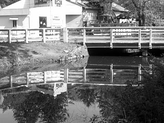
Hopewell Township is a township in Mercer County, New Jersey, United States. Located within the Raritan Valley region, the township is an exurb of New York City in the New York metropolitan area as defined by the United States Census Bureau, while also directly bordering the Philadelphia metropolitan area, being a part of the Federal Communications Commission's Philadelphia Designated Market Area. As of the 2010 United States Census, the township's population was 17,304, reflecting an increase of 1,199 (+7.4%) from the 16,105 counted in the 2000 Census, which had in turn increased by 4,515 (+39.0%) from the 11,590 counted in the 1990 Census.
Lawrence Township is a township in Mercer County, New Jersey, United States. Located at the cross-roads between the Delaware Valley region to the south and the Raritan Valley region to the north, the township is an outer-ring suburb of New York City in the New York Metropolitan area, as defined by the United States Census Bureau, while also directly bordering the Philadelphia metropolitan area and is part of the Federal Communications Commission's Philadelphia Designated Market Area. The township is a regional commercial hub for central New Jersey. As of the 2010 United States Census, the township's population was 33,472, reflecting an increase of 4,313 (+14.8%) from the 29,159 counted in the 2000 Census, which had in turn increased by 3,372 (+13.1%) from the 25,787 counted in the 1990 Census.
Pennington is a borough in Mercer County, New Jersey, United States. The borough is located at the cross-roads between the Delaware Valley region to the south and the Raritan Valley region to the north. As of the 2010 United States Census, the borough's population was 2,585, reflecting a decline of 111 (-4.1%) from the 2,696 counted in the 2000 Census, which had in turn increased by 159 (+6.3%) from the 2,537 counted in the 1990 Census.
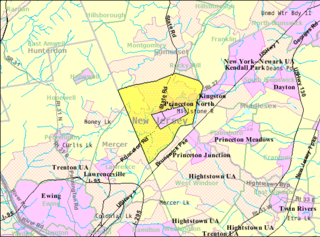
Princeton Township was a township in Mercer County, New Jersey, United States, that existed from 1838 until it was dissolved after it was merged with Princeton Borough in 2013 to form Princeton, New Jersey. As of the 2010 United States Census, the township's population was 16,265, reflecting an increase of 238 (+1.5%) from the 16,027 counted in the 2000 Census, which had in turn increased by 2,829 (+21.4%) from the 13,198 counted in the 1990 Census.
Robbinsville Township is a township in Mercer County, New Jersey, United States. The township is part of the New York Metropolitan area as defined by the United States Census Bureau, but directly borders the Philadelphia metropolitan area and is part of the Federal Communications Commission's Philadelphia Designated Market Area. As of the 2010 United States Census, the township's population was 13,642, reflecting an increase of 3,367 (+32.8%) from the 10,275 counted in the 2000 Census, which had in turn increased by 4,460 (+76.7%) from the 5,815 counted in the 1990 Census. The township is named for George R. Robbins, who served in the United States House of Representatives from 1855 to 1859 and lived in the area.
West Windsor is a township in Mercer County, New Jersey, in the United States. Located within the Raritan Valley region, the township is an outer-ring suburb of New York City in the New York metropolitan area, as defined by the United States Census Bureau. As of the 2010 United States Census, the township's population was 27,165, reflecting an increase of 5,258 (+24.0%) from the 21,907 counted in the 2000 Census, which had in turn increased by 5,886 (+36.7%) from the 16,021 counted in the 1990 Census.
Cranbury is a township in Middlesex County, New Jersey, United States. Located within the Raritan Valley region, Cranbury is roughly equidistant between New York City and Philadelphia in the heart of the state. As of the 2010 United States Census, the township's population was 3,857, reflecting an increase of 630 (+19.5%) from the 3,227 counted in the 2000 Census, which had in turn increased by 727 (+29.1%) from the 2,500 counted in 1990.
Monroe Township is a township in southern Middlesex County, New Jersey, United States. It is part of the outer-ring suburbs of the New York Metropolitan area. The township is also centrally located within the Raritan Valley region. As of the 2010 United States Census, the township's population was 39,132, reflecting an increase of 11,133 (+39.8%) from the 27,999 counted in the 2000 Census, which had in turn increased by 5,744 (+25.8%) from the 22,255 counted in the 1990 Census.
Plainsboro Township is a township in Middlesex County in the U.S. state of New Jersey. The township is centrally located in the Raritan Valley region and is a part of the New York metropolitan area. As of the 2010 United States Census, the township's population was 22,999, reflecting an increase of 2,784 (+13.8%) from the 20,215 counted in the 2000 Census, which had in turn increased by 6,002 (+42.2%) from the 14,213 counted in the 1990 Census.
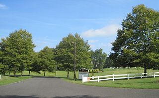
Upper Freehold Township is a township in Monmouth County, New Jersey, United States. As of the 2010 United States Census, the township's population was 6,902, reflecting an increase of 2,620 (+61.2%) from the 4,282 counted in the 2000 Census, which had in turn increased by 1,005 (+30.7%) from the 3,277 counted in the 1990 Census.
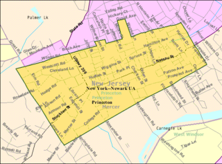
The Borough of Princeton was a borough until December 31, 2012, that is now one of the two former municipalities making up Princeton, New Jersey. It was located in Mercer County, New Jersey, and was completely surrounded by the former Princeton Township, from which it was formed in 1894. As of the 2010 United States Census, the borough had a population of 12,307, reflecting a decline of 1,896 (-13.3%) from the 14,203 counted in the 2000 Census, which had in turn increased by 2,187 (+18.2%) from the 12,016 counted in the 1990 Census.
Windsor is a small historic unincorporated community located within Robbinsville Township in Mercer County, New Jersey, United States. The area is served as United States Postal Service ZIP Code 08561. There are approximately 50 homes in the area, and as of the 2010 United States Census, the population for ZIP Code Tabulation Area 08561 was 226. The community, covering 570 acres (230 ha), was added to the National Register of Historic Places in 1992.
The Roosevelt Public School District is a community public school district that serves students in pre-kindergarten through fifth grade from Roosevelt in Monmouth County, New Jersey, United States.
The lesser-known story is that Randal, who grew up in East Windsor and now lives in Somerset, was a success long before his "Apprentice" victory.
Wikimedia Commons has media related to East Windsor Township, New Jersey . |