
Marlboro Township is a township in Monmouth County, New Jersey, United States. The township is located within the Raritan Valley region and is a part of the New York Metropolitan Area. As of the 2010 United States Census, the township had a population of 40,191, reflecting an increase of 5,449 (+16.3%) from the 33,423 counted in the 2000 Census, which had in turn increased by 6,707 (+25.1%) from the 26,716 counted in the 1990 Census.
Route 79 is a state highway located in Monmouth County in the U.S. state of New Jersey. It runs 12.13 mi (19.52 km) from an intersection with U.S. Route 9 in Freehold Township north to an intersection with Route 34 and County Route 516 Spur in Matawan. The route is a mostly two-lane undivided road that passes through both suburban residential areas and rural areas. The route intersects Route 33 in Freehold Township, Route 33 Business and CR 537 in Freehold Borough, Route 18 and CR 520 in Marlboro Township, and CR 516 in Matawan.
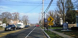
Marlboro is an unincorporated community located within Marlboro Township in Monmouth County, New Jersey, United States.
County Route 520 is a county highway in the U.S. state of New Jersey. County Route 520 is a major road across Monmouth County connecting the county's central towns to the Jersey Shore at Sea Bright. The highway extends 22.39 miles (36.03 km) from Englishtown Road in Old Bridge Township to Ocean Avenue in Sea Bright.

Georgia is an unincorporated community located within Freehold Township in Monmouth County, New Jersey, United States. Exit 22 on Interstate 195 provides access to Georgia via Jackson Mills Road. There is also a road in the area called Georgia Road, leading to Turkey Swamp Park. Georgia sits at the northern reaches of the Pine Barrens and numerous housing developments are located north and east of the settlement.
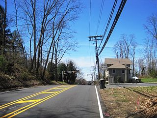
Bradevelt is an unincorporated community located within the Morganville section of Marlboro Township, in Monmouth County, New Jersey, United States. County Route 520 travels through Bradevelt, while Route 79 is located west of the community. The area consists of a mix of businesses along the two main roads, farmland, and the remains of the Marlboro Psychiatric Hospital which is being converted to Big Brook Park. The former Monmouth County Agricultural Railroad runs north and south through Bradevelt. Early to mid 1800s the area was called Hulsetown.
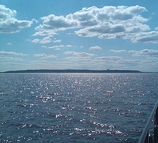
The Navesink Highlands, sometimes referred to as the Highlands of Navesink and also known as the Atlantic Highlands, are a range of low hills and upland areas located along the United States Atlantic coast in New Jersey. The hills of the Highlands reach over 350 feet (107 m) in elevation, reportedly reaching a maximum elevation of 391 feet at Crawford Hill, which is the highest point in Monmouth County. The seaward front of the Navesink Highlands constitute the highest headlands along the United States east coast south of Maine, with the highest point of the headlands reaching an elevation of 266 feet at Mount Mitchill.
Montrose is an unincorporated community located near the intersection of Dutch Lane Road and Boundary Road along the border of Colts Neck and Marlboro townships in Monmouth County, New Jersey, United States. The town was located in "Atlantic Township" at one time prior to the name being changed to "Colts Neck". Prior to being called Montrose, the area was called "Barrentown".

Spring Valley is an unincorporated community located within Marlboro Township in Monmouth County, New Jersey, United States. Located in the northern section of the township, the area is mainly forested with some businesses and cemeteries lining the main roads in the area, Spring Valley Road and Texas Road. U.S. Route 9, Route 18 and County Route 3 are major roads nearby Spring Valley.

Prospertown is an unincorporated community located within the New Jersey townships of Jackson and Plumsted in Ocean County and Upper Freehold in Monmouth County. The community is home to Prospertown Lake and is adjacent to Six Flags Great Adventure, both located on County Route 537. The center of the community is located at the intersection of CR 537, Hawkin Road, and Emleys Hill Road. Most of the area consists of pine forests but there are some homes along the roads in the area.

Emleys Hill is an unincorporated community located within Upper Freehold Township in Monmouth County, New Jersey, United States. The settlement is located at the intersection of Emleys Hill Road and Burlington Path Road.

Claytons Corner is an unincorporated community located within Marlboro Township in Monmouth County, New Jersey, United States. The community is located along Gordons Corner Road near its intersections with Church Road and Robertsville Road and is completely suburban in nature as the area is part of houses in planned communities. The last remaining farm in Clayton's Corner belonged to the Yoncak family.

Freewood Acres is an unincorporated community located within Howell Township in Monmouth County, New Jersey, United States. The area is made up of mostly single-story homes arranged along a street grid in the northern reaches of the Pine Barrens. U.S. Route 9 runs through the center of the community just north of its interchange with Interstate 195. The Land O'Pines Elementary School and Manasquan Reservoir County Park exist to the east of the community. It became the center of the Kalmyk American community in the latter part of the 20th century.

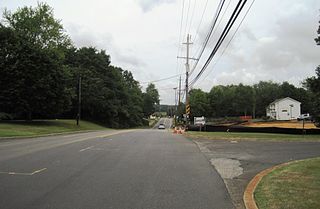
Henningers Mills or Henningers Mill is an unincorporated community located along the border of Aberdeen and Marlboro townships in Monmouth County, New Jersey, United States.
Hillsdale is an unincorporated community located within Colts Neck and Marlboro townships in Monmouth County, New Jersey, United States. The community is located at the intersection of County Route 520 which runs east and west, Conover Road which heads north, and Boundary Road which heads south. The southeastern quadrant of this intersection is a part of Colts Neck while the other three are in Marlboro. The community is located atop a small hill and is largely rural. The Colts Neck quadrant is made up of a housing development while the Marlboro side is mostly forests, parkland, and the remains of the Marlboro Psychiatric Hospital.

Monmouth Heights at Marlboro is an unincorporated community located within Marlboro Township in Monmouth County, New Jersey, United States. The housing development was created in the 1960s by Levitt & Sons though some protests occurred by long-time residents of Marlboro Township at the time of its creation. The community is located along New Jersey Route 79 across the highway from Marlboro High School.

Mount Pleasant is an unincorporated community located within Marlboro Township in Monmouth County, New Jersey, United States. It is named for a hill of the same name, one of the highest points in Marlboro Township. The settlement is located at the intersection of Reids Hill Road and Beacon Hill Road.

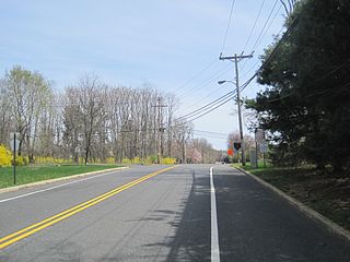
Pleasant Valley is an unincorporated community located within Marlboro Township in Monmouth County, New Jersey, United States. The area reportedly received its name from George Washington after he went through the area in 1777. The area is hilly and forested and is dotted by medium to large-sized residences. Pleasant Valley Road and Reids Hill Road are main roads that pass through the area connecting to Routes 34, 79, and 520. A large part of land which makes up Pleasant Valley was originally granted by the King of England in 1665 to the Rev. Obadiah Holmes. In 1690, the area was settled by people of Dutch heritage and the original dominant language in the area was Low Dutch.

Smocks Corner or Smocks Corners is an unincorporated community located within Marlboro Township in Monmouth County, New Jersey, United States. Located at the intersection of Pleasant Valley Road and Conover Road, the area is mostly residences with some open space and farmland. It was called "Smocks Corner" because the Smock Family had houses in that area, both sides of the street back in the 1700s.

Ellisdale is an unincorporated community located along the border of North Hanover Township in Burlington County and Upper Freehold Township in Monmouth County, in New Jersey, United States. The community is centered about the intersection of Province Line Road and Hill Road / Ellisdale-Crosswicks Road. The Crosswicks Creek runs to the north of the settlement and the nearby Ellisdale Fossil Site takes its name from Ellisdale.


